Property Record
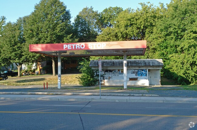
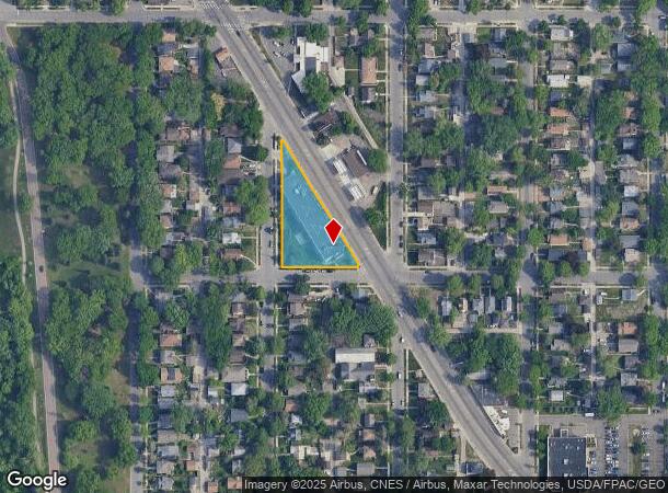
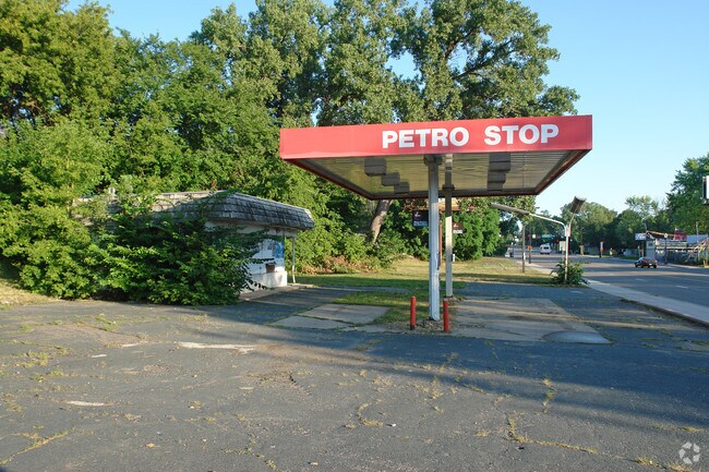
2601 W Broadway Ave, Minneapolis, MN 55411
NEARBY LISTINGS FOR SALE OR LEASE
Property Detail
2601 W Broadway Ave
Minneapolis-St. Paul-Bloomington, MN-WI
Radisson Park Addn
08-029-24-43-0106
LOT 004 BLOCK 002 A RADISSON PARK ADDN LOTS 1 THROUGH 8, BLOCK 2, RADISSON PARK ADDITION TO MINNEAPOLIS; EXCEPT STREET. IRREGULAR
Apartment
Hennepin
X
Minnesota
27053C0214F
4
2024
0.75 AC
2024
Brookdale
102000
Minneapolis/St Paul
36,434 SF
DEMOGRAPHICS near 2601 W Broadway Ave
1 Mile
3 Mile
5 Mile
2024 Total Population
22,559
131,261
430,943
2029 Population
22,137
129,019
425,446
Pop Growth 2024-2029
(1.87%)
(1.71%)
(1.28%)
Average Age
34
37
37
2024 Total Households
7,487
54,140
188,973
HH Growth 2024-2029
(2.12%)
(1.54%)
(1.23%)
Median Household Inc
$59,226
$70,980
$67,026
Avg Household Size
2.80
2.30
2.10
2024 Avg HH Vehicles
2.00
1.00
1.00
Median Home Value
$220,013
$265,244
$283,342
Median Year Built
1948
1957
1964
Nearby Places
Map Layers
Map Styles
 Street
 Aerial
- Restaurants
- Banks
- Shops
- Fitness
- Groceries
PUBLIC TRANSPORTATION
COMMUTER RAIL
Target Field Station (Northstar Corridor - Northstar Commuter Rail)
DRIVE
WALK
Distance
Target Field Station (Northstar Corridor - Northstar Commuter Rail)
9 min
3.1 mi
Fridley Station (Northstar Corridor - Northstar Commuter Rail)
DRIVE
WALK
Distance
Fridley Station (Northstar Corridor - Northstar Commuter Rail)
13 min
7.7 mi
AIRPORT
Minneapolis-St Paul International/Wold-Chamberlain
DRIVE
WALK
Distance
Minneapolis-St Paul International/Wold-Chamberlain
28 min
15.1 mi
Freight Ports
Port Milwaukee
DRIVE
WALK
Distance
Port Milwaukee
383 min
343.3 mi
Nearby Properties
Address
Land Use
TOTAL SIZE
Lot Size
Zoning
Address
Land Use
TOTAL SIZE
Lot Size
Zoning
1,021,060 SF
1.71 AC
B4S-2
Address
Land Use
TOTAL SIZE
Lot Size
Zoning
2,282,334 SF
3.25 AC
B4-2
Address
Land Use
TOTAL SIZE
Lot Size
Zoning
1,054,492 SF
1.70 AC
B4-1
Address
Land Use
TOTAL SIZE
Lot Size
Zoning
1,208,190 SF
1.20 AC
B4-2
Address
Land Use
TOTAL SIZE
Lot Size
Zoning
621,608 SF
1.03 AC
B4-2
Address
Land Use
TOTAL SIZE
Lot Size
Zoning
442,731 SF
0.97 AC
B4S-2
Address
Land Use
TOTAL SIZE
Lot Size
Zoning
1,044,454 SF
1.08 AC
B4-2
Address
Land Use
TOTAL SIZE
Lot Size
Zoning
2.67 AC
C3A
Address
Land Use
TOTAL SIZE
Lot Size
Zoning
1 SF
69.72 AC
I3
Address
Land Use
TOTAL SIZE
Lot Size
Zoning
722,423 SF
1.33 AC
B4-2
Address
Land Use
TOTAL SIZE
Lot Size
Zoning
Address
Land Use
TOTAL SIZE
Lot Size
Zoning
323,404 SF
2.54 AC
B4S-2
Address
Land Use
TOTAL SIZE
Lot Size
Zoning
439,615 SF
1.23 AC
B4-2
Address
Land Use
TOTAL SIZE
Lot Size
Zoning
341,894 SF
2.62 AC
R6
Address
Land Use
TOTAL SIZE
Lot Size
Zoning
502,092 SF
1.16 AC
B4N
Address
Land Use
TOTAL SIZE
Lot Size
Zoning
573,174 SF
1.51 AC
B4-2
Address
Land Use
TOTAL SIZE
Lot Size
Zoning
739,208 SF
2.48 AC
B4-1
Address
Land Use
TOTAL SIZE
Lot Size
Zoning
399,841 SF
2.51 AC
C3A
Address
Land Use
TOTAL SIZE
Lot Size
Zoning
406,627 SF
0.36 AC
B4-2
Address
Land Use
TOTAL SIZE
Lot Size
Zoning
466,335 SF
2.82 AC
B4-2
Address
Land Use
TOTAL SIZE
Lot Size
Zoning
742,084 SF
2.49 AC
B4-1
Address
Land Use
TOTAL SIZE
Lot Size
Zoning
405,028 SF
B4N
Address
Land Use
TOTAL SIZE
Lot Size
Zoning
576,900 SF
25.79 AC
OR2
Address
Land Use
TOTAL SIZE
Lot Size
Zoning
225,845 SF
1 AC
C3A
Address
Land Use
TOTAL SIZE
Lot Size
Zoning
753,429 SF
0.64 AC
B4-2
Address
Land Use
TOTAL SIZE
Lot Size
Zoning
661,904 SF
6.49 AC
C3A
Address
Land Use
TOTAL SIZE
Lot Size
Zoning
Address
Land Use
TOTAL SIZE
Lot Size
Zoning
251,080 SF
1.27 AC
B4S-1
Address
Land Use
TOTAL SIZE
Lot Size
Zoning
458,954 SF
1.73 AC
B4N
Address
Land Use
TOTAL SIZE
Lot Size
Zoning
265,561 SF
1.22 AC
B4N
The World's #1 Commercial Real Estate Marketplace
Connect with us
© 2025 CoStar Group
The information above has been obtained from sources believed reliable. While we do not doubt its accuracy we have not verified it and make no guarantee, warranty or representation about it. It is your responsibility to independently confirm its accuracy and completeness. Any projections, opinions, assumptions, or estimates used are for example only and do not represent the current or future performance of the property. The value of this transaction to you depends on tax and other factors which should be evaluated by your tax, financial, and legal advisors. You and your advisors should conduct a careful, independent investigation of the property to determine to your satisfaction the suitability of the property for your needs.