Property Record
2601 Wigwam Pky, Henderson, NV 89074

NEARBY LISTINGS FOR SALE OR LEASE
Property Detail
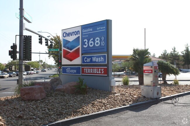
2601 Wigwam Pky
Las Vegas-Henderson-North Las Vegas, NV
Green Valley South Center
177-13-727-005
GREEN VALLEY SOUTH CENTER PLAT BOOK 63 PAGE 8 PT LOT 1 BLOCK 1
Servicestation
Clark
X
Nevada
32003C2590F
1
2026
0.57 AC
2026
Southeast Las Vegas
005320
Las Vegas
DEMOGRAPHICS near 2601 Wigwam Pky
1 mile
3 mile
5 mile
2024 Total Population
18,551
164,734
339,890
2029 Population
19,892
176,075
364,764
Pop Growth 2024-2029
+ 7.23%
+ 6.88%
+ 7.32%
Average Age
43
42
41
2024 Total Households
7,449
67,092
137,109
HH Growth 2024-2029
+ 7.14%
+ 6.88%
+ 7.29%
Median Household Inc
$78,030
$75,496
$71,805
Avg Household Size
2.40
2.40
2.40
2024 Avg HH Vehicles
2.00
2.00
2.00
Median Home Value
$388,710
$399,952
$399,844
Median Year Built
1993
1995
1996
Nearby Places
Map Layers
Map Styles
 Street
 Aerial
Transit
 Traffic
 Biking
Places
Listings with unknown addresses are not visible on the map
- Restaurants
- Banks
- Shops
- Fitness
- Groceries
PUBLIC TRANSPORTATION
AIRPORT
Harry Reid International
Drive
Walk
Distance
Harry Reid International
11 min
7.0 mi
Boulder City Municipal
Drive
Walk
Distance
Boulder City Municipal
26 min
17.9 mi
Nearby Properties
Address
Land Use
TOTAL SIZE
Lot Size
Zoning
Address
Land Use
TOTAL SIZE
Lot Size
Zoning
630,906 SF
39.87 AC
CT
Address
Land Use
TOTAL SIZE
Lot Size
Zoning
9,314 SF
23.10 AC
PS
Address
Land Use
TOTAL SIZE
Lot Size
Zoning
8,536 SF
24.93 AC
Address
Land Use
TOTAL SIZE
Lot Size
Zoning
7,177 SF
15.88 AC
Address
Land Use
TOTAL SIZE
Lot Size
Zoning
4,312 SF
19.42 AC
C:R-4
Address
Land Use
TOTAL SIZE
Lot Size
Zoning
36.85 AC
PS
Address
Land Use
TOTAL SIZE
Lot Size
Zoning
438,778 SF
19.30 AC
C:R-4
Address
Land Use
TOTAL SIZE
Lot Size
Zoning
7,825 SF
15.41 AC
Address
Land Use
TOTAL SIZE
Lot Size
Zoning
18.08 AC
RE
Address
Land Use
TOTAL SIZE
Lot Size
Zoning
402,610 SF
15.51 AC
R3
Address
Land Use
TOTAL SIZE
Lot Size
Zoning
324 SF
7.01 AC
C2
Address
Land Use
TOTAL SIZE
Lot Size
Zoning
371,958 SF
22.85 AC
RM16
Address
Land Use
TOTAL SIZE
Lot Size
Zoning
9,164 SF
22.81 AC
R3
Address
Land Use
TOTAL SIZE
Lot Size
Zoning
4,444 SF
15.48 AC
H:RH-24
Address
Land Use
TOTAL SIZE
Lot Size
Zoning
213,957 SF
19.68 AC
Address
Land Use
TOTAL SIZE
Lot Size
Zoning
148.64 AC
PF
Address
Land Use
TOTAL SIZE
Lot Size
Zoning
3,850 SF
6.09 AC
R3
Address
Land Use
TOTAL SIZE
Lot Size
Zoning
61,157 SF
2.54 AC
Address
Land Use
TOTAL SIZE
Lot Size
Zoning
59,421 SF
14 AC
Address
Land Use
TOTAL SIZE
Lot Size
Zoning
5,179 SF
24.21 AC
RM16
Address
Land Use
TOTAL SIZE
Lot Size
Zoning
325,872 SF
5.77 AC
Address
Land Use
TOTAL SIZE
Lot Size
Zoning
9,196 SF
17.77 AC
R3
Address
Land Use
TOTAL SIZE
Lot Size
Zoning
18.75 AC
PF
Address
Land Use
TOTAL SIZE
Lot Size
Zoning
341,744 SF
21.82 AC
RM16
Address
Land Use
TOTAL SIZE
Lot Size
Zoning
4,330 SF
21.45 AC
RM16
Address
Land Use
TOTAL SIZE
Lot Size
Zoning
20 AC
RE
Address
Land Use
TOTAL SIZE
Lot Size
Zoning
6,295 SF
13.58 AC
R3
Address
Land Use
TOTAL SIZE
Lot Size
Zoning
6,074 SF
21.91 AC
C:R-3
Address
Land Use
TOTAL SIZE
Lot Size
Zoning
17.18 AC
PS
Address
Land Use
TOTAL SIZE
Lot Size
Zoning
222,167 SF
6.99 AC
The World's #1 Commercial Real Estate Marketplace
Connect with us
© 2026 CoStar Group
The information above has been obtained from sources believed reliable. While we do not doubt its accuracy we have not verified it and make no guarantee, warranty or representation about it. It is your responsibility to independently confirm its accuracy and completeness. Any projections, opinions, assumptions, or estimates used are for example only and do not represent the current or future performance of the property. The value of this transaction to you depends on tax and other factors which should be evaluated by your tax, financial, and legal advisors. You and your advisors should conduct a careful, independent investigation of the property to determine to your satisfaction the suitability of the property for your needs.