Property Record
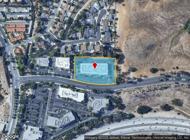
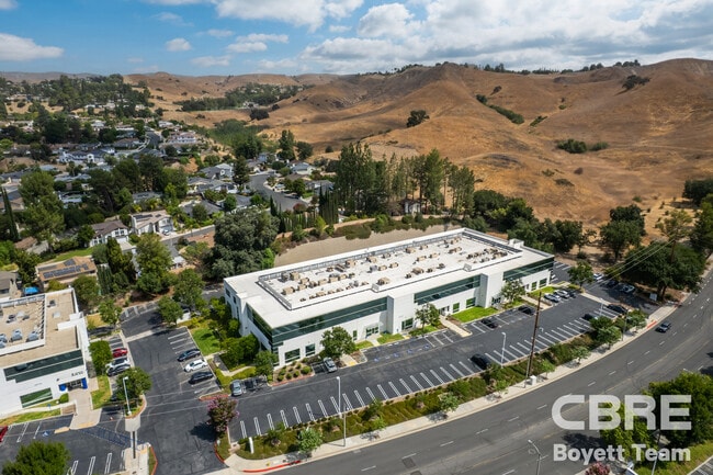
26025 Mureau Rd, Calabasas, CA 91302
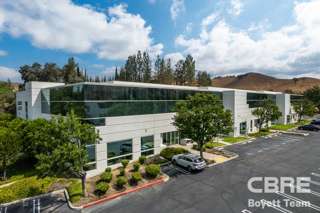
This Property Is For Sale
NEARBY LISTINGS FOR SALE OR LEASE
Property Detail
26025 Mureau Rd
2052-043-011
P M 263-78-84 OT 1
Officebuilding
Los Angeles
X
California
06037C1264G
2.67 AC
2024
Calabasas/Westlake Vill
2025
Los Angeles
800205
Los Angeles-Long Beach-Glendale, CA
45,888 SF
DEMOGRAPHICS near 26025 Mureau Rd
1 Mile
3 Mile
5 Mile
2024 Total Population
3,861
25,694
97,283
2029 Population
3,734
24,841
94,179
Pop Growth 2024-2029
(3.29%)
(3.32%)
(3.19%)
Average Age
40
43
43
2024 Total Households
1,509
9,594
35,016
HH Growth 2024-2029
(3.51%)
(3.56%)
(3.45%)
Median Household Inc
$122,718
$144,851
$140,629
Avg Household Size
2.60
2.70
2.70
2024 Avg HH Vehicles
2.00
2.00
2.00
Median Home Value
$895,019
$1,069,705
$1,009,911
Median Year Built
1985
1983
1975
Nearby Places
- Restaurants
- Banks
- Shops
- Fitness
- Groceries
PUBLIC TRANSPORTATION
AIRPORT
Bob Hope
DRIVE
WALK
Distance
Bob Hope
33 min
24.4 mi
Los Angeles International
DRIVE
WALK
Distance
Los Angeles International
43 min
32.5 mi
Freight Ports
The Port of Hueneme
DRIVE
WALK
Distance
The Port of Hueneme
46 min
33.6 mi
Nearby Properties
Address
Land Use
TOTAL SIZE
Lot Size
Zoning
Address
Land Use
TOTAL SIZE
Lot Size
Zoning
294,536 SF
16.70 AC
CS R-MF*
Address
Land Use
TOTAL SIZE
Lot Size
Zoning
329,741 SF
20.14 AC
LCC3DP*
Address
Land Use
TOTAL SIZE
Lot Size
Zoning
210,268 SF
13.77 AC
CS R-MF*
Address
Land Use
TOTAL SIZE
Lot Size
Zoning
198,668 SF
17.98 AC
CSCB*
Address
Land Use
TOTAL SIZE
Lot Size
Zoning
107,395 SF
4.98 AC
CPD
Address
Land Use
TOTAL SIZE
Lot Size
Zoning
257,241 SF
29.19 AC
LCRPD15000
Address
Land Use
TOTAL SIZE
Lot Size
Zoning
237,492 SF
18.84 AC
LCRPD15000
Address
Land Use
TOTAL SIZE
Lot Size
Zoning
165,362 SF
4.08 AC
LCCM
Address
Land Use
TOTAL SIZE
Lot Size
Zoning
106,712 SF
11.55 AC
CSCM
Address
Land Use
TOTAL SIZE
Lot Size
Zoning
280,491 SF
4.74 AC
CSCM
Address
Land Use
TOTAL SIZE
Lot Size
Zoning
257,344 SF
4.09 AC
CSCM
Address
Land Use
TOTAL SIZE
Lot Size
Zoning
110,229 SF
5.31 AC
CSCB
Address
Land Use
TOTAL SIZE
Lot Size
Zoning
230,800 SF
4.39 AC
LCMP
Address
Land Use
TOTAL SIZE
Lot Size
Zoning
98,127 SF
2.56 AC
AHRA20000*
Address
Land Use
TOTAL SIZE
Lot Size
Zoning
92,367 SF
4.16 AC
CSCR-SC*
Address
Land Use
TOTAL SIZE
Lot Size
Zoning
98,270 SF
4.69 AC
CSCM
Address
Land Use
TOTAL SIZE
Lot Size
Zoning
101,087 SF
4.47 AC
Address
Land Use
TOTAL SIZE
Lot Size
Zoning
65,706 SF
1.24 AC
LACRA 1-A2
Address
Land Use
TOTAL SIZE
Lot Size
Zoning
104,838 SF
2.41 AC
CSCR-SC*
Address
Land Use
TOTAL SIZE
Lot Size
Zoning
133,511 SF
16.96 AC
C2
Address
Land Use
TOTAL SIZE
Lot Size
Zoning
296,707 SF
9.22 AC
CSCM
Address
Land Use
TOTAL SIZE
Lot Size
Zoning
58,094 SF
4.51 AC
CSCR-SC*
Address
Land Use
TOTAL SIZE
Lot Size
Zoning
39,412 SF
104.84 AC
LC A2-1*
Address
Land Use
TOTAL SIZE
Lot Size
Zoning
36,042 SF
4.97 AC
LCM1*
Address
Land Use
TOTAL SIZE
Lot Size
Zoning
78,847 SF
3.37 AC
CSCM
Address
Land Use
TOTAL SIZE
Lot Size
Zoning
204,986 SF
3.99 AC
LCCM*
Address
Land Use
TOTAL SIZE
Lot Size
Zoning
44,244 SF
4.36 AC
CSCR
Address
Land Use
TOTAL SIZE
Lot Size
Zoning
89,864 SF
3.16 AC
CSCR-SC*
Address
Land Use
TOTAL SIZE
Lot Size
Zoning
87,138 SF
5.02 AC
CSCM
Address
Land Use
TOTAL SIZE
Lot Size
Zoning
83,177 SF
3.87 AC
LCRPD15000
The World's #1 Commercial Real Estate Marketplace
Connect with us
© 2025 CoStar Group
The information above has been obtained from sources believed reliable. While we do not doubt its accuracy we have not verified it and make no guarantee, warranty or representation about it. It is your responsibility to independently confirm its accuracy and completeness. Any projections, opinions, assumptions, or estimates used are for example only and do not represent the current or future performance of the property. The value of this transaction to you depends on tax and other factors which should be evaluated by your tax, financial, and legal advisors. You and your advisors should conduct a careful, independent investigation of the property to determine to your satisfaction the suitability of the property for your needs.