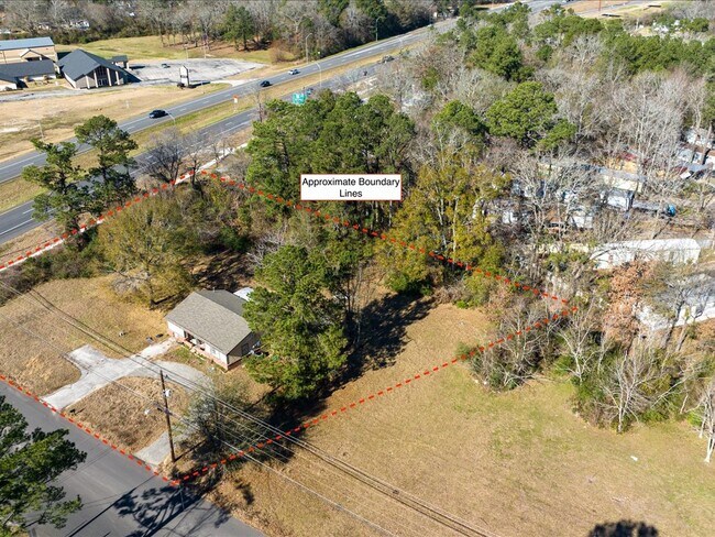
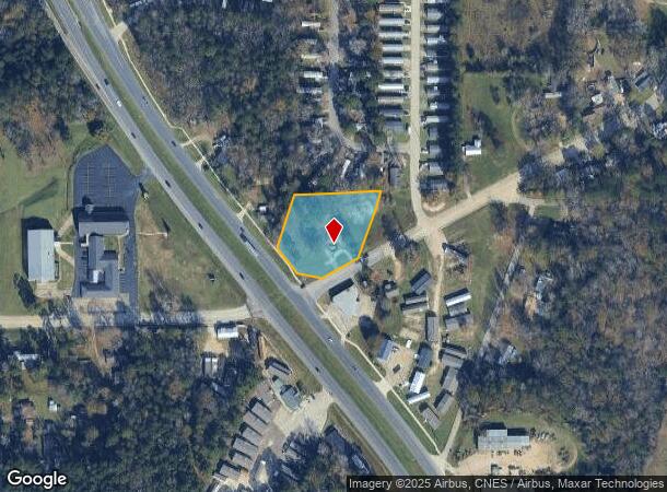
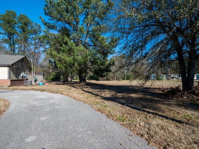
Property Record
2603 Paul Ave, Lufkin, TX 75901
NEARBY LISTINGS FOR SALE OR LEASE
Property Detail
2603 Paul Ave
28864
Holloway L
Commercialnec
ABS 0310 HOLLOWAY L.,TRACT 218 & ABS 0475 TR 2 & ABS 0127 TRACT 105,ACRES 1.3541
X
Angelina
48005C0255E
Texas
2025
1.35 AC
2025
Texas East Area
000600
Other Market Areas
810 SF
Lufkin, TX
DEMOGRAPHICS near 2603 Paul Ave
1 Mile
3 Mile
5 Mile
2024 Total Population
2,593
21,323
41,528
2029 Population
2,611
21,582
41,949
Pop Growth 2024-2029
+ 0.69%
+ 1.21%
+ 1.01%
Average Age
36
38
39
2024 Total Households
829
7,610
15,756
HH Growth 2024-2029
+ 0.72%
+ 1.30%
+ 1.05%
Median Household Inc
$48,382
$41,250
$47,416
Avg Household Size
2.90
2.60
2.50
2024 Avg HH Vehicles
2.00
2.00
2.00
Median Home Value
$96,950
$113,473
$134,342
Median Year Built
1971
1971
1979
Nearby Places
Map Layers
Map Styles
 Street
 Aerial
- Restaurants
- Banks
- Shops
- Fitness
- Groceries
SALE & LEASE HISTORY
LISTING DATE
SALE/LEASE

Jan 17, 2023
For Sale
Nearby Properties
Address
Land Use
TOTAL SIZE
Lot Size
Zoning
Address
Land Use
TOTAL SIZE
Lot Size
Zoning
9,222 SF
10.69 AC
Address
Land Use
TOTAL SIZE
Lot Size
Zoning
34,528 SF
1.86 AC
CBD
Address
Land Use
TOTAL SIZE
Lot Size
Zoning
13,632 SF
28.08 AC
Address
Land Use
TOTAL SIZE
Lot Size
Zoning
Address
Land Use
TOTAL SIZE
Lot Size
Zoning
14,514 SF
12.90 AC
RL
Address
Land Use
TOTAL SIZE
Lot Size
Zoning
50,378 SF
19.90 AC
RL
Address
Land Use
TOTAL SIZE
Lot Size
Zoning
1,540 SF
7.82 AC
Address
Land Use
TOTAL SIZE
Lot Size
Zoning
423,495 SF
87.05 AC
LM
Address
Land Use
TOTAL SIZE
Lot Size
Zoning
Address
Land Use
TOTAL SIZE
Lot Size
Zoning
39,207 SF
1.92 AC
Address
Land Use
TOTAL SIZE
Lot Size
Zoning
10,521 SF
22.92 AC
RL
Address
Land Use
TOTAL SIZE
Lot Size
Zoning
128,270 SF
17.89 AC
LB
Address
Land Use
TOTAL SIZE
Lot Size
Zoning
32,834 SF
3.40 AC
LM
Address
Land Use
TOTAL SIZE
Lot Size
Zoning
Address
Land Use
TOTAL SIZE
Lot Size
Zoning
199,212 SF
36.43 AC
LMSU
Address
Land Use
TOTAL SIZE
Lot Size
Zoning
102,458 SF
11.64 AC
Address
Land Use
TOTAL SIZE
Lot Size
Zoning
61,488 SF
0.90 AC
CBSU
Address
Land Use
TOTAL SIZE
Lot Size
Zoning
57,883 SF
11.79 AC
C
Address
Land Use
TOTAL SIZE
Lot Size
Zoning
Address
Land Use
TOTAL SIZE
Lot Size
Zoning
4,056 SF
7.44 AC
Address
Land Use
TOTAL SIZE
Lot Size
Zoning
26,890 SF
1.31 AC
LM
Address
Land Use
TOTAL SIZE
Lot Size
Zoning
33,004 SF
2.74 AC
CSU
Address
Land Use
TOTAL SIZE
Lot Size
Zoning
12,615 SF
2.07 AC
LBD
Address
Land Use
TOTAL SIZE
Lot Size
Zoning
24,445 SF
0.94 AC
CB
Address
Land Use
TOTAL SIZE
Lot Size
Zoning
18.40 AC
C
Address
Land Use
TOTAL SIZE
Lot Size
Zoning
22,554 SF
2.20 AC
RL
Address
Land Use
TOTAL SIZE
Lot Size
Zoning
16,888 SF
5.07 AC
CRL
Address
Land Use
TOTAL SIZE
Lot Size
Zoning
73,944 SF
5.12 AC
Address
Land Use
TOTAL SIZE
Lot Size
Zoning
89,500 SF
5.06 AC
LBSU
Address
Land Use
TOTAL SIZE
Lot Size
Zoning
22,011 SF
4.84 AC
The World's #1 Commercial Real Estate Marketplace
Connect with us
© 2026 CoStar Group
The information above has been obtained from sources believed reliable. While we do not doubt its accuracy we have not verified it and make no guarantee, warranty or representation about it. It is your responsibility to independently confirm its accuracy and completeness. Any projections, opinions, assumptions, or estimates used are for example only and do not represent the current or future performance of the property. The value of this transaction to you depends on tax and other factors which should be evaluated by your tax, financial, and legal advisors. You and your advisors should conduct a careful, independent investigation of the property to determine to your satisfaction the suitability of the property for your needs.