Property Record
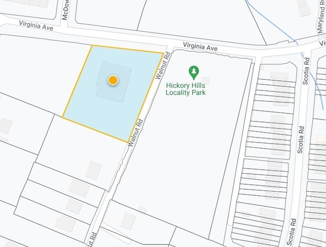
2603 Virginia Ave, Halethorpe, MD 21227

Property Detail
2603 Virginia Ave
13-1306100220
1.1288 AC SS
Fratsororityhouse
BALTIMORE
DR5.5
Maryland
B and X Area of moderate flood hazard, usually the area between the limits of the 100-year and 500-year floods.
1.10 AC
2024
BWI/Baltimore County
2025
Baltimore
430101
Baltimore-Columbia-Towson, MD
10,488 SF
NEARBY LISTINGS FOR SALE OR LEASE
DEMOGRAPHICS near 2603 Virginia Ave
1 mile
3 mile
5 mile
2025 Total Population
14,273
93,866
300,518
2030 Population
14,333
93,650
301,241
Pop Growth 2025-2030
+ 0.42%
(0.23%)
+ 0.24%
Average Age
36
38
38
2025 Total Households
4,957
34,430
126,011
HH Growth 2025-2030
+ 0.42%
(0.33%)
+ 0.02%
Median Household Inc
$61,120
$69,042
$68,030
Avg Household Size
2.80
2.60
2.30
2025 Avg HH Vehicles
2.00
2.00
1.00
Median Home Value
$234,735
$273,399
$280,498
Median Year Built
1957
1956
1954
Nearby Places
Map Layers
Map Styles
 Street
 Aerial
Layers
 Traffic
 Biking
Places
Listings with unknown addresses are not visible on the map
- Restaurants
- Banks
- Shops
- Fitness
- Groceries
PUBLIC TRANSPORTATION
TRANSIT/SUBWAY
Baltimore Highlands (Hunt Valley & BWI Marshall - Maryland Transit Administration Light Rail (Baltimore Light Rail), Timonium & Cromwell - Maryland Transit Administration Light Rail (Baltimore Light Rail))
Drive
Walk
Distance
Baltimore Highlands (Hunt Valley & BWI Marshall - Maryland Transit Administration Light Rail (Baltimore Light Rail), Timonium & Cromwell - Maryland Transit Administration Light Rail (Baltimore Light Rail))
4 min
19 min
1.0 mi
COMMUTER RAIL
Drive
Walk
Distance
12 min
4.5 mi
Drive
Walk
Distance
12 min
4.5 mi
AIRPORT
Baltimore/Washington International Thurgood Marshall
Drive
Walk
Distance
Baltimore/Washington International Thurgood Marshall
14 min
5.8 mi
Ronald Reagan Washington Ntl
Drive
Walk
Distance
Ronald Reagan Washington Ntl
63 min
40.9 mi
Freight Ports
Port of Baltimore
Drive
Walk
Distance
Port of Baltimore
12 min
4.9 mi
SALE & LEASE HISTORY
LISTING DATE
SALE/LEASE

Sep 23, 2022
For Sale
Nearby Properties
Address
Land Use
TOTAL SIZE
Lot Size
Zoning
Address
Land Use
TOTAL SIZE
Lot Size
Zoning
308,887 SF
3.98 AC
C-5DC
Address
Land Use
TOTAL SIZE
Lot Size
Zoning
1,396,807 SF
32.73 AC
R-6
Address
Land Use
TOTAL SIZE
Lot Size
Zoning
430,940 SF
18.81 AC
MXDT
Address
Land Use
TOTAL SIZE
Lot Size
Zoning
642,817 SF
1.91 AC
PC-2
Address
Land Use
TOTAL SIZE
Lot Size
Zoning
520,407 SF
16.85 AC
H
Address
Land Use
TOTAL SIZE
Lot Size
Zoning
305,483 SF
11.38 AC
MXDT
Address
Land Use
TOTAL SIZE
Lot Size
Zoning
332,190 SF
21.80 AC
W1-BW
Address
Land Use
TOTAL SIZE
Lot Size
Zoning
309,558 SF
3.01 AC
C-2
Address
Land Use
TOTAL SIZE
Lot Size
Zoning
315,605 SF
1.80 AC
Address
Land Use
TOTAL SIZE
Lot Size
Zoning
442,145 SF
2.30 AC
C-2
Address
Land Use
TOTAL SIZE
Lot Size
Zoning
523,800 SF
28.02 AC
I-1
Address
Land Use
TOTAL SIZE
Lot Size
Zoning
383,697 SF
68.35 AC
R5
Address
Land Use
TOTAL SIZE
Lot Size
Zoning
1,105,167 SF
6.35 AC
C-5DC
Address
Land Use
TOTAL SIZE
Lot Size
Zoning
234,439 SF
1.02 AC
Address
Land Use
TOTAL SIZE
Lot Size
Zoning
290,000 SF
1.51 AC
PC-2
Address
Land Use
TOTAL SIZE
Lot Size
Zoning
315,055 SF
9.60 AC
ML
Address
Land Use
TOTAL SIZE
Lot Size
Zoning
231,128 SF
8.30 AC
W1-BW
Address
Land Use
TOTAL SIZE
Lot Size
Zoning
1,308,804 SF
16.24 AC
I-MU
Address
Land Use
TOTAL SIZE
Lot Size
Zoning
19.20 AC
R15
Address
Land Use
TOTAL SIZE
Lot Size
Zoning
12.90 AC
R15
Address
Land Use
TOTAL SIZE
Lot Size
Zoning
132,655 SF
0.74 AC
Address
Land Use
TOTAL SIZE
Lot Size
Zoning
263,024 SF
6.87 AC
C3
Address
Land Use
TOTAL SIZE
Lot Size
Zoning
18.86 AC
DR16
Address
Land Use
TOTAL SIZE
Lot Size
Zoning
184,317 SF
16.23 AC
MH
Address
Land Use
TOTAL SIZE
Lot Size
Zoning
173,735 SF
17.31 AC
PC-4
Address
Land Use
TOTAL SIZE
Lot Size
Zoning
41.14 AC
W1-BW
Address
Land Use
TOTAL SIZE
Lot Size
Zoning
300,513 SF
32.53 AC
I-1
Address
Land Use
TOTAL SIZE
Lot Size
Zoning
15.05 AC
R15
Address
Land Use
TOTAL SIZE
Lot Size
Zoning
187,814 SF
38.47 AC
R5
Address
Land Use
TOTAL SIZE
Lot Size
Zoning
48,300 SF
30.96 AC
ML
The World's #1 Commercial Real Estate Marketplace
Connect with us
© 2026 CoStar Group
The information above has been obtained from sources believed reliable. While we do not doubt its accuracy we have not verified it and make no guarantee, warranty or representation about it. It is your responsibility to independently confirm its accuracy and completeness. Any projections, opinions, assumptions, or estimates used are for example only and do not represent the current or future performance of the property. The value of this transaction to you depends on tax and other factors which should be evaluated by your tax, financial, and legal advisors. You and your advisors should conduct a careful, independent investigation of the property to determine to your satisfaction the suitability of the property for your needs.