Property Record
26039 State Highway 74, Evergreen, CO 80439
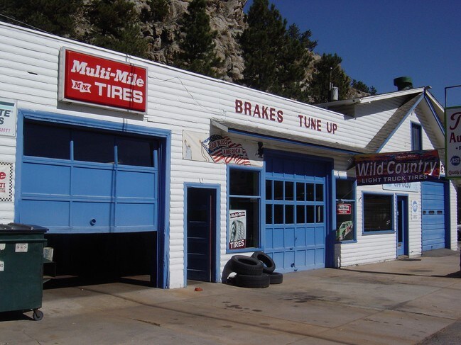


Property Detail
26039 State Highway 74
41-354-01-045
SECTION 35 TOWNSHIP 04 RANGE 71 SUBDIVISIONCD 425400 SUBDIVISIONNAME KITTREDGE & KITTREDGE AMD MAP BLOCK LOT 0466 SIZE: 6490 TRACT VALUE: .149
Commercialnec
JEFFERSON
C1
Colorado
AE The base floodplain where base flood elevations are provided. AE Zones are now used on new format FIRMs instead of A1-A30 Zones.
466
2025
0.15 AC
2025
West
009848
Denver
2,728 SF
Denver-Aurora-Centennial, CO
NEARBY LISTINGS FOR SALE OR LEASE
DEMOGRAPHICS near 26039 State Highway 74
1 mile
3 mile
5 mile
2025 Total Population
1,131
10,811
23,836
2030 Population
1,091
10,677
23,643
Pop Growth 2025-2030
(3.54%)
(1.24%)
(0.81%)
Average Age
43
46
47
2025 Total Households
443
4,472
9,631
HH Growth 2025-2030
(3.84%)
(1.32%)
(0.92%)
Median Household Inc
$186,701
$160,533
$157,948
Avg Household Size
2.50
2.40
2.40
2025 Avg HH Vehicles
3.00
2.00
2.00
Median Home Value
$820,135
$883,137
$949,681
Median Year Built
1984
1980
1982
Nearby Places
Map Layers
Map Styles
 Street
 Aerial
Layers
 Traffic
 Biking
Places
Listings with unknown addresses are not visible on the map
- Restaurants
- Banks
- Shops
- Fitness
- Groceries
SALE & LEASE HISTORY
LISTING DATE
SALE/LEASE

Jul 19, 2017
For Lease
Nearby Properties
Address
Land Use
TOTAL SIZE
Lot Size
Zoning
Address
Land Use
TOTAL SIZE
Lot Size
Zoning
360 AC
CO
Address
Land Use
TOTAL SIZE
Lot Size
Zoning
769.90 AC
CO
Address
Land Use
TOTAL SIZE
Lot Size
Zoning
480 AC
CO
Address
Land Use
TOTAL SIZE
Lot Size
Zoning
9,973 SF
15.50 AC
A2
Address
Land Use
TOTAL SIZE
Lot Size
Zoning
116.70 AC
CO
Address
Land Use
TOTAL SIZE
Lot Size
Zoning
31,437 SF
12.36 AC
PD
Address
Land Use
TOTAL SIZE
Lot Size
Zoning
54,443 SF
4.16 AC
PD
Address
Land Use
TOTAL SIZE
Lot Size
Zoning
17,262 SF
0.91 AC
PD
Address
Land Use
TOTAL SIZE
Lot Size
Zoning
17,554 SF
25.57 AC
A2
Address
Land Use
TOTAL SIZE
Lot Size
Zoning
320 AC
CO
Address
Land Use
TOTAL SIZE
Lot Size
Zoning
53,371 SF
3.69 AC
C1
Address
Land Use
TOTAL SIZE
Lot Size
Zoning
51,104 SF
5.57 AC
PD
Address
Land Use
TOTAL SIZE
Lot Size
Zoning
34,581 SF
1.98 AC
PD
Address
Land Use
TOTAL SIZE
Lot Size
Zoning
37,332 SF
5.06 AC
PD
Address
Land Use
TOTAL SIZE
Lot Size
Zoning
25,104 SF
1.47 AC
PD
Address
Land Use
TOTAL SIZE
Lot Size
Zoning
5,298 SF
147.29 AC
CO
Address
Land Use
TOTAL SIZE
Lot Size
Zoning
256.19 AC
CO
Address
Land Use
TOTAL SIZE
Lot Size
Zoning
17,510 SF
5.24 AC
MR1
Address
Land Use
TOTAL SIZE
Lot Size
Zoning
14,563 SF
2.21 AC
Address
Land Use
TOTAL SIZE
Lot Size
Zoning
17,230 SF
1.85 AC
C1
Address
Land Use
TOTAL SIZE
Lot Size
Zoning
311.44 AC
PD
Address
Land Use
TOTAL SIZE
Lot Size
Zoning
27,699 SF
2.59 AC
PD
Address
Land Use
TOTAL SIZE
Lot Size
Zoning
11,317 SF
1.45 AC
C1
Address
Land Use
TOTAL SIZE
Lot Size
Zoning
5,753 SF
1.37 AC
PD
Address
Land Use
TOTAL SIZE
Lot Size
Zoning
32,461 SF
3.92 AC
C1
Address
Land Use
TOTAL SIZE
Lot Size
Zoning
23,920 SF
2.04 AC
PD
Address
Land Use
TOTAL SIZE
Lot Size
Zoning
15,972 SF
0.71 AC
I1
Address
Land Use
TOTAL SIZE
Lot Size
Zoning
15,005 SF
1.17 AC
Address
Land Use
TOTAL SIZE
Lot Size
Zoning
14,237 SF
1.58 AC
C1
Address
Land Use
TOTAL SIZE
Lot Size
Zoning
37.01 AC
CO
The World's #1 Commercial Real Estate Marketplace
Connect with us
© 2026 CoStar Group
The information above has been obtained from sources believed reliable. While we do not doubt its accuracy we have not verified it and make no guarantee, warranty or representation about it. It is your responsibility to independently confirm its accuracy and completeness. Any projections, opinions, assumptions, or estimates used are for example only and do not represent the current or future performance of the property. The value of this transaction to you depends on tax and other factors which should be evaluated by your tax, financial, and legal advisors. You and your advisors should conduct a careful, independent investigation of the property to determine to your satisfaction the suitability of the property for your needs.