Property Record
2605 S Southeast Loop 323, Tyler, TX 75701

Save to a Folder
{{folder.Name}}
{{folder.ListingIds.length}} Properties
{{folder.ListingIds.length}} Property
Create a New Folder
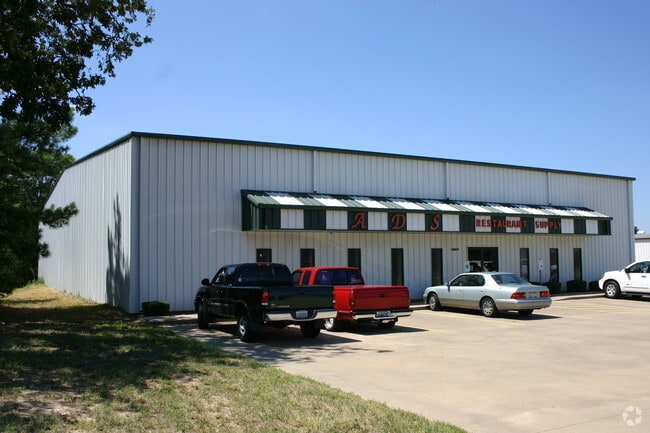
Property Detail
2605 S Southeast Loop 323
1-00000-0048-00-016020
ABST A0048 L ASHCRAFTBLOCK 852-V TRACT LT 17-E
Officebuilding
SMITH
C2
Texas
B and X Area of moderate flood hazard, usually the area between the limits of the 100-year and 500-year floods.
17
2025
1.35 AC
2025
Tyler
001101
Other Market Areas
10,070 SF
Tyler, TX
NEARBY LISTINGS FOR SALE OR LEASE
DEMOGRAPHICS near 2605 S Southeast Loop 323
1 mile
3 mile
5 mile
2025 Total Population
2,771
37,235
106,695
2030 Population
2,925
39,116
112,206
Pop Growth 2025-2030
+ 5.56%
+ 5.05%
+ 5.17%
Average Age
39
39
38
2025 Total Households
1,352
15,423
41,461
HH Growth 2025-2030
+ 4.81%
+ 4.49%
+ 4.61%
Median Household Inc
$70,487
$61,585
$63,036
Avg Household Size
2.00
2.30
2.40
2025 Avg HH Vehicles
1.00
2.00
2.00
Median Home Value
$284,931
$219,013
$233,402
Median Year Built
2004
1975
1977
Nearby Places
Map Layers
Map Styles
 Street
 Aerial
Layers
 Traffic
 Biking
Places
Listings with unknown addresses are not visible on the map
- Restaurants
- Banks
- Shops
- Fitness
- Groceries
PUBLIC TRANSPORTATION
AIRPORT
Tyler Pounds Regional
Drive
Walk
Distance
Tyler Pounds Regional
14 min
7.6 mi
Nearby Properties
Address
Land Use
TOTAL SIZE
Lot Size
Zoning
Address
Land Use
TOTAL SIZE
Lot Size
Zoning
403,396 SF
45.40 AC
C4
Address
Land Use
TOTAL SIZE
Lot Size
Zoning
278 SF
22.07 AC
PMF
Address
Land Use
TOTAL SIZE
Lot Size
Zoning
168,390 SF
7.51 AC
Address
Land Use
TOTAL SIZE
Lot Size
Zoning
24.83 AC
Address
Land Use
TOTAL SIZE
Lot Size
Zoning
39.16 AC
C2
Address
Land Use
TOTAL SIZE
Lot Size
Zoning
14,504 SF
16.68 AC
Address
Land Use
TOTAL SIZE
Lot Size
Zoning
5,068 SF
18.35 AC
RMF
Address
Land Use
TOTAL SIZE
Lot Size
Zoning
31.74 AC
Address
Land Use
TOTAL SIZE
Lot Size
Zoning
71,337 SF
15.70 AC
M1
Address
Land Use
TOTAL SIZE
Lot Size
Zoning
4,333 SF
13.32 AC
Address
Land Use
TOTAL SIZE
Lot Size
Zoning
2,774 SF
16.15 AC
RMF
Address
Land Use
TOTAL SIZE
Lot Size
Zoning
3,724 SF
33.26 AC
RMF
Address
Land Use
TOTAL SIZE
Lot Size
Zoning
53,412 SF
11.17 AC
PMF
Address
Land Use
TOTAL SIZE
Lot Size
Zoning
187.64 AC
R1A
Address
Land Use
TOTAL SIZE
Lot Size
Zoning
10.51 AC
Address
Land Use
TOTAL SIZE
Lot Size
Zoning
88,964 SF
11.33 AC
Address
Land Use
TOTAL SIZE
Lot Size
Zoning
1,867 SF
13.63 AC
RMF
Address
Land Use
TOTAL SIZE
Lot Size
Zoning
126.94 AC
Address
Land Use
TOTAL SIZE
Lot Size
Zoning
3,806 SF
18.86 AC
RMF
Address
Land Use
TOTAL SIZE
Lot Size
Zoning
63 AC
R1A
Address
Land Use
TOTAL SIZE
Lot Size
Zoning
3,477 SF
9.56 AC
RMF
Address
Land Use
TOTAL SIZE
Lot Size
Zoning
22.85 AC
Address
Land Use
TOTAL SIZE
Lot Size
Zoning
2,936 SF
9.66 AC
RMF
Address
Land Use
TOTAL SIZE
Lot Size
Zoning
82,385 SF
7.11 AC
C1
Address
Land Use
TOTAL SIZE
Lot Size
Zoning
4,478 SF
9.06 AC
RMF
Address
Land Use
TOTAL SIZE
Lot Size
Zoning
722 SF
14 AC
RMF
Address
Land Use
TOTAL SIZE
Lot Size
Zoning
58,161 SF
7.02 AC
Address
Land Use
TOTAL SIZE
Lot Size
Zoning
14.16 AC
Address
Land Use
TOTAL SIZE
Lot Size
Zoning
129,070 SF
3.75 AC
Address
Land Use
TOTAL SIZE
Lot Size
Zoning
22,500 SF
6.98 AC
The World's #1 Commercial Real Estate Marketplace
Connect with us
© 2026 CoStar Group
The information above has been obtained from sources believed reliable. While we do not doubt its accuracy we have not verified it and make no guarantee, warranty or representation about it. It is your responsibility to independently confirm its accuracy and completeness. Any projections, opinions, assumptions, or estimates used are for example only and do not represent the current or future performance of the property. The value of this transaction to you depends on tax and other factors which should be evaluated by your tax, financial, and legal advisors. You and your advisors should conduct a careful, independent investigation of the property to determine to your satisfaction the suitability of the property for your needs.