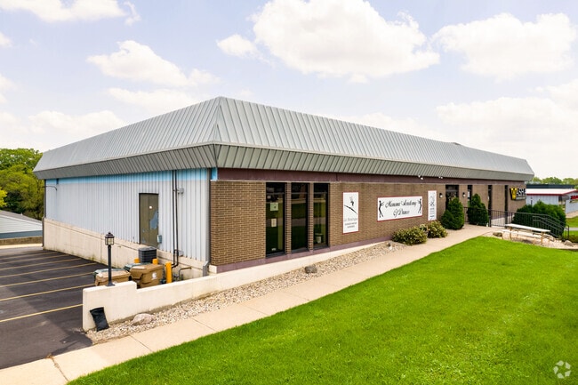
Property Record
2605 S Stoughton Rd, Madison, WI 53716


NEARBY LISTINGS FOR SALE OR LEASE
Property Detail
2605 S Stoughton Rd
Madison, WI
Glendale Industrial Park
0710-211-0203-4
GLENDALE INDUSTRIAL PARK, LOTS 12 & 13, BLK 2
Commercialnec
Dane
X
Wisconsin
55025C0441H
12,13
2024
0.76 AC
2024
Southeast Madison
003100
Milwaukee/Madison
10,236 SF
DEMOGRAPHICS near 2605 S Stoughton Rd
1 Mile
3 Mile
5 Mile
2024 Total Population
4,554
47,540
156,135
2029 Population
4,682
49,240
161,318
Pop Growth 2024-2029
+ 2.81%
+ 3.58%
+ 3.32%
Average Age
44
42
37
2024 Total Households
2,089
21,170
70,451
HH Growth 2024-2029
+ 2.97%
+ 3.68%
+ 3.52%
Median Household Inc
$68,781
$79,345
$63,306
Avg Household Size
2.10
2.20
2.00
2024 Avg HH Vehicles
2.00
2.00
1.00
Median Home Value
$262,076
$286,435
$295,152
Median Year Built
1966
1972
1974
Nearby Places
Map Layers
Map Styles
 Street
 Aerial
- Restaurants
- Banks
- Shops
- Fitness
- Groceries
PUBLIC TRANSPORTATION
AIRPORT
Dane County Regional/Truax Field
DRIVE
WALK
Distance
Dane County Regional/Truax Field
12 min
7.3 mi
Freight Ports
Port Milwaukee
DRIVE
WALK
Distance
Port Milwaukee
91 min
78.3 mi
SALE & LEASE HISTORY
LISTING DATE
SALE/LEASE

Jan 29, 2021
For Lease
Nearby Properties
Address
Land Use
TOTAL SIZE
Lot Size
Zoning
Address
Land Use
TOTAL SIZE
Lot Size
Zoning
168,685 SF
14.05 AC
IL
Address
Land Use
TOTAL SIZE
Lot Size
Zoning
13,440 SF
10.98 AC
IL
Address
Land Use
TOTAL SIZE
Lot Size
Zoning
216,017 SF
3.35 AC
TE
Address
Land Use
TOTAL SIZE
Lot Size
Zoning
2.03 AC
Address
Land Use
TOTAL SIZE
Lot Size
Zoning
13.40 AC
Address
Land Use
TOTAL SIZE
Lot Size
Zoning
3.59 AC
Address
Land Use
TOTAL SIZE
Lot Size
Zoning
12,450 SF
9.40 AC
SE
Address
Land Use
TOTAL SIZE
Lot Size
Zoning
2.38 AC
Address
Land Use
TOTAL SIZE
Lot Size
Zoning
225,108 SF
2 AC
PD
Address
Land Use
TOTAL SIZE
Lot Size
Zoning
19.81 AC
Address
Land Use
TOTAL SIZE
Lot Size
Zoning
149,897 SF
17.72 AC
IL
Address
Land Use
TOTAL SIZE
Lot Size
Zoning
5.53 AC
Address
Land Use
TOTAL SIZE
Lot Size
Zoning
3.49 AC
Address
Land Use
TOTAL SIZE
Lot Size
Zoning
6,868 SF
18.35 AC
IL
Address
Land Use
TOTAL SIZE
Lot Size
Zoning
167,519 SF
4.51 AC
PD
Address
Land Use
TOTAL SIZE
Lot Size
Zoning
202,800 SF
13.05 AC
IL
Address
Land Use
TOTAL SIZE
Lot Size
Zoning
154,403 SF
1.21 AC
PD
Address
Land Use
TOTAL SIZE
Lot Size
Zoning
176,496 SF
3.51 AC
PD
Address
Land Use
TOTAL SIZE
Lot Size
Zoning
95,909 SF
1 AC
TE
Address
Land Use
TOTAL SIZE
Lot Size
Zoning
156,368 SF
4.01 AC
PD
Address
Land Use
TOTAL SIZE
Lot Size
Zoning
117,606 SF
1.85 AC
TR-U2
Address
Land Use
TOTAL SIZE
Lot Size
Zoning
16.40 AC
IL
Address
Land Use
TOTAL SIZE
Lot Size
Zoning
280,000 SF
15.01 AC
IL
Address
Land Use
TOTAL SIZE
Lot Size
Zoning
10.45 AC
IL
Address
Land Use
TOTAL SIZE
Lot Size
Zoning
78,300 SF
14.35 AC
CC
Address
Land Use
TOTAL SIZE
Lot Size
Zoning
49,562 SF
4.42 AC
SE
Address
Land Use
TOTAL SIZE
Lot Size
Zoning
17,980 SF
6.25 AC
SR-V2
Address
Land Use
TOTAL SIZE
Lot Size
Zoning
111,768 SF
2.38 AC
PD
Address
Land Use
TOTAL SIZE
Lot Size
Zoning
134,814 SF
3.79 AC
SR-V2
Address
Land Use
TOTAL SIZE
Lot Size
Zoning
175,270 SF
6.11 AC
SR-V2
The World's #1 Commercial Real Estate Marketplace
Connect with us
© 2025 CoStar Group
The information above has been obtained from sources believed reliable. While we do not doubt its accuracy we have not verified it and make no guarantee, warranty or representation about it. It is your responsibility to independently confirm its accuracy and completeness. Any projections, opinions, assumptions, or estimates used are for example only and do not represent the current or future performance of the property. The value of this transaction to you depends on tax and other factors which should be evaluated by your tax, financial, and legal advisors. You and your advisors should conduct a careful, independent investigation of the property to determine to your satisfaction the suitability of the property for your needs.