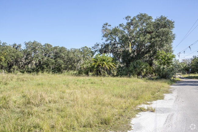
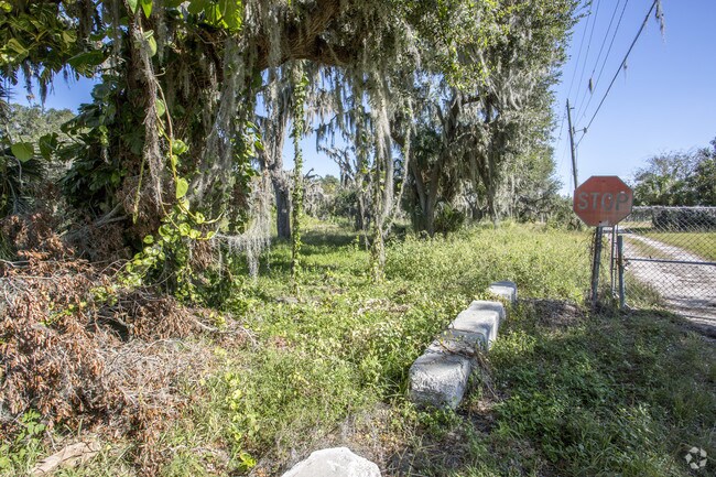
Property Record
2606 112Th Ln E, Palmetto, FL 34221
Property Detail
2606 112Th Ln E
6206-0000-7
N 182 FT OF S 647.7 FT OF N1/2 OF NE1/4 LESS U S 41 ROAD R/W ON THE W, SUBJ TO EASMT OVER N 20 FT PRMCF P-1-1; SUBJ TO CONSERVATION EASMTS DESC IN OR 2138/6920, PI#6187.0000/9
Commercialacreage
MANATEE
RVP
Florida
AE The base floodplain where base flood elevations are provided. AE Zones are now used on new format FIRMs instead of A1-A30 Zones.
20 AC
2023
Manatee
2025
Tampa/St Petersburg
001501
North Port-Bradenton-Sarasota, FL
NEARBY LISTINGS FOR SALE OR LEASE
DEMOGRAPHICS near 2606 112Th Ln E
1 mile
3 mile
5 mile
2025 Total Population
1,525
17,068
41,841
2030 Population
1,764
19,867
48,164
Pop Growth 2025-2030
+ 15.67%
+ 16.40%
+ 15.11%
Average Age
44
48
44
2025 Total Households
383
6,512
15,583
HH Growth 2025-2030
+ 19.58%
+ 17.52%
+ 15.37%
Median Household Inc
$97,413
$85,470
$90,521
Avg Household Size
2.40
2.30
2.50
2025 Avg HH Vehicles
2.00
2.00
2.00
Median Home Value
$396,720
$388,757
$385,365
Median Year Built
2010
2010
2007
Nearby Places
Map Layers
Map Styles
 Street
 Aerial
Layers
 Traffic
 Biking
Places
Listings with unknown addresses are not visible on the map
- Restaurants
- Banks
- Shops
- Fitness
- Groceries
PUBLIC TRANSPORTATION
AIRPORT
Sarasota/Bradenton International
Drive
Walk
Distance
Sarasota/Bradenton International
29 min
17.4 mi
St Pete-Clearwater International
Drive
Walk
Distance
St Pete-Clearwater International
48 min
33.9 mi
Tampa International
Drive
Walk
Distance
Tampa International
55 min
42.6 mi
Freight Ports
Port Manatee
Drive
Walk
Distance
Port Manatee
7 min
2.5 mi
Nearby Properties
Address
Land Use
TOTAL SIZE
Lot Size
Zoning
Address
Land Use
TOTAL SIZE
Lot Size
Zoning
594,436 SF
68.40 AC
PD-PM
Address
Land Use
TOTAL SIZE
Lot Size
Zoning
359,418 SF
16.36 AC
PD-C
Address
Land Use
TOTAL SIZE
Lot Size
Zoning
350,076 SF
349 AC
PD-PM
Address
Land Use
TOTAL SIZE
Lot Size
Zoning
184,048 SF
21.11 AC
PD-MU
Address
Land Use
TOTAL SIZE
Lot Size
Zoning
608,665 SF
30 AC
PD-MU
Address
Land Use
TOTAL SIZE
Lot Size
Zoning
322,319 SF
17.98 AC
PD-EZ
Address
Land Use
TOTAL SIZE
Lot Size
Zoning
3,904 SF
94 AC
Address
Land Use
TOTAL SIZE
Lot Size
Zoning
177,572 SF
16.48 AC
PD-EZ
Address
Land Use
TOTAL SIZE
Lot Size
Zoning
208,893 SF
12.17 AC
PD-MU
Address
Land Use
TOTAL SIZE
Lot Size
Zoning
122,346 SF
12.43 AC
PD-EZ
Address
Land Use
TOTAL SIZE
Lot Size
Zoning
124,400 SF
4.05 AC
PD-MU
Address
Land Use
TOTAL SIZE
Lot Size
Zoning
118,152 SF
30.66 AC
A-1 SUBURB
Address
Land Use
TOTAL SIZE
Lot Size
Zoning
6,552 SF
30.06 AC
RVP
Address
Land Use
TOTAL SIZE
Lot Size
Zoning
137,104 SF
10 AC
PD-EZ
Address
Land Use
TOTAL SIZE
Lot Size
Zoning
3.09 AC
PD-R
Address
Land Use
TOTAL SIZE
Lot Size
Zoning
75,001 SF
18.15 AC
PD-C
Address
Land Use
TOTAL SIZE
Lot Size
Zoning
178,041 SF
414.24 AC
PD-PM
Address
Land Use
TOTAL SIZE
Lot Size
Zoning
98,574 SF
5.60 AC
PD-MU
Address
Land Use
TOTAL SIZE
Lot Size
Zoning
127,606 SF
18.02 AC
LM LIGHT M
Address
Land Use
TOTAL SIZE
Lot Size
Zoning
40.84 AC
Address
Land Use
TOTAL SIZE
Lot Size
Zoning
181.15 AC
AR
Address
Land Use
TOTAL SIZE
Lot Size
Zoning
21.19 AC
Address
Land Use
TOTAL SIZE
Lot Size
Zoning
3,800 SF
17.63 AC
PD-RV
Address
Land Use
TOTAL SIZE
Lot Size
Zoning
139,909 SF
3.25 AC
PD-M
Address
Land Use
TOTAL SIZE
Lot Size
Zoning
4,454 SF
1,348.39 AC
PD-R
Address
Land Use
TOTAL SIZE
Lot Size
Zoning
154,940 SF
3.94 AC
PD-M
Address
Land Use
TOTAL SIZE
Lot Size
Zoning
14,756 SF
82.96 AC
PD
Address
Land Use
TOTAL SIZE
Lot Size
Zoning
1,890 SF
20.42 AC
PD-RV
Address
Land Use
TOTAL SIZE
Lot Size
Zoning
7.24 AC
Address
Land Use
TOTAL SIZE
Lot Size
Zoning
47,330 SF
5.92 AC
PD-MU
The World's #1 Commercial Real Estate Marketplace
Connect with us
© 2026 CoStar Group
The information above has been obtained from sources believed reliable. While we do not doubt its accuracy we have not verified it and make no guarantee, warranty or representation about it. It is your responsibility to independently confirm its accuracy and completeness. Any projections, opinions, assumptions, or estimates used are for example only and do not represent the current or future performance of the property. The value of this transaction to you depends on tax and other factors which should be evaluated by your tax, financial, and legal advisors. You and your advisors should conduct a careful, independent investigation of the property to determine to your satisfaction the suitability of the property for your needs.