Property Record
2607 Ahtanum Rd, Yakima, WA 98903


NEARBY LISTINGS FOR SALE OR LEASE
Property Detail
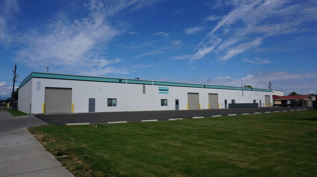
2607 Ahtanum Rd
Yakima, WA
Sp D-47
181203-14401
SP D-47: LOT A ALSO E 10 FT OF LOT 4 OF SP 85-122 EX S CO RD R/W
Industrialgeneral
Yakima
X
Washington
53077C1041E
a,4
2025
2.01 AC
2025
Greater Yakima
001100
Yakima
25,376 SF
DEMOGRAPHICS near 2607 Ahtanum Rd
1 Mile
3 Mile
5 Mile
2024 Total Population
622
49,048
112,800
2029 Population
621
49,261
113,616
Pop Growth 2024-2029
(0.16%)
+ 0.43%
+ 0.72%
Average Age
42
37
37
2024 Total Households
227
17,765
40,951
HH Growth 2024-2029
(0.44%)
+ 0.36%
+ 0.72%
Median Household Inc
$80,357
$58,265
$54,123
Avg Household Size
2.80
2.70
2.60
2024 Avg HH Vehicles
3.00
2.00
2.00
Median Home Value
$279,411
$236,282
$252,131
Median Year Built
1976
1967
1972
Nearby Places
Map Layers
Map Styles
 Street
 Aerial
- Restaurants
- Banks
- Shops
- Fitness
- Groceries
PUBLIC TRANSPORTATION
AIRPORT
Yakima Air Trml/McAllister Field
DRIVE
WALK
Distance
Yakima Air Trml/McAllister Field
6 min
2.5 mi
Freight Ports
Port of Tacoma
DRIVE
WALK
Distance
Port of Tacoma
193 min
159.5 mi
SALE & LEASE HISTORY
LISTING DATE
SALE/LEASE

Sep 24, 2016
For Sale
Nearby Properties
Address
Land Use
TOTAL SIZE
Lot Size
Zoning
Address
Land Use
TOTAL SIZE
Lot Size
Zoning
331,736 SF
34.95 AC
R1
Address
Land Use
TOTAL SIZE
Lot Size
Zoning
390,527 SF
11.86 AC
R3
Address
Land Use
TOTAL SIZE
Lot Size
Zoning
409,453 SF
8.25 AC
R3
Address
Land Use
TOTAL SIZE
Lot Size
Zoning
326,323 SF
30.05 AC
R2
Address
Land Use
TOTAL SIZE
Lot Size
Zoning
347,665 SF
37.77 AC
B2
Address
Land Use
TOTAL SIZE
Lot Size
Zoning
329,388 SF
16.13 AC
M1
Address
Land Use
TOTAL SIZE
Lot Size
Zoning
132,213 SF
4 AC
R3
Address
Land Use
TOTAL SIZE
Lot Size
Zoning
162,216 SF
11 AC
M1
Address
Land Use
TOTAL SIZE
Lot Size
Zoning
57,009 SF
212.58 AC
AS
Address
Land Use
TOTAL SIZE
Lot Size
Zoning
64,171 SF
48.08 AC
PUB
Address
Land Use
TOTAL SIZE
Lot Size
Zoning
158,890 SF
13.84 AC
B2
Address
Land Use
TOTAL SIZE
Lot Size
Zoning
105,756 SF
6.89 AC
R3
Address
Land Use
TOTAL SIZE
Lot Size
Zoning
128,789 SF
6.65 AC
R3
Address
Land Use
TOTAL SIZE
Lot Size
Zoning
97,976 SF
3.98 AC
SCC
Address
Land Use
TOTAL SIZE
Lot Size
Zoning
89,850 SF
14.03 AC
R1
Address
Land Use
TOTAL SIZE
Lot Size
Zoning
325,959 SF
11.95 AC
M2
Address
Land Use
TOTAL SIZE
Lot Size
Zoning
80,374 SF
8.99 AC
C1
Address
Land Use
TOTAL SIZE
Lot Size
Zoning
151,831 SF
21.08 AC
M1
Address
Land Use
TOTAL SIZE
Lot Size
Zoning
195,753 SF
11.66 AC
M1
Address
Land Use
TOTAL SIZE
Lot Size
Zoning
49,899 SF
1.22 AC
R3
Address
Land Use
TOTAL SIZE
Lot Size
Zoning
38,498 SF
7 AC
C1
Address
Land Use
TOTAL SIZE
Lot Size
Zoning
73,797 SF
8.20 AC
R1
Address
Land Use
TOTAL SIZE
Lot Size
Zoning
65,602 SF
10 AC
AS
Address
Land Use
TOTAL SIZE
Lot Size
Zoning
123,690 SF
12.02 AC
M1
Address
Land Use
TOTAL SIZE
Lot Size
Zoning
71,728 SF
2.96 AC
LCC
Address
Land Use
TOTAL SIZE
Lot Size
Zoning
117,962 SF
2.93 AC
BCOM
Address
Land Use
TOTAL SIZE
Lot Size
Zoning
81,126 SF
3.98 AC
R3
Address
Land Use
TOTAL SIZE
Lot Size
Zoning
34,271 SF
5.87 AC
B2
Address
Land Use
TOTAL SIZE
Lot Size
Zoning
138,550 SF
10.20 AC
M1
Address
Land Use
TOTAL SIZE
Lot Size
Zoning
48,952 SF
3.67 AC
SCC
The World's #1 Commercial Real Estate Marketplace
Connect with us
© 2026 CoStar Group
The information above has been obtained from sources believed reliable. While we do not doubt its accuracy we have not verified it and make no guarantee, warranty or representation about it. It is your responsibility to independently confirm its accuracy and completeness. Any projections, opinions, assumptions, or estimates used are for example only and do not represent the current or future performance of the property. The value of this transaction to you depends on tax and other factors which should be evaluated by your tax, financial, and legal advisors. You and your advisors should conduct a careful, independent investigation of the property to determine to your satisfaction the suitability of the property for your needs.