Property Record
26075 Ridge Rd, Damascus, MD 20872
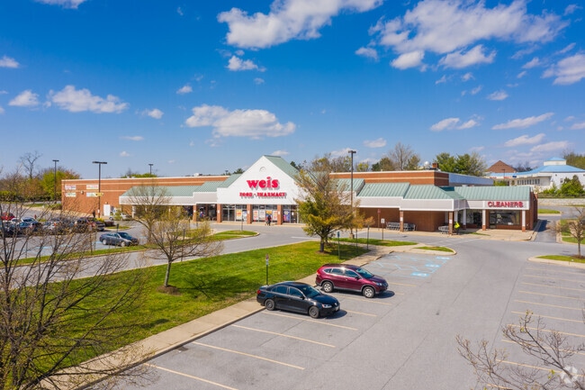


Property Detail
26075 Ridge Rd
12-03790023
PAR B-2 RIDGEVIE OWNERSHIP PARCELS
Storebuilding
Montgomery
CRT1.
Maryland
B and X Area of moderate flood hazard, usually the area between the limits of the 100-year and 500-year floods.
9.37 AC
2025
Outlying Montgmery Cnty E
2025
Washington, DC
700207
Washington-Arlington-Alexandria, DC-VA-MD-WV
91,381 SF
NEARBY LISTINGS FOR SALE OR LEASE
-
-
View all Damascus listings for lease on LoopNet.com
DEMOGRAPHICS near 26075 Ridge Rd
1 mile
3 mile
5 mile
2025 Total Population
5,126
19,174
54,505
2030 Population
5,316
19,745
56,476
Pop Growth 2025-2030
+ 3.71%
+ 2.98%
+ 3.62%
Average Age
39
41
40
2025 Total Households
1,735
6,345
17,436
HH Growth 2025-2030
+ 3.63%
+ 2.90%
+ 3.61%
Median Household Inc
$121,497
$149,188
$166,212
Avg Household Size
2.90
3.00
3.10
2025 Avg HH Vehicles
2.00
2.00
2.00
Median Home Value
$456,169
$535,313
$635,985
Median Year Built
1981
1982
1992
Nearby Places
Map Layers
Map Styles
 Street
 Aerial
Layers
 Traffic
 Biking
Places
Listings with unknown addresses are not visible on the map
- Restaurants
- Banks
- Shops
- Fitness
- Groceries
PUBLIC TRANSPORTATION
AIRPORT
Baltimore/Washington International Thurgood Marshall
Drive
Walk
Distance
Baltimore/Washington International Thurgood Marshall
51 min
40.3 mi
Washington Dulles International
Drive
Walk
Distance
Washington Dulles International
64 min
44.1 mi
Freight Ports
Port of Baltimore
Drive
Walk
Distance
Port of Baltimore
52 min
40.8 mi
SALE & LEASE HISTORY
LISTING DATE
SALE/LEASE

Aug 01, 2018
For Lease
Nearby Properties
Address
Land Use
TOTAL SIZE
Lot Size
Zoning
Address
Land Use
TOTAL SIZE
Lot Size
Zoning
235,986 SF
26.49 AC
R200
Address
Land Use
TOTAL SIZE
Lot Size
Zoning
145,148 SF
15 AC
CRT17
Address
Land Use
TOTAL SIZE
Lot Size
Zoning
120,532 SF
19.68 AC
RC
Address
Land Use
TOTAL SIZE
Lot Size
Zoning
79,453 SF
10 AC
R200
Address
Land Use
TOTAL SIZE
Lot Size
Zoning
73,280 SF
3.43 AC
R200
Address
Land Use
TOTAL SIZE
Lot Size
Zoning
75,520 SF
10.56 AC
R200
Address
Land Use
TOTAL SIZE
Lot Size
Zoning
135.12 AC
AR
Address
Land Use
TOTAL SIZE
Lot Size
Zoning
48.66 AC
RC
Address
Land Use
TOTAL SIZE
Lot Size
Zoning
57,307 SF
9.60 AC
R200
Address
Land Use
TOTAL SIZE
Lot Size
Zoning
53,121 SF
10 AC
R200
Address
Land Use
TOTAL SIZE
Lot Size
Zoning
53,239 SF
9.42 AC
CRT1.
Address
Land Use
TOTAL SIZE
Lot Size
Zoning
111,801 SF
5.98 AC
CRT1.
Address
Land Use
TOTAL SIZE
Lot Size
Zoning
37,329 SF
8.88 AC
CRT1.
Address
Land Use
TOTAL SIZE
Lot Size
Zoning
45,000 SF
12.96 AC
AR
Address
Land Use
TOTAL SIZE
Lot Size
Zoning
16,938 SF
15.69 AC
AR
Address
Land Use
TOTAL SIZE
Lot Size
Zoning
7.59 AC
RE2
Address
Land Use
TOTAL SIZE
Lot Size
Zoning
31,064 SF
37.97 AC
RE2C
Address
Land Use
TOTAL SIZE
Lot Size
Zoning
18,016 SF
1.66 AC
CRT1.
Address
Land Use
TOTAL SIZE
Lot Size
Zoning
28,125 SF
1.22 AC
CRT1.
Address
Land Use
TOTAL SIZE
Lot Size
Zoning
34,755 SF
8.47 AC
CRT1.
Address
Land Use
TOTAL SIZE
Lot Size
Zoning
15,562 SF
7.04 AC
R200
Address
Land Use
TOTAL SIZE
Lot Size
Zoning
10,125 SF
1.36 AC
CRT1.
Address
Land Use
TOTAL SIZE
Lot Size
Zoning
20,327 SF
0.82 AC
CRT17
Address
Land Use
TOTAL SIZE
Lot Size
Zoning
14,200 SF
2.50 AC
CRT1.
Address
Land Use
TOTAL SIZE
Lot Size
Zoning
15,264 SF
6.96 AC
AR
Address
Land Use
TOTAL SIZE
Lot Size
Zoning
16,219 SF
5.36 AC
AR
Address
Land Use
TOTAL SIZE
Lot Size
Zoning
26,320 SF
0.70 AC
CRT17
Address
Land Use
TOTAL SIZE
Lot Size
Zoning
16,144 SF
2.15 AC
CRT17
Address
Land Use
TOTAL SIZE
Lot Size
Zoning
12,122 SF
15.80 AC
AR
The World's #1 Commercial Real Estate Marketplace
Connect with us
© 2026 CoStar Group
The information above has been obtained from sources believed reliable. While we do not doubt its accuracy we have not verified it and make no guarantee, warranty or representation about it. It is your responsibility to independently confirm its accuracy and completeness. Any projections, opinions, assumptions, or estimates used are for example only and do not represent the current or future performance of the property. The value of this transaction to you depends on tax and other factors which should be evaluated by your tax, financial, and legal advisors. You and your advisors should conduct a careful, independent investigation of the property to determine to your satisfaction the suitability of the property for your needs.