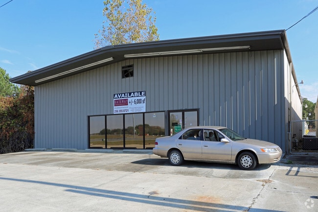
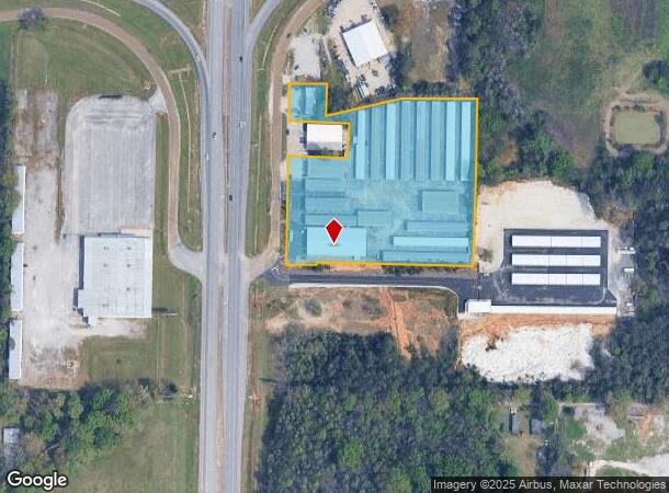
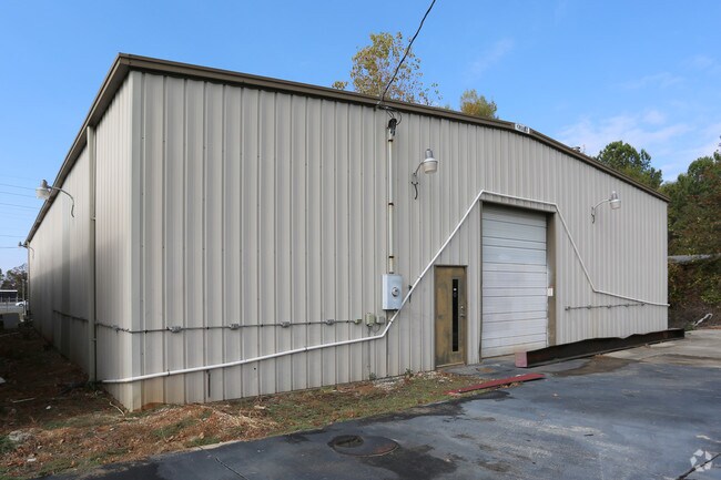
Property Record
2608 Beltline Rd Sw, Decatur, AL 35601

NEARBY LISTINGS FOR SALE OR LEASE
Property Detail
2608 Beltline Rd Sw
02-06-23-0-005-006.004
Morgan Mesa 01
Autorepair
COM AT THE SW COR OF SE1/4 OF NW1/4 OF SEC 23, T5S, R5W, TH E 450', TH N 400' TO POB, TH CONT N 481', TH W 226', SW 236' N 70
X
Morgan
01103C0057F
Alabama
2025
3.70 AC
2024
Alabama North Area
000700
Other Market Areas
9,600 SF
Decatur, AL
DEMOGRAPHICS near 2608 Beltline Rd Sw
1 Mile
3 Mile
5 Mile
2024 Total Population
1,906
31,779
58,527
2029 Population
1,911
32,034
58,871
Pop Growth 2024-2029
+ 0.26%
+ 0.80%
+ 0.59%
Average Age
40
39
40
2024 Total Households
782
12,659
23,752
HH Growth 2024-2029
+ 0.26%
+ 0.81%
+ 0.59%
Median Household Inc
$60,099
$48,075
$48,941
Avg Household Size
2.40
2.40
2.30
2024 Avg HH Vehicles
2.00
2.00
2.00
Median Home Value
$161,853
$142,964
$155,218
Median Year Built
1986
1977
1977
Nearby Places
Map Layers
Map Styles
 Street
 Aerial
- Restaurants
- Banks
- Shops
- Fitness
- Groceries
PUBLIC TRANSPORTATION
AIRPORT
Huntsville International-Carl T Jones Field
DRIVE
WALK
Distance
Huntsville International-Carl T Jones Field
29 min
18.9 mi
Freight Ports
Port of Mobile
DRIVE
WALK
Distance
Port of Mobile
373 min
338.1 mi
SALE & LEASE HISTORY
LISTING DATE
SALE/LEASE

Nov 28, 2016
For Lease
Apr 18, 2017
For Lease
Nearby Properties
Address
Land Use
TOTAL SIZE
Lot Size
Zoning
Address
Land Use
TOTAL SIZE
Lot Size
Zoning
176,476 SF
Address
Land Use
TOTAL SIZE
Lot Size
Zoning
70,936 SF
37 AC
Address
Land Use
TOTAL SIZE
Lot Size
Zoning
121,551 SF
Address
Land Use
TOTAL SIZE
Lot Size
Zoning
81,916 SF
45 AC
Address
Land Use
TOTAL SIZE
Lot Size
Zoning
124,209 SF
26 AC
Address
Land Use
TOTAL SIZE
Lot Size
Zoning
90,249 SF
8 AC
Address
Land Use
TOTAL SIZE
Lot Size
Zoning
36,304 SF
97 AC
Address
Land Use
TOTAL SIZE
Lot Size
Zoning
103,569 SF
6.69 AC
Address
Land Use
TOTAL SIZE
Lot Size
Zoning
15,331 SF
87 AC
Address
Land Use
TOTAL SIZE
Lot Size
Zoning
132,156 SF
1.69 AC
Address
Land Use
TOTAL SIZE
Lot Size
Zoning
35,727 SF
10 AC
Address
Land Use
TOTAL SIZE
Lot Size
Zoning
9,332 SF
Address
Land Use
TOTAL SIZE
Lot Size
Zoning
33,520 SF
Address
Land Use
TOTAL SIZE
Lot Size
Zoning
48,364 SF
1.80 AC
Address
Land Use
TOTAL SIZE
Lot Size
Zoning
40,212 SF
1.21 AC
Address
Land Use
TOTAL SIZE
Lot Size
Zoning
54,544 SF
6.53 AC
Address
Land Use
TOTAL SIZE
Lot Size
Zoning
51,958 SF
14 AC
Address
Land Use
TOTAL SIZE
Lot Size
Zoning
261,328 SF
67 AC
Address
Land Use
TOTAL SIZE
Lot Size
Zoning
106,165 SF
0.80 AC
Address
Land Use
TOTAL SIZE
Lot Size
Zoning
377,685 SF
17 AC
Address
Land Use
TOTAL SIZE
Lot Size
Zoning
81,682 SF
13 AC
Address
Land Use
TOTAL SIZE
Lot Size
Zoning
135,440 SF
6.76 AC
Address
Land Use
TOTAL SIZE
Lot Size
Zoning
10,884 SF
0.90 AC
Address
Land Use
TOTAL SIZE
Lot Size
Zoning
2,546 SF
9.30 AC
Address
Land Use
TOTAL SIZE
Lot Size
Zoning
40,008 SF
19.90 AC
Address
Land Use
TOTAL SIZE
Lot Size
Zoning
4,181 SF
6.70 AC
Address
Land Use
TOTAL SIZE
Lot Size
Zoning
81,042 SF
2.39 AC
Address
Land Use
TOTAL SIZE
Lot Size
Zoning
146,160 SF
41.50 AC
Address
Land Use
TOTAL SIZE
Lot Size
Zoning
42,197 SF
3.75 AC
Address
Land Use
TOTAL SIZE
Lot Size
Zoning
31,473 SF
2.90 AC
The World's #1 Commercial Real Estate Marketplace
Connect with us
© 2025 CoStar Group
The information above has been obtained from sources believed reliable. While we do not doubt its accuracy we have not verified it and make no guarantee, warranty or representation about it. It is your responsibility to independently confirm its accuracy and completeness. Any projections, opinions, assumptions, or estimates used are for example only and do not represent the current or future performance of the property. The value of this transaction to you depends on tax and other factors which should be evaluated by your tax, financial, and legal advisors. You and your advisors should conduct a careful, independent investigation of the property to determine to your satisfaction the suitability of the property for your needs.