Property Record
2609 Pine Rd, Seward, NE 68434
NEARBY LISTINGS FOR SALE OR LEASE
-
-
View all Seward listings for sale on LoopNet.com
Property Detail
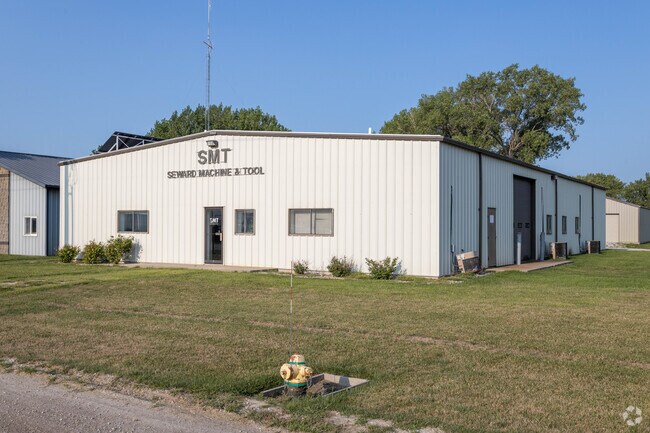
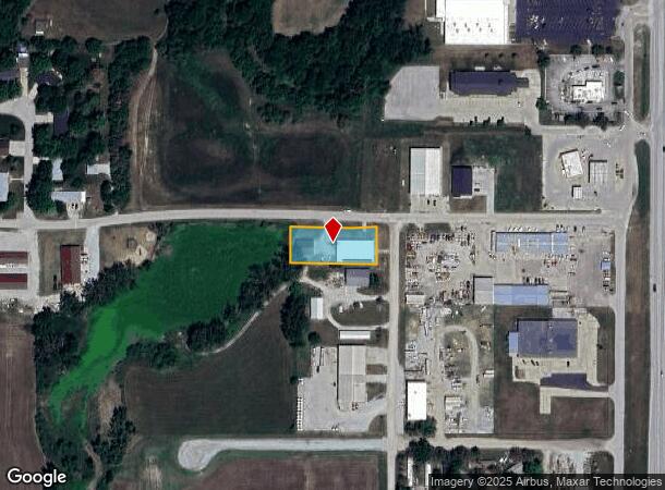
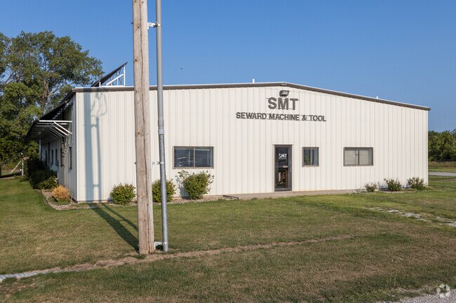
2609 Pine Rd
Lincoln
Twin Oaks 2Nd
Lincoln, NE
SEWARD TWIN OAKS DEVELOPMENT 2ND ADDITION LOT 1
800102479
Seward
Manufacturinglight
Nebraska
2024
1
2025
1.36 AC
960200
Seward County
6,000 SF
DEMOGRAPHICS near 2609 Pine Rd
1 Mile
3 Mile
5 Mile
2024 Total Population
172
7,772
8,487
2029 Population
176
7,836
8,558
Pop Growth 2024-2029
+ 2.33%
+ 0.82%
+ 0.84%
Average Age
38
38
39
2024 Total Households
71
2,862
3,137
HH Growth 2024-2029
+ 1.41%
+ 0.84%
+ 0.83%
Median Household Inc
$55,000
$74,303
$75,244
Avg Household Size
2.30
2.40
2.40
2024 Avg HH Vehicles
2.00
2.00
2.00
Median Home Value
$157,142
$194,879
$196,614
Median Year Built
1961
1974
1974
Nearby Places
Map Layers
Map Styles
 Street
 Aerial
- Restaurants
- Banks
- Shops
- Fitness
- Groceries
PUBLIC TRANSPORTATION
AIRPORT
Lincoln
DRIVE
WALK
Distance
Lincoln
31 min
26.6 mi
Freight Ports
Tulsa Port Of Catoosa
DRIVE
WALK
Distance
Tulsa Port Of Catoosa
478 min
450.3 mi
Nearby Properties
Address
Land Use
TOTAL SIZE
Lot Size
Zoning
Address
Land Use
TOTAL SIZE
Lot Size
Zoning
179,572 SF
15.38 AC
INDUSTRIAL
Address
Land Use
TOTAL SIZE
Lot Size
Zoning
25,328 SF
1.48 AC
COMMERCIAL
Address
Land Use
TOTAL SIZE
Lot Size
Zoning
70,000 SF
49.01 AC
INDUSTRIAL
Address
Land Use
TOTAL SIZE
Lot Size
Zoning
475,394 SF
60.33 AC
INDUSTRIAL
Address
Land Use
TOTAL SIZE
Lot Size
Zoning
99,652 SF
14.55 AC
COMMERCIAL
Address
Land Use
TOTAL SIZE
Lot Size
Zoning
88,480 SF
5.23 AC
MULTI-FAMI
Address
Land Use
TOTAL SIZE
Lot Size
Zoning
8,585 SF
2.47 AC
COMMERCIAL
Address
Land Use
TOTAL SIZE
Lot Size
Zoning
38,390 SF
5.43 AC
COMMERCIAL
Address
Land Use
TOTAL SIZE
Lot Size
Zoning
60,440 SF
6.03 AC
COMMERCIAL
Address
Land Use
TOTAL SIZE
Lot Size
Zoning
86,880 SF
18.45 AC
INDUSTRIAL
Address
Land Use
TOTAL SIZE
Lot Size
Zoning
21,518 SF
0.41 AC
COMMERCIAL
Address
Land Use
TOTAL SIZE
Lot Size
Zoning
13,719 SF
1.50 AC
COMMERCIAL
Address
Land Use
TOTAL SIZE
Lot Size
Zoning
40,508 SF
3.09 AC
COMMERCIAL
Address
Land Use
TOTAL SIZE
Lot Size
Zoning
34,800 SF
2.46 AC
INDUSTRIAL
Address
Land Use
TOTAL SIZE
Lot Size
Zoning
12,762 SF
0.76 AC
SINGLE-FAM
Address
Land Use
TOTAL SIZE
Lot Size
Zoning
20,536 SF
2.88 AC
COMMERCIAL
Address
Land Use
TOTAL SIZE
Lot Size
Zoning
2,184 SF
12.70 AC
AGRICULTUR
Address
Land Use
TOTAL SIZE
Lot Size
Zoning
13,650 SF
0.32 AC
MULTI-FAMI
Address
Land Use
TOTAL SIZE
Lot Size
Zoning
11,832 SF
1.38 AC
MULTI-FAMI
Address
Land Use
TOTAL SIZE
Lot Size
Zoning
22,252 SF
3.52 AC
MULTI-FAMI
Address
Land Use
TOTAL SIZE
Lot Size
Zoning
13,650 SF
0.35 AC
MULTI-FAMI
Address
Land Use
TOTAL SIZE
Lot Size
Zoning
161,250 SF
14.99 AC
INDUSTRIAL
Address
Land Use
TOTAL SIZE
Lot Size
Zoning
41,137 SF
6.37 AC
COMMERCIAL
Address
Land Use
TOTAL SIZE
Lot Size
Zoning
10,800 SF
0.49 AC
MULTI-FAMI
Address
Land Use
TOTAL SIZE
Lot Size
Zoning
10,800 SF
0.45 AC
MULTI-FAMI
Address
Land Use
TOTAL SIZE
Lot Size
Zoning
25,080 SF
1.82 AC
MULTI-FAMI
Address
Land Use
TOTAL SIZE
Lot Size
Zoning
8,414 SF
0.49 AC
COMMERCIAL
Address
Land Use
TOTAL SIZE
Lot Size
Zoning
6,930 SF
0.59 AC
COMMERCIAL
Address
Land Use
TOTAL SIZE
Lot Size
Zoning
14,800 SF
15.71 AC
INDUSTRIAL
Address
Land Use
TOTAL SIZE
Lot Size
Zoning
20,640 SF
0.23 AC
COMMERCIAL
The World's #1 Commercial Real Estate Marketplace
Connect with us
© 2026 CoStar Group
The information above has been obtained from sources believed reliable. While we do not doubt its accuracy we have not verified it and make no guarantee, warranty or representation about it. It is your responsibility to independently confirm its accuracy and completeness. Any projections, opinions, assumptions, or estimates used are for example only and do not represent the current or future performance of the property. The value of this transaction to you depends on tax and other factors which should be evaluated by your tax, financial, and legal advisors. You and your advisors should conduct a careful, independent investigation of the property to determine to your satisfaction the suitability of the property for your needs.