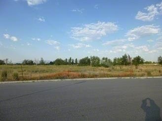
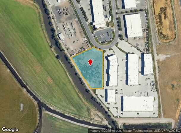
Property Record
250 S 1200 W, North Salt Lake, UT 84054
NEARBY LISTINGS FOR SALE OR LEASE
Property Detail
250 S 1200 W
Ogden-Clearfield, UT
River Bend Industrial Sub
01-400-0010
ALL OF LOT 10, RIVER BEND INDUSTRIAL SUBDIVISION. CONT. 2.03000 ACRES
Industrialgeneral
Davis
AE
Utah
49035C0129G
10
2025
2.03 AC
2025
Davis/Weber Counties
127002
Salt Lake City
DEMOGRAPHICS near 250 S 1200 W
1 Mile
3 Mile
5 Mile
2024 Total Population
1,981
35,281
105,963
2029 Population
2,080
36,987
110,305
Pop Growth 2024-2029
+ 5.00%
+ 4.84%
+ 4.10%
Average Age
32
34
35
2024 Total Households
572
11,139
37,043
HH Growth 2024-2029
+ 5.07%
+ 5.02%
+ 4.14%
Median Household Inc
$115,770
$81,009
$71,637
Avg Household Size
3.20
3.10
2.80
2024 Avg HH Vehicles
2.00
2.00
2.00
Median Home Value
$375,806
$408,267
$404,956
Median Year Built
2005
1998
1983
Nearby Places
- Restaurants
- Banks
- Shops
- Fitness
- Groceries
PUBLIC TRANSPORTATION
COMMUTER RAIL
Woods Cross (FrontRunner North - Utah Transit Authority (UTA))
DRIVE
WALK
Distance
Woods Cross (FrontRunner North - Utah Transit Authority (UTA))
11 min
7.3 mi
AIRPORT
Salt Lake City International
DRIVE
WALK
Distance
Salt Lake City International
12 min
10.0 mi
Freight Ports
Port of Oakland
DRIVE
WALK
Distance
Port of Oakland
1 min
590.7 mi
Nearby Properties
Address
Land Use
TOTAL SIZE
Lot Size
Zoning
Address
Land Use
TOTAL SIZE
Lot Size
Zoning
1,140,230 SF
53.87 AC
B-P
Address
Land Use
TOTAL SIZE
Lot Size
Zoning
6,673 SF
345.82 AC
Address
Land Use
TOTAL SIZE
Lot Size
Zoning
463,000 SF
25.21 AC
B-P
Address
Land Use
TOTAL SIZE
Lot Size
Zoning
354,506 SF
18.44 AC
B-P
Address
Land Use
TOTAL SIZE
Lot Size
Zoning
380,631 SF
20.34 AC
BP
Address
Land Use
TOTAL SIZE
Lot Size
Zoning
341,830 SF
17.75 AC
BP
Address
Land Use
TOTAL SIZE
Lot Size
Zoning
74,454 SF
12.17 AC
RMF-30
Address
Land Use
TOTAL SIZE
Lot Size
Zoning
167,620 SF
114.91 AC
M-1
Address
Land Use
TOTAL SIZE
Lot Size
Zoning
307,112 SF
15.21 AC
M-1
Address
Land Use
TOTAL SIZE
Lot Size
Zoning
247,240 SF
15.06 AC
1205
Address
Land Use
TOTAL SIZE
Lot Size
Zoning
152,165 SF
8.47 AC
4144
Address
Land Use
TOTAL SIZE
Lot Size
Zoning
186,948 SF
12.03 AC
IP-M-1
Address
Land Use
TOTAL SIZE
Lot Size
Zoning
121,083 SF
9.66 AC
M-1
Address
Land Use
TOTAL SIZE
Lot Size
Zoning
158 AC
AIRPT
Address
Land Use
TOTAL SIZE
Lot Size
Zoning
181,565 SF
11.31 AC
M-1
Address
Land Use
TOTAL SIZE
Lot Size
Zoning
657,526 SF
35.95 AC
MD
Address
Land Use
TOTAL SIZE
Lot Size
Zoning
4,241 SF
8.67 AC
P
Address
Land Use
TOTAL SIZE
Lot Size
Zoning
208,638 SF
56.05 AC
Address
Land Use
TOTAL SIZE
Lot Size
Zoning
190,822 SF
17.69 AC
PL
Address
Land Use
TOTAL SIZE
Lot Size
Zoning
3,026 SF
14.42 AC
P
Address
Land Use
TOTAL SIZE
Lot Size
Zoning
240 AC
AIRPRT
Address
Land Use
TOTAL SIZE
Lot Size
Zoning
138,720 SF
8.76 AC
BP
Address
Land Use
TOTAL SIZE
Lot Size
Zoning
13,126 SF
7.83 AC
P
Address
Land Use
TOTAL SIZE
Lot Size
Zoning
77.59 AC
AIRPRT
Address
Land Use
TOTAL SIZE
Lot Size
Zoning
259,785 SF
18 AC
ARPORT
Address
Land Use
TOTAL SIZE
Lot Size
Zoning
74.85 AC
ARPORT
Address
Land Use
TOTAL SIZE
Lot Size
Zoning
230,020 SF
27.33 AC
MD
Address
Land Use
TOTAL SIZE
Lot Size
Zoning
259,942 SF
18.52 AC
MD
Address
Land Use
TOTAL SIZE
Lot Size
Zoning
155,896 SF
8.96 AC
Address
Land Use
TOTAL SIZE
Lot Size
Zoning
58,273 SF
3.80 AC
I1
The World's #1 Commercial Real Estate Marketplace
Connect with us
© 2025 CoStar Group
The information above has been obtained from sources believed reliable. While we do not doubt its accuracy we have not verified it and make no guarantee, warranty or representation about it. It is your responsibility to independently confirm its accuracy and completeness. Any projections, opinions, assumptions, or estimates used are for example only and do not represent the current or future performance of the property. The value of this transaction to you depends on tax and other factors which should be evaluated by your tax, financial, and legal advisors. You and your advisors should conduct a careful, independent investigation of the property to determine to your satisfaction the suitability of the property for your needs.