Property Record
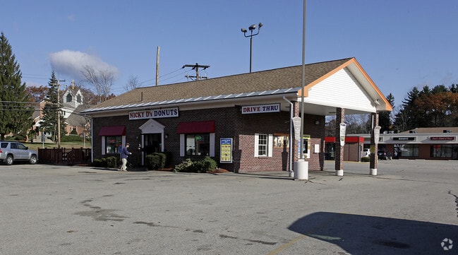
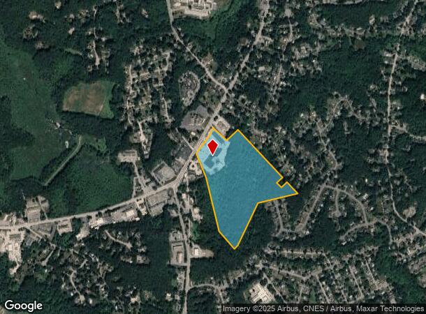
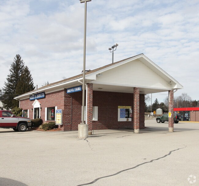
243 W Main St, Northborough, MA 01532
NEARBY LISTINGS FOR SALE OR LEASE
Property Detail
243 W Main St
NBOR-000820-000000-000016
Worcester
Commercialnec
Massachusetts
X
16
25027C0642F
36.90 AC
2025
The Boroughs
2025
Boston
740101
Worcester, MA-CT
44,726 SF
DEMOGRAPHICS near 243 W Main St
1 Mile
3 Mile
5 Mile
2024 Total Population
4,760
36,583
78,594
2029 Population
4,765
36,679
78,782
Pop Growth 2024-2029
+ 0.11%
+ 0.26%
+ 0.24%
Average Age
43
41
41
2024 Total Households
1,740
13,224
29,284
HH Growth 2024-2029
+ 0.17%
+ 0.35%
+ 0.30%
Median Household Inc
$149,378
$140,372
$128,169
Avg Household Size
2.60
2.70
2.60
2024 Avg HH Vehicles
2.00
2.00
2.00
Median Home Value
$485,596
$576,127
$548,405
Median Year Built
1974
1983
1981
Nearby Places
- Restaurants
- Banks
- Shops
- Fitness
- Groceries
PUBLIC TRANSPORTATION
COMMUTER RAIL
Westborough (Framingham/Worcester Line - Massachusetts Bay Transportation Authority Commuter Rail (Purple Line))
DRIVE
WALK
Distance
Westborough (Framingham/Worcester Line - Massachusetts Bay Transportation Authority Commuter Rail (Purple Line))
9 min
3.9 mi
Grafton (Framingham/Worcester Line - Massachusetts Bay Transportation Authority Commuter Rail (Purple Line))
DRIVE
WALK
Distance
Grafton (Framingham/Worcester Line - Massachusetts Bay Transportation Authority Commuter Rail (Purple Line))
11 min
6.0 mi
AIRPORT
Worcester Regional
DRIVE
WALK
Distance
Worcester Regional
28 min
13.7 mi
Freight Ports
Port of Boston
DRIVE
WALK
Distance
Port of Boston
56 min
37.4 mi
Nearby Properties
Address
Land Use
TOTAL SIZE
Lot Size
Zoning
Address
Land Use
TOTAL SIZE
Lot Size
Zoning
42.01 AC
I
Address
Land Use
TOTAL SIZE
Lot Size
Zoning
68.85 AC
OFF-RE
Address
Land Use
TOTAL SIZE
Lot Size
Zoning
339,553 SF
42.94 AC
RC
Address
Land Use
TOTAL SIZE
Lot Size
Zoning
22.40 AC
COM BU
Address
Land Use
TOTAL SIZE
Lot Size
Zoning
67.29 AC
IB
Address
Land Use
TOTAL SIZE
Lot Size
Zoning
23.65 AC
RUR A
Address
Land Use
TOTAL SIZE
Lot Size
Zoning
19.69 AC
BA
Address
Land Use
TOTAL SIZE
Lot Size
Zoning
205,712 SF
3.95 AC
BA
Address
Land Use
TOTAL SIZE
Lot Size
Zoning
554,193 SF
52.56 AC
I
Address
Land Use
TOTAL SIZE
Lot Size
Zoning
201,818 SF
5.55 AC
BA
Address
Land Use
TOTAL SIZE
Lot Size
Zoning
205,712 SF
5.76 AC
BA
Address
Land Use
TOTAL SIZE
Lot Size
Zoning
260,605 SF
29 AC
I
Address
Land Use
TOTAL SIZE
Lot Size
Zoning
220,336 SF
24.65 AC
I
Address
Land Use
TOTAL SIZE
Lot Size
Zoning
299,149 SF
28.81 AC
I
Address
Land Use
TOTAL SIZE
Lot Size
Zoning
43.90 AC
M-1
Address
Land Use
TOTAL SIZE
Lot Size
Zoning
21.04 AC
APT 99
Address
Land Use
TOTAL SIZE
Lot Size
Zoning
10.28 AC
R
Address
Land Use
TOTAL SIZE
Lot Size
Zoning
167,438 SF
23.82 AC
I
Address
Land Use
TOTAL SIZE
Lot Size
Zoning
170,000 SF
27.66 AC
BA
Address
Land Use
TOTAL SIZE
Lot Size
Zoning
102,181 SF
38.62 AC
RES B-
Address
Land Use
TOTAL SIZE
Lot Size
Zoning
10.34 AC
APT 91
Address
Land Use
TOTAL SIZE
Lot Size
Zoning
125,914 SF
111.02 AC
Address
Land Use
TOTAL SIZE
Lot Size
Zoning
19.05 AC
I
Address
Land Use
TOTAL SIZE
Lot Size
Zoning
22.06 AC
COM BU
Address
Land Use
TOTAL SIZE
Lot Size
Zoning
157,014 SF
111.02 AC
Address
Land Use
TOTAL SIZE
Lot Size
Zoning
83,180 SF
24 AC
I
Address
Land Use
TOTAL SIZE
Lot Size
Zoning
184,960 SF
23.58 AC
IB
Address
Land Use
TOTAL SIZE
Lot Size
Zoning
124,262 SF
Address
Land Use
TOTAL SIZE
Lot Size
Zoning
184,523 SF
34.34 AC
BA
Address
Land Use
TOTAL SIZE
Lot Size
Zoning
139,212 SF
21 AC
RB
The World's #1 Commercial Real Estate Marketplace
Connect with us
© 2025 CoStar Group
The information above has been obtained from sources believed reliable. While we do not doubt its accuracy we have not verified it and make no guarantee, warranty or representation about it. It is your responsibility to independently confirm its accuracy and completeness. Any projections, opinions, assumptions, or estimates used are for example only and do not represent the current or future performance of the property. The value of this transaction to you depends on tax and other factors which should be evaluated by your tax, financial, and legal advisors. You and your advisors should conduct a careful, independent investigation of the property to determine to your satisfaction the suitability of the property for your needs.