Property Record
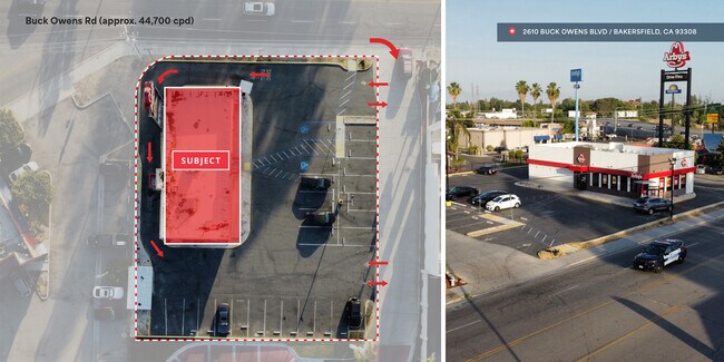
2610 Buck Owens Blvd, Bakersfield, CA 93308


Current Lease Availabilities
NEARBY LISTINGS FOR SALE OR LEASE
Property Detail
2610 Buck Owens Blvd
332-580-10-00-8
SECTION 23 , TOWNSHIP 29 , RANGE 27 , QUARTER
Restaurantdrivein
Kern
X
California
06029C1818F
0.52 AC
2024
Downtown
2025
Bakersfield
000507
Bakersfield, CA
1,922 SF
DEMOGRAPHICS near 2610 Buck Owens Blvd
1 Mile
3 Mile
5 Mile
2024 Total Population
3,751
104,410
300,212
2029 Population
3,774
104,734
300,248
Pop Growth 2024-2029
+ 0.61%
+ 0.31%
+ 0.01%
Average Age
39
36
35
2024 Total Households
1,631
37,597
101,217
HH Growth 2024-2029
+ 0.49%
+ 0.31%
0.00%
Median Household Inc
$64,809
$42,022
$49,186
Avg Household Size
2.30
2.70
2.90
2024 Avg HH Vehicles
2.00
2.00
2.00
Median Home Value
$347,717
$246,333
$265,613
Median Year Built
1954
1969
1974
Nearby Places
Map Layers
Map Styles
 Street
 Aerial
- Restaurants
- Banks
- Shops
- Fitness
- Groceries
PUBLIC TRANSPORTATION
COMMUTER RAIL
Bakersfield (San Joaquins - Amtrak)
DRIVE
WALK
Distance
Bakersfield (San Joaquins - Amtrak)
6 min
3.0 mi
AIRPORT
Meadows Field
DRIVE
WALK
Distance
Meadows Field
13 min
4.8 mi
Freight Ports
The Port of Hueneme
DRIVE
WALK
Distance
The Port of Hueneme
153 min
122.9 mi
Nearby Properties
Address
Land Use
TOTAL SIZE
Lot Size
Zoning
Address
Land Use
TOTAL SIZE
Lot Size
Zoning
60.03 AC
M-3
Address
Land Use
TOTAL SIZE
Lot Size
Zoning
3,788 SF
54.09 AC
M3
Address
Land Use
TOTAL SIZE
Lot Size
Zoning
402,037 SF
17.72 AC
R1
Address
Land Use
TOTAL SIZE
Lot Size
Zoning
104,693 SF
2.09 AC
HOSP
Address
Land Use
TOTAL SIZE
Lot Size
Zoning
Address
Land Use
TOTAL SIZE
Lot Size
Zoning
1,200 SF
5.89 AC
M-1
Address
Land Use
TOTAL SIZE
Lot Size
Zoning
85,971 SF
5.31 AC
C-2
Address
Land Use
TOTAL SIZE
Lot Size
Zoning
59,242 SF
3.01 AC
C2
Address
Land Use
TOTAL SIZE
Lot Size
Zoning
112,849 SF
5.31 AC
C-2
Address
Land Use
TOTAL SIZE
Lot Size
Zoning
2,032 SF
11.08 AC
M3
Address
Land Use
TOTAL SIZE
Lot Size
Zoning
16.64 AC
Address
Land Use
TOTAL SIZE
Lot Size
Zoning
1 SF
14.26 AC
R-2 PUD
Address
Land Use
TOTAL SIZE
Lot Size
Zoning
386,282 SF
14.05 AC
Address
Land Use
TOTAL SIZE
Lot Size
Zoning
10,064 SF
13.44 AC
R3
Address
Land Use
TOTAL SIZE
Lot Size
Zoning
155,550 SF
18.51 AC
M2
Address
Land Use
TOTAL SIZE
Lot Size
Zoning
63,428 SF
5.18 AC
C-2
Address
Land Use
TOTAL SIZE
Lot Size
Zoning
41,394 SF
14.74 AC
Address
Land Use
TOTAL SIZE
Lot Size
Zoning
188,976 SF
4.92 AC
Address
Land Use
TOTAL SIZE
Lot Size
Zoning
87,389 SF
1.76 AC
M1
Address
Land Use
TOTAL SIZE
Lot Size
Zoning
161,539 SF
4 AC
CO
Address
Land Use
TOTAL SIZE
Lot Size
Zoning
233,512 SF
9.19 AC
R-3
Address
Land Use
TOTAL SIZE
Lot Size
Zoning
66,849 SF
5.32 AC
CO
Address
Land Use
TOTAL SIZE
Lot Size
Zoning
71,000 SF
5.89 AC
C-2
Address
Land Use
TOTAL SIZE
Lot Size
Zoning
193,524 SF
2.34 AC
C-O
Address
Land Use
TOTAL SIZE
Lot Size
Zoning
3,383 SF
19.40 AC
M-2
Address
Land Use
TOTAL SIZE
Lot Size
Zoning
78,140 SF
2.52 AC
CC
Address
Land Use
TOTAL SIZE
Lot Size
Zoning
8 AC
M-3
Address
Land Use
TOTAL SIZE
Lot Size
Zoning
140,210 SF
1.74 AC
C-2
Address
Land Use
TOTAL SIZE
Lot Size
Zoning
92,953 SF
13.59 AC
C2
Address
Land Use
TOTAL SIZE
Lot Size
Zoning
105,513 SF
1.60 AC
C-B
The World's #1 Commercial Real Estate Marketplace
Connect with us
© 2025 CoStar Group
The information above has been obtained from sources believed reliable. While we do not doubt its accuracy we have not verified it and make no guarantee, warranty or representation about it. It is your responsibility to independently confirm its accuracy and completeness. Any projections, opinions, assumptions, or estimates used are for example only and do not represent the current or future performance of the property. The value of this transaction to you depends on tax and other factors which should be evaluated by your tax, financial, and legal advisors. You and your advisors should conduct a careful, independent investigation of the property to determine to your satisfaction the suitability of the property for your needs.