Property Record
2610 Daniel Ave, San Diego, CA 92111
This Property Is For Sale
NEARBY LISTINGS FOR SALE OR LEASE
Property Detail
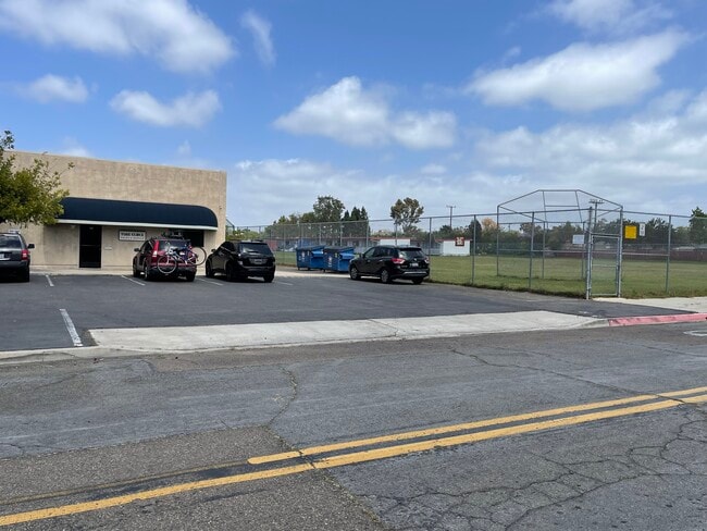
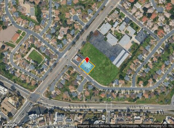
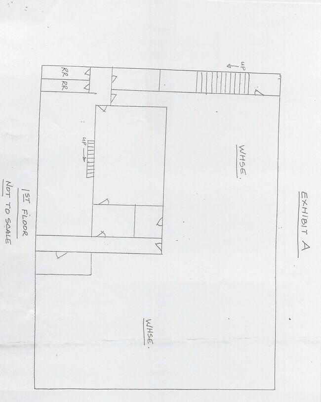
2610 Daniel Ave
427-332-05
Chesterton Ext
Storesoffices
BLK 4 ALLEY CLSD ADJ & POR TR 002062
X
San Diego
06073C1616G
California
2024
0.40 AC
2025
PB/Rose Canyon/Morena
008701
San Diego
6,380 SF
San Diego-Carlsbad, CA
DEMOGRAPHICS near 2610 Daniel Ave
1 Mile
3 Mile
5 Mile
2024 Total Population
22,584
170,619
435,088
2029 Population
22,624
171,711
436,003
Pop Growth 2024-2029
+ 0.18%
+ 0.64%
+ 0.21%
Average Age
37
39
39
2024 Total Households
7,601
72,115
192,131
HH Growth 2024-2029
(0.14%)
+ 0.71%
+ 0.16%
Median Household Inc
$75,170
$94,073
$90,909
Avg Household Size
2.70
2.20
2.20
2024 Avg HH Vehicles
2.00
2.00
2.00
Median Home Value
$714,190
$764,774
$800,743
Median Year Built
1972
1976
1974
Nearby Places
- Restaurants
- Banks
- Shops
- Fitness
- Groceries
PUBLIC TRANSPORTATION
COMMUTER RAIL
Old Town Transit Center (Coaster - San Diego North County Transit District (Coaster/Sprinter/Breeze))
DRIVE
WALK
Distance
Old Town Transit Center (Coaster - San Diego North County Transit District (Coaster/Sprinter/Breeze))
9 min
4.2 mi
San Diego (Santa Fe Depot) (Coaster - San Diego North County Transit District (Coaster/Sprinter/Breeze))
DRIVE
WALK
Distance
San Diego (Santa Fe Depot) (Coaster - San Diego North County Transit District (Coaster/Sprinter/Breeze))
11 min
7.0 mi
AIRPORT
San Diego International
DRIVE
WALK
Distance
San Diego International
12 min
6.0 mi
Freight Ports
Port of San Diego
DRIVE
WALK
Distance
Port of San Diego
14 min
8.2 mi
Nearby Properties
Address
Land Use
TOTAL SIZE
Lot Size
Zoning
Address
Land Use
TOTAL SIZE
Lot Size
Zoning
30,000 SF
62.51 AC
MVPD-MV-CR
Address
Land Use
TOTAL SIZE
Lot Size
Zoning
189,644 SF
20.49 AC
CO-1-2
Address
Land Use
TOTAL SIZE
Lot Size
Zoning
17.88 AC
CO-1-2
Address
Land Use
TOTAL SIZE
Lot Size
Zoning
12.97 AC
RM-3-7
Address
Land Use
TOTAL SIZE
Lot Size
Zoning
46.03 AC
IH-2-1
Address
Land Use
TOTAL SIZE
Lot Size
Zoning
5.93 AC
CC-1-3
Address
Land Use
TOTAL SIZE
Lot Size
Zoning
5.09 AC
CC-3-8
Address
Land Use
TOTAL SIZE
Lot Size
Zoning
2.53 AC
EMX-1
Address
Land Use
TOTAL SIZE
Lot Size
Zoning
1.51 AC
CC-3-9
Address
Land Use
TOTAL SIZE
Lot Size
Zoning
6.96 AC
MVPD-MVR-4
Address
Land Use
TOTAL SIZE
Lot Size
Zoning
19.25 AC
CC-3-5
Address
Land Use
TOTAL SIZE
Lot Size
Zoning
18.10 AC
RM-2-5
Address
Land Use
TOTAL SIZE
Lot Size
Zoning
15.37 AC
CC-3-8
Address
Land Use
TOTAL SIZE
Lot Size
Zoning
7.48 AC
RM-3-9
Address
Land Use
TOTAL SIZE
Lot Size
Zoning
54,240 SF
8.18 AC
MVPD-MVR-2
Address
Land Use
TOTAL SIZE
Lot Size
Zoning
2.50 AC
MVPD-MV-CO
Address
Land Use
TOTAL SIZE
Lot Size
Zoning
13.45 AC
IL-2-1
Address
Land Use
TOTAL SIZE
Lot Size
Zoning
5.35 AC
MVPD-MV-CR
Address
Land Use
TOTAL SIZE
Lot Size
Zoning
7.69 AC
MVPD-MV-M/
Address
Land Use
TOTAL SIZE
Lot Size
Zoning
13.04 AC
RM-2-5
Address
Land Use
TOTAL SIZE
Lot Size
Zoning
7.19 AC
MVPD-MV-M/
Address
Land Use
TOTAL SIZE
Lot Size
Zoning
17.35 AC
C-6
Address
Land Use
TOTAL SIZE
Lot Size
Zoning
902,919 SF
45.23 AC
MVPD-MV-CR
Address
Land Use
TOTAL SIZE
Lot Size
Zoning
5.39 AC
CO-1-2
Address
Land Use
TOTAL SIZE
Lot Size
Zoning
2.90 AC
MVPD-MV-CR
Address
Land Use
TOTAL SIZE
Lot Size
Zoning
94,500 SF
9.96 AC
IL-3-1
Address
Land Use
TOTAL SIZE
Lot Size
Zoning
1.99 AC
EMX-1
Address
Land Use
TOTAL SIZE
Lot Size
Zoning
11.78 AC
CC-1-3
Address
Land Use
TOTAL SIZE
Lot Size
Zoning
5.87 AC
IL-2-1
Address
Land Use
TOTAL SIZE
Lot Size
Zoning
1.81 AC
EMX-1
The World's #1 Commercial Real Estate Marketplace
Connect with us
© 2025 CoStar Group
The information above has been obtained from sources believed reliable. While we do not doubt its accuracy we have not verified it and make no guarantee, warranty or representation about it. It is your responsibility to independently confirm its accuracy and completeness. Any projections, opinions, assumptions, or estimates used are for example only and do not represent the current or future performance of the property. The value of this transaction to you depends on tax and other factors which should be evaluated by your tax, financial, and legal advisors. You and your advisors should conduct a careful, independent investigation of the property to determine to your satisfaction the suitability of the property for your needs.