Property Record
2610 Highway 4, Jay, FL 32565


This Property Is For Sale
Property Detail
2610 Highway 4
40-5N-30-0000-00100-0000
**UPDAATED 2025** SECTION 40 TWNSHIP 5N RANGE 30W PARCEL A: BEG AT A 4X4 INCH CONCRETE MARKER, BEING NE COR OF SECTION 40; THN S01*5915W ALONG MONMTD E LINE OF SAID SECTION 40 FOR 476.83 FT TO A 5/8 INCH REBAR AT SE COR OF A PARCEL DESC IN OR 4219 PG
Timberlandforesttreesagricultural
SANTA ROSA
AG-RR
Florida
A Areas with a 1% annual chance of flooding and a 26% chance of flooding over the life of a 30-year mortgage.
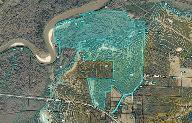
339.55 AC
2024
Upper Santa Rosa County
2025
Pensacola
010200
Pensacola-Ferry Pass-Brent, FL
792 SF
NEARBY LISTINGS FOR SALE OR LEASE
-
-
View all Jay listings for sale on LoopNet.com
DEMOGRAPHICS near 2610 Highway 4
1 mile
3 mile
5 mile
2024 Total Population
78
1,083
6,362
2029 Population
89
1,183
6,733
Pop Growth 2024-2029
+ 14.10%
+ 9.23%
+ 5.83%
Average Age
42
41
40
2024 Total Households
30
435
2,440
HH Growth 2024-2029
+ 16.67%
+ 9.43%
+ 5.98%
Median Household Inc
$89,062
$55,156
$42,387
Avg Household Size
2.60
2.50
2.50
2024 Avg HH Vehicles
2.00
2.00
2.00
Median Home Value
$164,999
$132,243
$116,012
Median Year Built
1972
1977
1983
Nearby Places
Map Layers
Map Styles
 Street
 Aerial
Transit
 Traffic
 Biking
Places
Listings with unknown addresses are not visible on the map
- Restaurants
- Banks
- Shops
- Fitness
- Groceries
Nearby Properties
Address
Land Use
TOTAL SIZE
Lot Size
Zoning
Address
Land Use
TOTAL SIZE
Lot Size
Zoning
83,334 SF
59.80 AC
M2
Address
Land Use
TOTAL SIZE
Lot Size
Zoning
27,670 SF
24.23 AC
PF
Address
Land Use
TOTAL SIZE
Lot Size
Zoning
28,239 SF
14.42 AC
IH
Address
Land Use
TOTAL SIZE
Lot Size
Zoning
58,162 SF
11.48 AC
IH
Address
Land Use
TOTAL SIZE
Lot Size
Zoning
28,352 SF
4.28 AC
HCD
Address
Land Use
TOTAL SIZE
Lot Size
Zoning
20,251 SF
3.18 AC
IH
Address
Land Use
TOTAL SIZE
Lot Size
Zoning
14,052 SF
30.17 AC
AG2
Address
Land Use
TOTAL SIZE
Lot Size
Zoning
27,430 SF
7.34 AC
INCORP
Address
Land Use
TOTAL SIZE
Lot Size
Zoning
360.01 AC
AG2
Address
Land Use
TOTAL SIZE
Lot Size
Zoning
8,027 SF
24.01 AC
RR
Address
Land Use
TOTAL SIZE
Lot Size
Zoning
8,150 SF
0.62 AC
RMU
Address
Land Use
TOTAL SIZE
Lot Size
Zoning
7,972 SF
3.42 AC
CC
Address
Land Use
TOTAL SIZE
Lot Size
Zoning
15,284 SF
2.77 AC
HCD
Address
Land Use
TOTAL SIZE
Lot Size
Zoning
3,936 SF
0.77 AC
CC-A
Address
Land Use
TOTAL SIZE
Lot Size
Zoning
6,057 SF
10.29 AC
AG-RR
Address
Land Use
TOTAL SIZE
Lot Size
Zoning
8,937 SF
2.02 AC
RMU
Address
Land Use
TOTAL SIZE
Lot Size
Zoning
5,197 SF
6.41 AC
AG-RR
Address
Land Use
TOTAL SIZE
Lot Size
Zoning
4,174 SF
8 AC
AG-RR
Address
Land Use
TOTAL SIZE
Lot Size
Zoning
2,427 SF
2.18 AC
AG-RR
Address
Land Use
TOTAL SIZE
Lot Size
Zoning
8,821 SF
20 AC
AG-RR
Address
Land Use
TOTAL SIZE
Lot Size
Zoning
3,748 SF
8.48 AC
AG-RR
Address
Land Use
TOTAL SIZE
Lot Size
Zoning
2,442 SF
14.97 AC
RR
Address
Land Use
TOTAL SIZE
Lot Size
Zoning
8,790 SF
6.33 AC
RC-PUD
Address
Land Use
TOTAL SIZE
Lot Size
Zoning
8,700 SF
2.01 AC
HCD
Address
Land Use
TOTAL SIZE
Lot Size
Zoning
22.96 AC
IND
Address
Land Use
TOTAL SIZE
Lot Size
Zoning
3,565 SF
61.31 AC
RA
Address
Land Use
TOTAL SIZE
Lot Size
Zoning
2,280 SF
17.29 AC
AG-RR
Address
Land Use
TOTAL SIZE
Lot Size
Zoning
4,444 SF
40 AC
AG-RR
Address
Land Use
TOTAL SIZE
Lot Size
Zoning
5,020 SF
25.92 AC
RA
Address
Land Use
TOTAL SIZE
Lot Size
Zoning
2,692 SF
14.93 AC
AG-RR
The World's #1 Commercial Real Estate Marketplace
Connect with us
© 2026 CoStar Group
The information above has been obtained from sources believed reliable. While we do not doubt its accuracy we have not verified it and make no guarantee, warranty or representation about it. It is your responsibility to independently confirm its accuracy and completeness. Any projections, opinions, assumptions, or estimates used are for example only and do not represent the current or future performance of the property. The value of this transaction to you depends on tax and other factors which should be evaluated by your tax, financial, and legal advisors. You and your advisors should conduct a careful, independent investigation of the property to determine to your satisfaction the suitability of the property for your needs.