Property Record
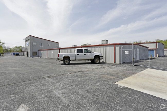
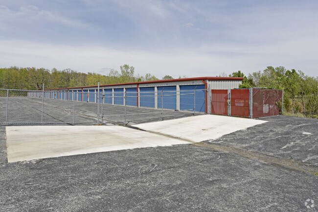
2610 N Storage Pkwy, Rogers, AR 72756
NEARBY LISTINGS FOR SALE OR LEASE
Property Detail
2610 N Storage Pkwy
02-02113-000
Rogers
Officebuilding
PART OF THE SOUTHEAST QUARTER (SE 1/4) OF THE SOUTHWEST QUARTER (SW 1/4) OF SECTION 36, TOWNSHIP 20 NORTH, RANGE 30 WEST, BENTON COUNTY, ARKANSAS, MORE PARTICULARLY DESCRIBED AS FOLLOWS: BEGINNING AT A POINT WHICH IS 880 FEET NORTH OF THE SOUTHWEST C
AE
Benton
05007C0260K
Arkansas
0
9.95 AC
2025
East Rogers
020203
Fayetteville/Springdale/Rogers
143,840 SF
Fayetteville-Springdale-Rogers, AR-MO
DEMOGRAPHICS near 2610 N Storage Pkwy
1 Mile
3 Mile
5 Mile
2024 Total Population
4,743
38,647
88,995
2029 Population
5,496
45,024
104,410
Pop Growth 2024-2029
+ 15.88%
+ 16.50%
+ 17.32%
Average Age
36
38
37
2024 Total Households
1,612
14,004
33,150
HH Growth 2024-2029
+ 15.88%
+ 16.55%
+ 17.52%
Median Household Inc
$61,464
$62,203
$66,862
Avg Household Size
2.70
2.60
2.60
2024 Avg HH Vehicles
2.00
2.00
2.00
Median Home Value
$214,220
$201,156
$217,700
Median Year Built
1988
1988
1992
Nearby Places
Map Layers
Map Styles
 Street
 Aerial
- Restaurants
- Banks
- Shops
- Fitness
- Groceries
PUBLIC TRANSPORTATION
AIRPORT
Northwest Arkansas Ntl
DRIVE
WALK
Distance
Northwest Arkansas Ntl
32 min
15.8 mi
Freight Ports
Tulsa Port of Inola
DRIVE
WALK
Distance
Tulsa Port of Inola
118 min
101.0 mi
Nearby Properties
Address
Land Use
TOTAL SIZE
Lot Size
Zoning
Address
Land Use
TOTAL SIZE
Lot Size
Zoning
117,522 SF
0.12 AC
Address
Land Use
TOTAL SIZE
Lot Size
Zoning
675,465 SF
37.34 AC
Address
Land Use
TOTAL SIZE
Lot Size
Zoning
746,783 SF
77.03 AC
Address
Land Use
TOTAL SIZE
Lot Size
Zoning
542,873 SF
16.52 AC
Address
Land Use
TOTAL SIZE
Lot Size
Zoning
97,660 SF
5.35 AC
Address
Land Use
TOTAL SIZE
Lot Size
Zoning
573,476 SF
57.80 AC
Address
Land Use
TOTAL SIZE
Lot Size
Zoning
249,843 SF
19.21 AC
Address
Land Use
TOTAL SIZE
Lot Size
Zoning
214,791 SF
9.13 AC
Address
Land Use
TOTAL SIZE
Lot Size
Zoning
156,100 SF
7.89 AC
Address
Land Use
TOTAL SIZE
Lot Size
Zoning
274,312 SF
12.24 AC
Address
Land Use
TOTAL SIZE
Lot Size
Zoning
152,759 SF
12.01 AC
Address
Land Use
TOTAL SIZE
Lot Size
Zoning
114,250 SF
7.54 AC
Address
Land Use
TOTAL SIZE
Lot Size
Zoning
117,522 SF
13.66 AC
Address
Land Use
TOTAL SIZE
Lot Size
Zoning
231,576 SF
15.18 AC
Address
Land Use
TOTAL SIZE
Lot Size
Zoning
102,477 SF
7.15 AC
Address
Land Use
TOTAL SIZE
Lot Size
Zoning
46,851 SF
4.28 AC
Address
Land Use
TOTAL SIZE
Lot Size
Zoning
74,243 SF
14.03 AC
Address
Land Use
TOTAL SIZE
Lot Size
Zoning
205,851 SF
20.13 AC
Address
Land Use
TOTAL SIZE
Lot Size
Zoning
263,095 SF
13.17 AC
Address
Land Use
TOTAL SIZE
Lot Size
Zoning
402,500 SF
19.54 AC
Address
Land Use
TOTAL SIZE
Lot Size
Zoning
191,610 SF
43 AC
Address
Land Use
TOTAL SIZE
Lot Size
Zoning
112,935 SF
6.75 AC
Address
Land Use
TOTAL SIZE
Lot Size
Zoning
195,563 SF
15.49 AC
Address
Land Use
TOTAL SIZE
Lot Size
Zoning
141,332 SF
18.26 AC
Address
Land Use
TOTAL SIZE
Lot Size
Zoning
4,329 SF
2.55 AC
Address
Land Use
TOTAL SIZE
Lot Size
Zoning
109,683 SF
Address
Land Use
TOTAL SIZE
Lot Size
Zoning
101,690 SF
8.76 AC
Address
Land Use
TOTAL SIZE
Lot Size
Zoning
123,791 SF
5.64 AC
Address
Land Use
TOTAL SIZE
Lot Size
Zoning
123,879 SF
5.31 AC
Address
Land Use
TOTAL SIZE
Lot Size
Zoning
143,368 SF
11.72 AC
The World's #1 Commercial Real Estate Marketplace
Connect with us
© 2025 CoStar Group
The information above has been obtained from sources believed reliable. While we do not doubt its accuracy we have not verified it and make no guarantee, warranty or representation about it. It is your responsibility to independently confirm its accuracy and completeness. Any projections, opinions, assumptions, or estimates used are for example only and do not represent the current or future performance of the property. The value of this transaction to you depends on tax and other factors which should be evaluated by your tax, financial, and legal advisors. You and your advisors should conduct a careful, independent investigation of the property to determine to your satisfaction the suitability of the property for your needs.