Property Record
2610 Northridge Pkwy, Ames, IA 50010
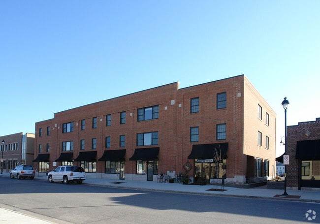


Property Detail
2610 Northridge Pkwy
05-33-227-135
SOMERSET SD 16TH ADD LOT:1 2, 3, 4 AMES
Apartment
STORY
SGA
Iowa
2024
0.50 AC
2025
Somerset
000105
Other Market Areas
24,392 SF
Ames, IA
NEARBY LISTINGS FOR SALE OR LEASE
DEMOGRAPHICS near 2610 Northridge Pkwy
1 mile
3 mile
5 mile
2025 Total Population
12,056
58,738
74,818
2030 Population
12,363
59,977
76,371
Pop Growth 2025-2030
+ 2.55%
+ 2.11%
+ 2.08%
Average Age
39
33
33
2025 Total Households
5,003
21,190
28,595
HH Growth 2025-2030
+ 3.40%
+ 2.68%
+ 2.51%
Median Household Inc
$80,943
$63,005
$63,110
Avg Household Size
2.10
2.10
2.10
2025 Avg HH Vehicles
2.00
2.00
2.00
Median Home Value
$337,660
$296,913
$297,161
Median Year Built
1995
1986
1990
Nearby Places
Map Layers
Map Styles
 Street
 Aerial
Layers
 Traffic
 Biking
Places
Listings with unknown addresses are not visible on the map
- Restaurants
- Banks
- Shops
- Fitness
- Groceries
SALE & LEASE HISTORY
LISTING DATE
SALE/LEASE

Oct 29, 2018
For Lease
Nearby Properties
Address
Land Use
TOTAL SIZE
Lot Size
Zoning
Address
Land Use
TOTAL SIZE
Lot Size
Zoning
2,216 SF
25.86 AC
RH
Address
Land Use
TOTAL SIZE
Lot Size
Zoning
54,112 SF
12.70 AC
Address
Land Use
TOTAL SIZE
Lot Size
Zoning
289,606 SF
1.77 AC
CSC
Address
Land Use
TOTAL SIZE
Lot Size
Zoning
45,627 SF
8.91 AC
RH
Address
Land Use
TOTAL SIZE
Lot Size
Zoning
215,689 SF
22.56 AC
HOC
Address
Land Use
TOTAL SIZE
Lot Size
Zoning
75,302 SF
16.66 AC
HOC
Address
Land Use
TOTAL SIZE
Lot Size
Zoning
117,797 SF
7.88 AC
Address
Land Use
TOTAL SIZE
Lot Size
Zoning
82,734 SF
1.42 AC
CSC
Address
Land Use
TOTAL SIZE
Lot Size
Zoning
156,833 SF
14.54 AC
PRC
Address
Land Use
TOTAL SIZE
Lot Size
Zoning
16,222 SF
10.44 AC
Address
Land Use
TOTAL SIZE
Lot Size
Zoning
78,379 SF
7.92 AC
SHM
Address
Land Use
TOTAL SIZE
Lot Size
Zoning
6,090 SF
20.72 AC
F-PRD
Address
Land Use
TOTAL SIZE
Lot Size
Zoning
133,668 SF
3.71 AC
RH
Address
Land Use
TOTAL SIZE
Lot Size
Zoning
20,619 SF
2.44 AC
RH
Address
Land Use
TOTAL SIZE
Lot Size
Zoning
78,507 SF
3 AC
FS-RM
Address
Land Use
TOTAL SIZE
Lot Size
Zoning
105,550 SF
0.62 AC
CSC
Address
Land Use
TOTAL SIZE
Lot Size
Zoning
7,181 SF
20.11 AC
PRC
Address
Land Use
TOTAL SIZE
Lot Size
Zoning
97,767 SF
0.05 AC
CSC
Address
Land Use
TOTAL SIZE
Lot Size
Zoning
122,502 SF
10.96 AC
HOC
Address
Land Use
TOTAL SIZE
Lot Size
Zoning
88,584 SF
0.57 AC
Address
Land Use
TOTAL SIZE
Lot Size
Zoning
100,588 SF
7.65 AC
HOC
Address
Land Use
TOTAL SIZE
Lot Size
Zoning
7,200 SF
4.32 AC
HOC
Address
Land Use
TOTAL SIZE
Lot Size
Zoning
8,820 SF
7.37 AC
PRC
Address
Land Use
TOTAL SIZE
Lot Size
Zoning
22,864 SF
2.13 AC
RH
Address
Land Use
TOTAL SIZE
Lot Size
Zoning
41,000 SF
1.73 AC
Address
Land Use
TOTAL SIZE
Lot Size
Zoning
63,021 SF
3.43 AC
Address
Land Use
TOTAL SIZE
Lot Size
Zoning
20,340 SF
5.66 AC
RH
Address
Land Use
TOTAL SIZE
Lot Size
Zoning
13,200 SF
8.28 AC
Address
Land Use
TOTAL SIZE
Lot Size
Zoning
43,805 SF
4.65 AC
HOC
Address
Land Use
TOTAL SIZE
Lot Size
Zoning
31,254 SF
3.51 AC
F-PRD
The World's #1 Commercial Real Estate Marketplace
Connect with us
© 2026 CoStar Group
The information above has been obtained from sources believed reliable. While we do not doubt its accuracy we have not verified it and make no guarantee, warranty or representation about it. It is your responsibility to independently confirm its accuracy and completeness. Any projections, opinions, assumptions, or estimates used are for example only and do not represent the current or future performance of the property. The value of this transaction to you depends on tax and other factors which should be evaluated by your tax, financial, and legal advisors. You and your advisors should conduct a careful, independent investigation of the property to determine to your satisfaction the suitability of the property for your needs.