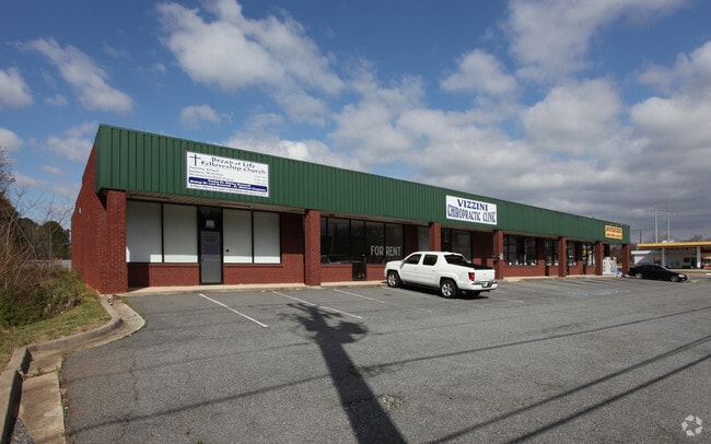
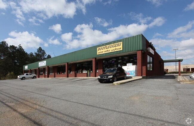
Property Record
2611 Moody Rd, Warner Robins, GA 31088
NEARBY LISTINGS FOR SALE OR LEASE
Property Detail
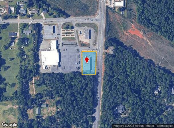
2611 Moody Rd
Warner Robins, GA
Moody Rd 700 Ff
0W80B0005000
PARCEL E 0.940 ACRE 226/10TH
Stripcommercialcenter
Houston
X
Georgia
13289C0200B
226
2024
0.94 AC
2024
Perry/Warner Robins
021121
Other Market Areas
11,250 SF
DEMOGRAPHICS near 2611 Moody Rd
1 Mile
3 Mile
5 Mile
2024 Total Population
4,224
46,989
108,448
2029 Population
4,573
51,517
118,939
Pop Growth 2024-2029
+ 8.26%
+ 9.64%
+ 9.67%
Average Age
41
37
37
2024 Total Households
1,724
18,304
41,182
HH Growth 2024-2029
+ 8.00%
+ 9.50%
+ 9.48%
Median Household Inc
$79,147
$78,019
$71,461
Avg Household Size
2.40
2.50
2.60
2024 Avg HH Vehicles
2.00
2.00
2.00
Median Home Value
$172,238
$162,179
$170,318
Median Year Built
1984
1989
1991
Nearby Places
Map Layers
Map Styles
 Street
 Aerial
- Restaurants
- Banks
- Shops
- Fitness
- Groceries
SALE & LEASE HISTORY
LISTING DATE
SALE/LEASE

Sep 25, 2016
For Lease
Nearby Properties
Address
Land Use
TOTAL SIZE
Lot Size
Zoning
Address
Land Use
TOTAL SIZE
Lot Size
Zoning
88,965 SF
18.72 AC
R2
Address
Land Use
TOTAL SIZE
Lot Size
Zoning
15,006 SF
30.30 AC
R4
Address
Land Use
TOTAL SIZE
Lot Size
Zoning
5,400 SF
22.93 AC
R4
Address
Land Use
TOTAL SIZE
Lot Size
Zoning
5,440 SF
36.50 AC
R4
Address
Land Use
TOTAL SIZE
Lot Size
Zoning
10,568 SF
35.44 AC
R4
Address
Land Use
TOTAL SIZE
Lot Size
Zoning
100,320 SF
26.91 AC
C2
Address
Land Use
TOTAL SIZE
Lot Size
Zoning
26,271 SF
17.43 AC
C2
Address
Land Use
TOTAL SIZE
Lot Size
Zoning
112,824 SF
Address
Land Use
TOTAL SIZE
Lot Size
Zoning
112,824 SF
Address
Land Use
TOTAL SIZE
Lot Size
Zoning
178,400 SF
49.03 AC
R2
Address
Land Use
TOTAL SIZE
Lot Size
Zoning
3,199 SF
41.42 AC
R4
Address
Land Use
TOTAL SIZE
Lot Size
Zoning
28,668 SF
17.38 AC
R4 C2
Address
Land Use
TOTAL SIZE
Lot Size
Zoning
16,570 SF
15.62 AC
R4
Address
Land Use
TOTAL SIZE
Lot Size
Zoning
842,179 SF
101.75 AC
M2
Address
Land Use
TOTAL SIZE
Lot Size
Zoning
139,756 SF
34.14 AC
R1
Address
Land Use
TOTAL SIZE
Lot Size
Zoning
134,400 SF
22.43 AC
R1
Address
Land Use
TOTAL SIZE
Lot Size
Zoning
76,751 SF
26.32 AC
R1
Address
Land Use
TOTAL SIZE
Lot Size
Zoning
210,408 SF
47.18 AC
C2
Address
Land Use
TOTAL SIZE
Lot Size
Zoning
19,200 SF
14.70 AC
R4
Address
Land Use
TOTAL SIZE
Lot Size
Zoning
122,858 SF
8.64 AC
C2
Address
Land Use
TOTAL SIZE
Lot Size
Zoning
156,000 SF
19.25 AC
R2
Address
Land Use
TOTAL SIZE
Lot Size
Zoning
17,832 SF
13.60 AC
R4
Address
Land Use
TOTAL SIZE
Lot Size
Zoning
39,810 SF
26.92 AC
C1
Address
Land Use
TOTAL SIZE
Lot Size
Zoning
38,112 SF
8.84 AC
R4
Address
Land Use
TOTAL SIZE
Lot Size
Zoning
6,624 SF
8.08 AC
R4
Address
Land Use
TOTAL SIZE
Lot Size
Zoning
6,574 SF
10.14 AC
R4
Address
Land Use
TOTAL SIZE
Lot Size
Zoning
120,000 SF
19.03 AC
R3
Address
Land Use
TOTAL SIZE
Lot Size
Zoning
4,592 SF
10.20 AC
R4
Address
Land Use
TOTAL SIZE
Lot Size
Zoning
93,450 SF
11.16 AC
R2
Address
Land Use
TOTAL SIZE
Lot Size
Zoning
100,000 SF
12.12 AC
RAG
The World's #1 Commercial Real Estate Marketplace
Connect with us
© 2025 CoStar Group
The information above has been obtained from sources believed reliable. While we do not doubt its accuracy we have not verified it and make no guarantee, warranty or representation about it. It is your responsibility to independently confirm its accuracy and completeness. Any projections, opinions, assumptions, or estimates used are for example only and do not represent the current or future performance of the property. The value of this transaction to you depends on tax and other factors which should be evaluated by your tax, financial, and legal advisors. You and your advisors should conduct a careful, independent investigation of the property to determine to your satisfaction the suitability of the property for your needs.