Property Record
2611 S Barrington Rd, Hoffman Estates, IL 60010
NEARBY LISTINGS FOR SALE OR LEASE
Property Detail
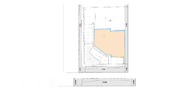
2611 S Barrington Rd
01-36-102-005-0000
Cook
Vacantlandnec
Illinois
X
16.13 AC
17031C0159J
Schaumburg Area
2023
Chicago
2024
Chicago-Naperville-Elgin, IL-IN-WI
864308
DEMOGRAPHICS near 2611 S Barrington Rd
1 Mile
3 Mile
5 Mile
2024 Total Population
1,440
53,050
173,457
2029 Population
1,392
51,446
168,019
Pop Growth 2024-2029
(3.33%)
(3.02%)
(3.14%)
Average Age
39
41
41
2024 Total Households
529
18,543
62,308
HH Growth 2024-2029
(3.59%)
(3.31%)
(3.43%)
Median Household Inc
$99,022
$99,309
$98,393
Avg Household Size
2.70
2.80
2.70
2024 Avg HH Vehicles
2.00
2.00
2.00
Median Home Value
$623,626
$339,992
$313,933
Median Year Built
1978
1978
1977
Nearby Places
Map Layers
Map Styles
 Street
 Aerial
- Restaurants
- Banks
- Shops
- Fitness
- Groceries
PUBLIC TRANSPORTATION
COMMUTER RAIL
Barrington Station (Union Pacific Northwest Line - Northeast Illinois Regional Commuter Railroad (Metra))
DRIVE
WALK
Distance
Barrington Station (Union Pacific Northwest Line - Northeast Illinois Regional Commuter Railroad (Metra))
12 min
5.8 mi
Palatine Station (Union Pacific Northwest Line - Northeast Illinois Regional Commuter Railroad (Metra))
DRIVE
WALK
Distance
Palatine Station (Union Pacific Northwest Line - Northeast Illinois Regional Commuter Railroad (Metra))
15 min
7.5 mi
AIRPORT
Chicago O'Hare International
DRIVE
WALK
Distance
Chicago O'Hare International
25 min
19.0 mi
Chicago Midway International
DRIVE
WALK
Distance
Chicago Midway International
49 min
35.3 mi
Freight Ports
Port Milwaukee
DRIVE
WALK
Distance
Port Milwaukee
103 min
75.2 mi
Nearby Properties
Address
Land Use
TOTAL SIZE
Lot Size
Zoning
Address
Land Use
TOTAL SIZE
Lot Size
Zoning
1,367,997 SF
Address
Land Use
TOTAL SIZE
Lot Size
Zoning
Address
Land Use
TOTAL SIZE
Lot Size
Zoning
Address
Land Use
TOTAL SIZE
Lot Size
Zoning
934,038 SF
45.88 AC
Address
Land Use
TOTAL SIZE
Lot Size
Zoning
245,525 SF
14.69 AC
Address
Land Use
TOTAL SIZE
Lot Size
Zoning
258,989 SF
27.84 AC
Address
Land Use
TOTAL SIZE
Lot Size
Zoning
527,661 SF
27.39 AC
Address
Land Use
TOTAL SIZE
Lot Size
Zoning
Address
Land Use
TOTAL SIZE
Lot Size
Zoning
382,200 SF
45.71 AC
Address
Land Use
TOTAL SIZE
Lot Size
Zoning
240,352 SF
9.65 AC
Address
Land Use
TOTAL SIZE
Lot Size
Zoning
Address
Land Use
TOTAL SIZE
Lot Size
Zoning
61,623 SF
3.73 AC
Address
Land Use
TOTAL SIZE
Lot Size
Zoning
272,944 SF
4.74 AC
Address
Land Use
TOTAL SIZE
Lot Size
Zoning
161,280 SF
5.50 AC
Address
Land Use
TOTAL SIZE
Lot Size
Zoning
Address
Land Use
TOTAL SIZE
Lot Size
Zoning
Address
Land Use
TOTAL SIZE
Lot Size
Zoning
123,875 SF
10.91 AC
Address
Land Use
TOTAL SIZE
Lot Size
Zoning
175,200 SF
89.08 AC
Address
Land Use
TOTAL SIZE
Lot Size
Zoning
29,250 SF
2.57 AC
Address
Land Use
TOTAL SIZE
Lot Size
Zoning
Address
Land Use
TOTAL SIZE
Lot Size
Zoning
12.41 AC
Address
Land Use
TOTAL SIZE
Lot Size
Zoning
58,690 SF
10 AC
Address
Land Use
TOTAL SIZE
Lot Size
Zoning
203,967 SF
8.14 AC
Address
Land Use
TOTAL SIZE
Lot Size
Zoning
81,014 SF
5.57 AC
Address
Land Use
TOTAL SIZE
Lot Size
Zoning
108,115 SF
3.74 AC
Address
Land Use
TOTAL SIZE
Lot Size
Zoning
110,940 SF
25.28 AC
Address
Land Use
TOTAL SIZE
Lot Size
Zoning
190,099 SF
24.23 AC
Address
Land Use
TOTAL SIZE
Lot Size
Zoning
289,251 SF
8.59 AC
Address
Land Use
TOTAL SIZE
Lot Size
Zoning
55,919 SF
7.08 AC
Address
Land Use
TOTAL SIZE
Lot Size
Zoning
51,632 SF
5 AC
The World's #1 Commercial Real Estate Marketplace
Connect with us
© 2025 CoStar Group
The information above has been obtained from sources believed reliable. While we do not doubt its accuracy we have not verified it and make no guarantee, warranty or representation about it. It is your responsibility to independently confirm its accuracy and completeness. Any projections, opinions, assumptions, or estimates used are for example only and do not represent the current or future performance of the property. The value of this transaction to you depends on tax and other factors which should be evaluated by your tax, financial, and legal advisors. You and your advisors should conduct a careful, independent investigation of the property to determine to your satisfaction the suitability of the property for your needs.