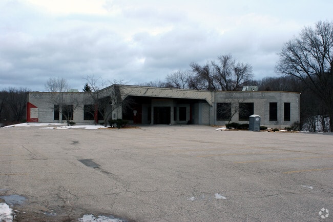
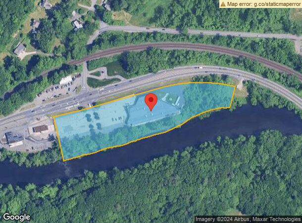
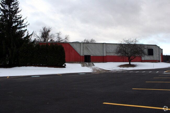
Property Record
2611 Westfield St, West Springfield, MA 01089
NEARBY LISTINGS FOR SALE OR LEASE
Property Detail
2611 Westfield St
WSPR-000394-016300-W000000
Hampden
Religious
Massachusetts
AE
w
25013C0381E
4.89 AC
0
Hampden County
2025
Hartford
812401
Springfield, MA
25,974 SF
DEMOGRAPHICS near 2611 Westfield St
1 Mile
3 Mile
5 Mile
2024 Total Population
2,283
36,659
107,004
2029 Population
2,243
36,050
104,929
Pop Growth 2024-2029
(1.75%)
(1.66%)
(1.94%)
Average Age
43
42
41
2024 Total Households
875
14,748
44,349
HH Growth 2024-2029
(1.83%)
(1.72%)
(1.99%)
Median Household Inc
$116,984
$88,191
$65,084
Avg Household Size
2.50
2.40
2.30
2024 Avg HH Vehicles
2.00
2.00
2.00
Median Home Value
$289,832
$282,224
$271,568
Median Year Built
1960
1963
1961
Nearby Places
Map Layers
Map Styles
 Street
 Aerial
- Restaurants
- Banks
- Shops
- Fitness
- Groceries
PUBLIC TRANSPORTATION
COMMUTER RAIL
DRIVE
WALK
Distance
12 min
5.7 mi
AIRPORT
Bradley International
DRIVE
WALK
Distance
Bradley International
37 min
15.7 mi
Nearby Properties
Address
Land Use
TOTAL SIZE
Lot Size
Zoning
Address
Land Use
TOTAL SIZE
Lot Size
Zoning
257,525 SF
64.03 AC
Address
Land Use
TOTAL SIZE
Lot Size
Zoning
16.48 AC
Address
Land Use
TOTAL SIZE
Lot Size
Zoning
128,877 SF
28.75 AC
Address
Land Use
TOTAL SIZE
Lot Size
Zoning
180,130 SF
90.75 AC
Address
Land Use
TOTAL SIZE
Lot Size
Zoning
1,992 SF
185 AC
Address
Land Use
TOTAL SIZE
Lot Size
Zoning
15,696 SF
0.47 AC
Address
Land Use
TOTAL SIZE
Lot Size
Zoning
Address
Land Use
TOTAL SIZE
Lot Size
Zoning
811.20 AC
RA2
Address
Land Use
TOTAL SIZE
Lot Size
Zoning
63,770 SF
18.22 AC
Address
Land Use
TOTAL SIZE
Lot Size
Zoning
2.60 AC
Address
Land Use
TOTAL SIZE
Lot Size
Zoning
113,406 SF
23.30 AC
Address
Land Use
TOTAL SIZE
Lot Size
Zoning
14.78 AC
Address
Land Use
TOTAL SIZE
Lot Size
Zoning
6.73 AC
BA
Address
Land Use
TOTAL SIZE
Lot Size
Zoning
28.81 AC
Address
Land Use
TOTAL SIZE
Lot Size
Zoning
17,428 SF
15.80 AC
Address
Land Use
TOTAL SIZE
Lot Size
Zoning
67,046 SF
11.63 AC
BA
Address
Land Use
TOTAL SIZE
Lot Size
Zoning
43,582 SF
4.39 AC
BA
Address
Land Use
TOTAL SIZE
Lot Size
Zoning
38.59 AC
RA2
Address
Land Use
TOTAL SIZE
Lot Size
Zoning
2.70 AC
RB
Address
Land Use
TOTAL SIZE
Lot Size
Zoning
8.85 AC
RA2
Address
Land Use
TOTAL SIZE
Lot Size
Zoning
43,050 SF
11.60 AC
Address
Land Use
TOTAL SIZE
Lot Size
Zoning
5,396 SF
329.20 AC
Address
Land Use
TOTAL SIZE
Lot Size
Zoning
5,400 SF
0.04 AC
Address
Land Use
TOTAL SIZE
Lot Size
Zoning
50,374 SF
15.89 AC
Address
Land Use
TOTAL SIZE
Lot Size
Zoning
4,615 SF
4.59 AC
BA
Address
Land Use
TOTAL SIZE
Lot Size
Zoning
1.69 AC
BA
Address
Land Use
TOTAL SIZE
Lot Size
Zoning
45,772 SF
0.50 AC
Address
Land Use
TOTAL SIZE
Lot Size
Zoning
53,734 SF
8 AC
Address
Land Use
TOTAL SIZE
Lot Size
Zoning
30,688 SF
2.22 AC
Address
Land Use
TOTAL SIZE
Lot Size
Zoning
The World's #1 Commercial Real Estate Marketplace
Connect with us
© 2025 CoStar Group
The information above has been obtained from sources believed reliable. While we do not doubt its accuracy we have not verified it and make no guarantee, warranty or representation about it. It is your responsibility to independently confirm its accuracy and completeness. Any projections, opinions, assumptions, or estimates used are for example only and do not represent the current or future performance of the property. The value of this transaction to you depends on tax and other factors which should be evaluated by your tax, financial, and legal advisors. You and your advisors should conduct a careful, independent investigation of the property to determine to your satisfaction the suitability of the property for your needs.