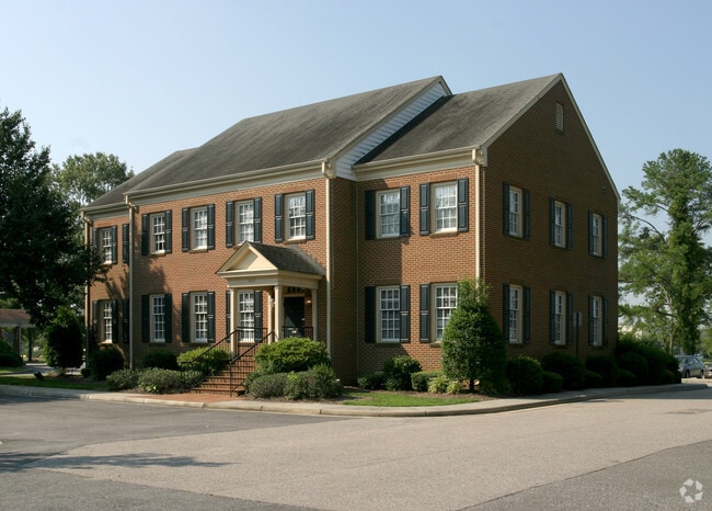
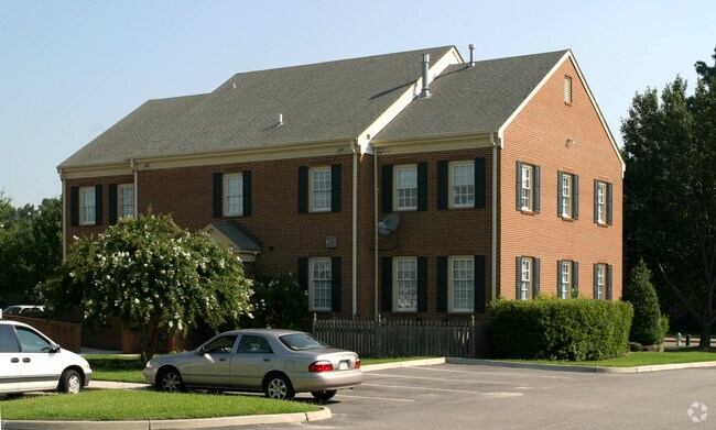
Property Record
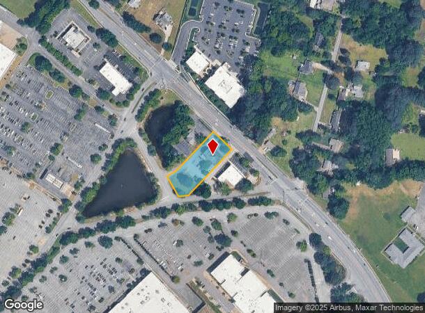
2612 Taylor Rd, Chesapeake, VA 23321
NEARBY LISTINGS FOR SALE OR LEASE
Property Detail
2612 Taylor Rd
0100000000620
Portsmouth Blvd Corridor
Officebuilding
PARCEL 2A SUBD PLAT OF CHESAPEAKE WEST .827AC
X
Chesapeake
5100340005D
Virginia
2024
0.83 AC
2025
Western Branch
021505
Hampton Roads
4,680 SF
Virginia Beach-Chesapeake-Norfolk, VA-NC
DEMOGRAPHICS near 2612 Taylor Rd
1 Mile
3 Mile
5 Mile
2024 Total Population
8,165
66,140
142,970
2029 Population
8,535
67,924
147,114
Pop Growth 2024-2029
+ 4.53%
+ 2.70%
+ 2.90%
Average Age
40
39
39
2024 Total Households
3,157
25,973
55,288
HH Growth 2024-2029
+ 4.69%
+ 2.71%
+ 2.87%
Median Household Inc
$93,214
$80,071
$73,456
Avg Household Size
2.60
2.50
2.50
2024 Avg HH Vehicles
2.00
2.00
2.00
Median Home Value
$302,632
$269,173
$254,909
Median Year Built
1988
1979
1978
Nearby Places
Map Layers
Map Styles
 Street
 Aerial
- Restaurants
- Banks
- Shops
- Fitness
- Groceries
PUBLIC TRANSPORTATION
COMMUTER RAIL
Norfolk (Northeast Regional - Amtrak)
DRIVE
WALK
Distance
Norfolk (Northeast Regional - Amtrak)
18 min
9.2 mi
AIRPORT
Norfolk International
DRIVE
WALK
Distance
Norfolk International
30 min
15.6 mi
Newport News/Williamsburg International
DRIVE
WALK
Distance
Newport News/Williamsburg International
39 min
27.5 mi
Freight Ports
Virginia Port Authority - Portsmouth
DRIVE
WALK
Distance
Virginia Port Authority - Portsmouth
18 min
8.1 mi
Nearby Properties
Address
Land Use
TOTAL SIZE
Lot Size
Zoning
Address
Land Use
TOTAL SIZE
Lot Size
Zoning
637,266 SF
73.24 AC
PUD: PLANN
Address
Land Use
TOTAL SIZE
Lot Size
Zoning
285,162 SF
101.91 AC
R10S: RESI
Address
Land Use
TOTAL SIZE
Lot Size
Zoning
359,146 SF
16.95 AC
RMF1: MULT
Address
Land Use
TOTAL SIZE
Lot Size
Zoning
30.85 AC
PLANNED DE
Address
Land Use
TOTAL SIZE
Lot Size
Zoning
71,039 SF
22.69 AC
R10S: RESI
Address
Land Use
TOTAL SIZE
Lot Size
Zoning
6,446 SF
8.76 AC
MIXED USE
Address
Land Use
TOTAL SIZE
Lot Size
Zoning
1,684 SF
23.36 AC
RMF1: MULT
Address
Land Use
TOTAL SIZE
Lot Size
Zoning
206,652 SF
64.32 AC
A1: AGRICU
Address
Land Use
TOTAL SIZE
Lot Size
Zoning
43,917 SF
5.72 AC
MIXED USE
Address
Land Use
TOTAL SIZE
Lot Size
Zoning
73,039 SF
11.68 AC
RMF1: MULT
Address
Land Use
TOTAL SIZE
Lot Size
Zoning
121,200 SF
9.81 AC
PUD: PLANN
Address
Land Use
TOTAL SIZE
Lot Size
Zoning
235,968 SF
13.25 AC
RMF1: MULT
Address
Land Use
TOTAL SIZE
Lot Size
Zoning
222,810 SF
42.16 AC
MULTI: MUL
Address
Land Use
TOTAL SIZE
Lot Size
Zoning
274,700 SF
24.69 AC
UR
Address
Land Use
TOTAL SIZE
Lot Size
Zoning
165,034 SF
13.12 AC
URM
Address
Land Use
TOTAL SIZE
Lot Size
Zoning
224,077 SF
27.30 AC
B2: GENERA
Address
Land Use
TOTAL SIZE
Lot Size
Zoning
178,266 SF
24.84 AC
B2: GENERA
Address
Land Use
TOTAL SIZE
Lot Size
Zoning
120,780 SF
10.20 AC
MIXED USE
Address
Land Use
TOTAL SIZE
Lot Size
Zoning
81,165 SF
23.07 AC
UR
Address
Land Use
TOTAL SIZE
Lot Size
Zoning
205,470 SF
12.39 AC
URM
Address
Land Use
TOTAL SIZE
Lot Size
Zoning
114,956 SF
12.28 AC
B2: GENERA
Address
Land Use
TOTAL SIZE
Lot Size
Zoning
42,666 SF
7.72 AC
RMF1: MULT
Address
Land Use
TOTAL SIZE
Lot Size
Zoning
282,816 SF
10.54 AC
URM
Address
Land Use
TOTAL SIZE
Lot Size
Zoning
154,389 SF
15.79 AC
GMU
Address
Land Use
TOTAL SIZE
Lot Size
Zoning
185,704 SF
12.59 AC
URM
Address
Land Use
TOTAL SIZE
Lot Size
Zoning
97,012 SF
5.40 AC
URM
Address
Land Use
TOTAL SIZE
Lot Size
Zoning
112,125 SF
2.90 AC
B2: GENERA
The World's #1 Commercial Real Estate Marketplace
Connect with us
© 2026 CoStar Group
The information above has been obtained from sources believed reliable. While we do not doubt its accuracy we have not verified it and make no guarantee, warranty or representation about it. It is your responsibility to independently confirm its accuracy and completeness. Any projections, opinions, assumptions, or estimates used are for example only and do not represent the current or future performance of the property. The value of this transaction to you depends on tax and other factors which should be evaluated by your tax, financial, and legal advisors. You and your advisors should conduct a careful, independent investigation of the property to determine to your satisfaction the suitability of the property for your needs.