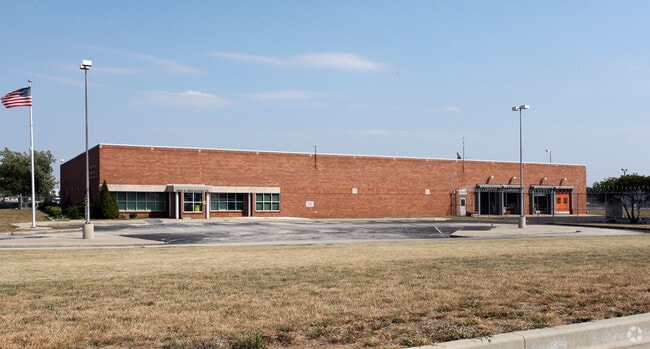
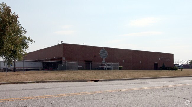
Property Record
2613 S High School Rd, Indianapolis, IN 46241
NEARBY LISTINGS FOR SALE OR LEASE
Property Detail
2613 S High School Rd
49-12-24-100-002.000-900
IMPROV ON LEASED GROUND 9000593
Municipalproperty
Marion
X
Indiana
18097C0207F
83.24 AC
0
Airport
2024
Indianapolis
390801
Indianapolis-Carmel-Anderson, IN
133,706 SF
DEMOGRAPHICS near 2613 S High School Rd
1 Mile
3 Mile
5 Mile
2024 Total Population
561
43,198
130,992
2029 Population
552
42,545
130,717
Pop Growth 2024-2029
(1.60%)
(1.51%)
(0.21%)
Average Age
34
36
36
2024 Total Households
186
15,891
49,684
HH Growth 2024-2029
(1.61%)
(1.58%)
(0.31%)
Median Household Inc
$65,131
$50,879
$54,651
Avg Household Size
3.00
2.60
2.60
2024 Avg HH Vehicles
2.00
2.00
2.00
Median Home Value
$87,499
$118,687
$143,356
Median Year Built
1986
1967
1971
Nearby Places
Map Layers
Map Styles
 Street
 Aerial
- Restaurants
- Banks
- Shops
- Fitness
- Groceries
PUBLIC TRANSPORTATION
COMMUTER RAIL
Indianapolis (Cardinal - Amtrak)
DRIVE
WALK
Distance
Indianapolis (Cardinal - Amtrak)
12 min
7.3 mi
AIRPORT
Indianapolis International
DRIVE
WALK
Distance
Indianapolis International
17 min
7.1 mi
Freight Ports
Port of Toledo
DRIVE
WALK
Distance
Port of Toledo
282 min
233.8 mi
Nearby Properties
Address
Land Use
TOTAL SIZE
Lot Size
Zoning
Address
Land Use
TOTAL SIZE
Lot Size
Zoning
1,340,481 SF
63.99 AC
ZO01
Address
Land Use
TOTAL SIZE
Lot Size
Zoning
1,413,414 SF
115.43 AC
ZO01
Address
Land Use
TOTAL SIZE
Lot Size
Zoning
434,240 SF
26.25 AC
ZO01
Address
Land Use
TOTAL SIZE
Lot Size
Zoning
9,750 SF
43.46 AC
ZO01
Address
Land Use
TOTAL SIZE
Lot Size
Zoning
366,600 SF
29.05 AC
ZO01
Address
Land Use
TOTAL SIZE
Lot Size
Zoning
49,008 SF
4.80 AC
ZO01
Address
Land Use
TOTAL SIZE
Lot Size
Zoning
3,394 SF
25.27 AC
ZO01
Address
Land Use
TOTAL SIZE
Lot Size
Zoning
12,880 SF
42.54 AC
ZO01
Address
Land Use
TOTAL SIZE
Lot Size
Zoning
28,400 SF
22.04 AC
ZO01
Address
Land Use
TOTAL SIZE
Lot Size
Zoning
101,718 SF
49.77 AC
ZO01
Address
Land Use
TOTAL SIZE
Lot Size
Zoning
5,616 SF
9.34 AC
Address
Land Use
TOTAL SIZE
Lot Size
Zoning
641,389 SF
44.90 AC
Address
Land Use
TOTAL SIZE
Lot Size
Zoning
20,143 SF
17.10 AC
ZO01
Address
Land Use
TOTAL SIZE
Lot Size
Zoning
161,500 SF
9.95 AC
ZO01
Address
Land Use
TOTAL SIZE
Lot Size
Zoning
1,284 SF
25.09 AC
ZO01
Address
Land Use
TOTAL SIZE
Lot Size
Zoning
178,680 SF
50 AC
ZO01
Address
Land Use
TOTAL SIZE
Lot Size
Zoning
377,760 SF
22.47 AC
ZO01
Address
Land Use
TOTAL SIZE
Lot Size
Zoning
18,209 SF
38.23 AC
ZO01
Address
Land Use
TOTAL SIZE
Lot Size
Zoning
4,874 SF
21.37 AC
Address
Land Use
TOTAL SIZE
Lot Size
Zoning
6,794 SF
5.37 AC
ZO01
Address
Land Use
TOTAL SIZE
Lot Size
Zoning
484,008 SF
17.95 AC
ZO01
Address
Land Use
TOTAL SIZE
Lot Size
Zoning
31,874 SF
4.39 AC
ZO01
Address
Land Use
TOTAL SIZE
Lot Size
Zoning
282,183 SF
23.96 AC
ZO01
Address
Land Use
TOTAL SIZE
Lot Size
Zoning
141,697 SF
11.49 AC
ZO01
Address
Land Use
TOTAL SIZE
Lot Size
Zoning
300,160 SF
17.16 AC
ZO01
Address
Land Use
TOTAL SIZE
Lot Size
Zoning
86,701 SF
8.86 AC
ZO01
Address
Land Use
TOTAL SIZE
Lot Size
Zoning
104,000 SF
8.56 AC
ZO01
Address
Land Use
TOTAL SIZE
Lot Size
Zoning
26,755 SF
2.33 AC
Address
Land Use
TOTAL SIZE
Lot Size
Zoning
221,088 SF
16.69 AC
ZO01
The World's #1 Commercial Real Estate Marketplace
Connect with us
© 2025 CoStar Group
The information above has been obtained from sources believed reliable. While we do not doubt its accuracy we have not verified it and make no guarantee, warranty or representation about it. It is your responsibility to independently confirm its accuracy and completeness. Any projections, opinions, assumptions, or estimates used are for example only and do not represent the current or future performance of the property. The value of this transaction to you depends on tax and other factors which should be evaluated by your tax, financial, and legal advisors. You and your advisors should conduct a careful, independent investigation of the property to determine to your satisfaction the suitability of the property for your needs.