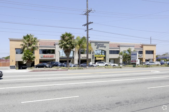
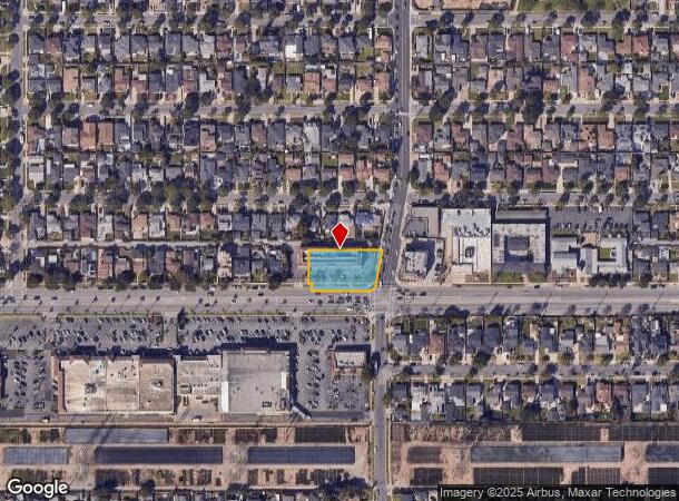
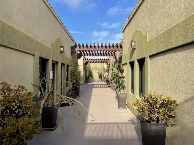
Property Record
2615 190Th St, Redondo Beach, CA 90278
Current Lease Availabilities
NEARBY LISTINGS FOR SALE OR LEASE
Property Detail
2615 190Th St
Los Angeles-Long Beach-Glendale, CA
Mc Donald Tract
4158-017-018
MCDONALD TRACT SAN PEDRO RO 0.55 MORE OR LESS AC E 10 FT VAC ALLEY ADJ ON W AND LOT COM AT INTERSECTION OF E LINE OF TR NO 18085 WITH N LINE OF 190TH ST TH N ON SD E LINE 120 FT TH N 89 5908 E TO NW W ON SD N LINE TO BEG PART OF LOT 5
Storesoffices
Los Angeles
X
California
06037C1930F
5
2025
0.56 AC
2025
Beach Cities/Palos Verdes
620602
Los Angeles
14,701 SF
DEMOGRAPHICS near 2615 190Th St
1 Mile
3 Mile
5 Mile
2024 Total Population
29,256
236,648
533,239
2029 Population
28,680
230,259
518,314
Pop Growth 2024-2029
(1.97%)
(2.70%)
(2.80%)
Average Age
41
41
41
2024 Total Households
10,958
90,740
195,923
HH Growth 2024-2029
(2.23%)
(2.88%)
(2.98%)
Median Household Inc
$120,510
$114,649
$96,950
Avg Household Size
2.60
2.50
2.60
2024 Avg HH Vehicles
2.00
2.00
2.00
Median Home Value
$968,619
$980,829
$900,676
Median Year Built
1968
1966
1965
Nearby Places
- Restaurants
- Banks
- Shops
- Fitness
- Groceries
PUBLIC TRANSPORTATION
AIRPORT
Los Angeles International
DRIVE
WALK
Distance
Los Angeles International
16 min
9.7 mi
Long Beach (Daugherty Field)
DRIVE
WALK
Distance
Long Beach (Daugherty Field)
20 min
13.2 mi
John Wayne/Orange County
DRIVE
WALK
Distance
John Wayne/Orange County
43 min
33.4 mi
Nearby Properties
Address
Land Use
TOTAL SIZE
Lot Size
Zoning
Address
Land Use
TOTAL SIZE
Lot Size
Zoning
997,143 SF
98.35 AC
TOMI-BP
Address
Land Use
TOTAL SIZE
Lot Size
Zoning
267,305 SF
1.59 AC
TOHC-CTR
Address
Land Use
TOTAL SIZE
Lot Size
Zoning
205,797 SF
4.10 AC
HBR3*
Address
Land Use
TOTAL SIZE
Lot Size
Zoning
10,152 SF
140.14 AC
TOMI-HVY
Address
Land Use
TOTAL SIZE
Lot Size
Zoning
267,131 SF
12.10 AC
TOHHM
Address
Land Use
TOTAL SIZE
Lot Size
Zoning
718,086 SF
41.24 AC
RBI-1A
Address
Land Use
TOTAL SIZE
Lot Size
Zoning
848,217 SF
36.09 AC
RBI-1A
Address
Land Use
TOTAL SIZE
Lot Size
Zoning
321,011 SF
15.06 AC
TOMI-LT
Address
Land Use
TOTAL SIZE
Lot Size
Zoning
297,420 SF
6.65 AC
TOHC-CTR
Address
Land Use
TOTAL SIZE
Lot Size
Zoning
173,186 SF
2.07 AC
HBR3*
Address
Land Use
TOTAL SIZE
Lot Size
Zoning
604,106 SF
42.72 AC
TOMI-HVY
Address
Land Use
TOTAL SIZE
Lot Size
Zoning
1,504,661 SF
RBCR
Address
Land Use
TOTAL SIZE
Lot Size
Zoning
202,924 SF
6.15 AC
TOHC-CTR
Address
Land Use
TOTAL SIZE
Lot Size
Zoning
257,723 SF
4.06 AC
TOCC-GEN
Address
Land Use
TOTAL SIZE
Lot Size
Zoning
405,352 SF
7.70 AC
TOHC-CTR
Address
Land Use
TOTAL SIZE
Lot Size
Zoning
239,992 SF
4.72 AC
RBI-1B
Address
Land Use
TOTAL SIZE
Lot Size
Zoning
103,228 SF
1.19 AC
TORR-HI
Address
Land Use
TOTAL SIZE
Lot Size
Zoning
502,236 SF
11.58 AC
TOMI-LT
Address
Land Use
TOTAL SIZE
Lot Size
Zoning
75,054 SF
1.17 AC
RBRMD
Address
Land Use
TOTAL SIZE
Lot Size
Zoning
282,280 SF
Address
Land Use
TOTAL SIZE
Lot Size
Zoning
176,514 SF
3.74 AC
TORR-MH
Address
Land Use
TOTAL SIZE
Lot Size
Zoning
670,305 SF
28.08 AC
TOMI-BP
Address
Land Use
TOTAL SIZE
Lot Size
Zoning
21.49 AC
RBP-GP
Address
Land Use
TOTAL SIZE
Lot Size
Zoning
147,414 SF
3.28 AC
TORR-MH
Address
Land Use
TOTAL SIZE
Lot Size
Zoning
81,328 SF
3.13 AC
TOCC-GEN
The World's #1 Commercial Real Estate Marketplace
Connect with us
© 2025 CoStar Group
The information above has been obtained from sources believed reliable. While we do not doubt its accuracy we have not verified it and make no guarantee, warranty or representation about it. It is your responsibility to independently confirm its accuracy and completeness. Any projections, opinions, assumptions, or estimates used are for example only and do not represent the current or future performance of the property. The value of this transaction to you depends on tax and other factors which should be evaluated by your tax, financial, and legal advisors. You and your advisors should conduct a careful, independent investigation of the property to determine to your satisfaction the suitability of the property for your needs.