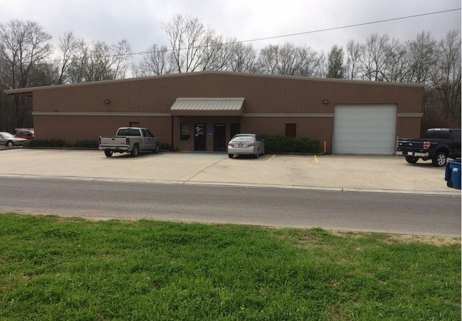
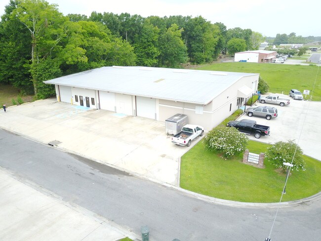
Property Record
2615 Phillips Way, Port Allen, LA 70767
NEARBY LISTINGS FOR SALE OR LEASE
Property Detail
2615 Phillips Way
305300000700
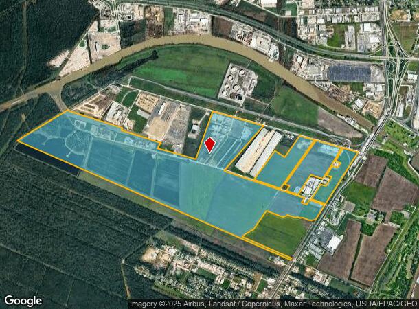
566 AC M/L SECS 70 71 72 73 95 96 97 & 98 T7S R12E (WEST SIDE OF HWY 1) 53-7 CB120 E220 CB201 E95 CB243 E73 CB247 E4 & E6 CB2
Industrialgeneral
W Baton Rouge
A
Louisiana
22121C0165D
566 AC
2024
West Baton Rouge
2024
Baton Rouge
020302
Baton Rouge, LA
15,000 SF
DEMOGRAPHICS near 2615 Phillips Way
1 Mile
3 Mile
5 Mile
2024 Total Population
1,493
37,267
90,748
2029 Population
1,569
37,906
91,945
Pop Growth 2024-2029
+ 5.09%
+ 1.71%
+ 1.32%
Average Age
42
31
34
2024 Total Households
578
13,603
37,219
HH Growth 2024-2029
+ 5.02%
+ 2.37%
+ 1.32%
Median Household Inc
$71,785
$35,898
$45,562
Avg Household Size
2.60
2.10
2.10
2024 Avg HH Vehicles
2.00
2.00
2.00
Median Home Value
$249,772
$212,281
$251,979
Median Year Built
1985
1985
1980
Nearby Places
Map Layers
Map Styles
 Street
 Aerial
- Restaurants
- Banks
- Shops
- Fitness
- Groceries
PUBLIC TRANSPORTATION
AIRPORT
Baton Rouge Metro Ryan Field
DRIVE
WALK
Distance
Baton Rouge Metro Ryan Field
20 min
12.1 mi
Freight Ports
Port of Greater Baton Rouge
DRIVE
WALK
Distance
Port of Greater Baton Rouge
10 min
3.2 mi
SALE & LEASE HISTORY
LISTING DATE
SALE/LEASE

Sep 04, 2019
For Lease
Sep 04, 2019
For Sale
Nov 14, 2018
For Lease
Jan 11, 2021
For Lease
Nearby Properties
Address
Land Use
TOTAL SIZE
Lot Size
Zoning
Address
Land Use
TOTAL SIZE
Lot Size
Zoning
Address
Land Use
TOTAL SIZE
Lot Size
Zoning
290,620 SF
1.76 AC
Address
Land Use
TOTAL SIZE
Lot Size
Zoning
Address
Land Use
TOTAL SIZE
Lot Size
Zoning
8.83 AC
Address
Land Use
TOTAL SIZE
Lot Size
Zoning
1,530 SF
55.83 AC
Address
Land Use
TOTAL SIZE
Lot Size
Zoning
153 AC
Address
Land Use
TOTAL SIZE
Lot Size
Zoning
681,854 SF
4.50 AC
Address
Land Use
TOTAL SIZE
Lot Size
Zoning
244,833 SF
0.84 AC
Address
Land Use
TOTAL SIZE
Lot Size
Zoning
350,000 SF
1.20 AC
Address
Land Use
TOTAL SIZE
Lot Size
Zoning
Address
Land Use
TOTAL SIZE
Lot Size
Zoning
521,303 SF
16.24 AC
Address
Land Use
TOTAL SIZE
Lot Size
Zoning
100,000 SF
Address
Land Use
TOTAL SIZE
Lot Size
Zoning
Address
Land Use
TOTAL SIZE
Lot Size
Zoning
2,074 SF
18.72 AC
Address
Land Use
TOTAL SIZE
Lot Size
Zoning
149,372 SF
0.19 AC
Address
Land Use
TOTAL SIZE
Lot Size
Zoning
15.49 AC
Address
Land Use
TOTAL SIZE
Lot Size
Zoning
166,222 SF
1.06 AC
Address
Land Use
TOTAL SIZE
Lot Size
Zoning
Address
Land Use
TOTAL SIZE
Lot Size
Zoning
Address
Land Use
TOTAL SIZE
Lot Size
Zoning
13.70 AC
Address
Land Use
TOTAL SIZE
Lot Size
Zoning
Address
Land Use
TOTAL SIZE
Lot Size
Zoning
15.85 AC
Address
Land Use
TOTAL SIZE
Lot Size
Zoning
247,104 SF
12 AC
Address
Land Use
TOTAL SIZE
Lot Size
Zoning
177,656 SF
1.73 AC
Address
Land Use
TOTAL SIZE
Lot Size
Zoning
300,888 SF
16.24 AC
Address
Land Use
TOTAL SIZE
Lot Size
Zoning
297,923 SF
16.24 AC
Address
Land Use
TOTAL SIZE
Lot Size
Zoning
Address
Land Use
TOTAL SIZE
Lot Size
Zoning
Address
Land Use
TOTAL SIZE
Lot Size
Zoning
157,739 SF
17.44 AC
Address
Land Use
TOTAL SIZE
Lot Size
Zoning
20.46 AC
The World's #1 Commercial Real Estate Marketplace
Connect with us
© 2025 CoStar Group
The information above has been obtained from sources believed reliable. While we do not doubt its accuracy we have not verified it and make no guarantee, warranty or representation about it. It is your responsibility to independently confirm its accuracy and completeness. Any projections, opinions, assumptions, or estimates used are for example only and do not represent the current or future performance of the property. The value of this transaction to you depends on tax and other factors which should be evaluated by your tax, financial, and legal advisors. You and your advisors should conduct a careful, independent investigation of the property to determine to your satisfaction the suitability of the property for your needs.