Property Record
2617 Sandy Plains Rd, Marietta, GA 30066


NEARBY LISTINGS FOR SALE OR LEASE
Property Detail
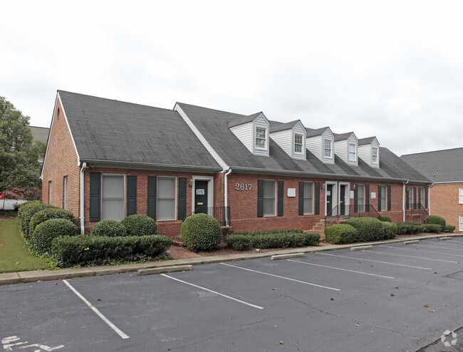
2617 Sandy Plains Rd
16-0595-0-105-0
Williamscraft Office Park
Officecondo
Cobb
X
Georgia
13057C0375E
10
2025
0.18 AC
2025
East Cobb
030362
Atlanta
8,029 SF
Atlanta-Sandy Springs-Roswell, GA
DEMOGRAPHICS near 2617 Sandy Plains Rd
1 Mile
3 Mile
5 Mile
2024 Total Population
8,042
64,607
185,078
2029 Population
8,117
65,229
188,093
Pop Growth 2024-2029
+ 0.93%
+ 0.96%
+ 1.63%
Average Age
42
41
40
2024 Total Households
3,022
23,158
67,826
HH Growth 2024-2029
+ 0.86%
+ 0.94%
+ 1.70%
Median Household Inc
$126,398
$118,517
$106,375
Avg Household Size
2.60
2.70
2.60
2024 Avg HH Vehicles
2.00
2.00
2.00
Median Home Value
$328,691
$367,842
$380,438
Median Year Built
1983
1983
1985
Nearby Places
Map Layers
Map Styles
 Street
 Aerial
- Restaurants
- Banks
- Shops
- Fitness
- Groceries
PUBLIC TRANSPORTATION
AIRPORT
Hartsfield - Jackson Atlanta International
DRIVE
WALK
Distance
Hartsfield - Jackson Atlanta International
46 min
31.5 mi
SALE & LEASE HISTORY
LISTING DATE
SALE/LEASE

Sep 29, 2021
For Lease
Nov 30, 2018
For Lease
May 24, 2021
For Lease
May 05, 2017
For Lease
Jan 28, 2024
For Sale
Feb 20, 2019
For Lease
Nearby Properties
Address
Land Use
TOTAL SIZE
Lot Size
Zoning
Address
Land Use
TOTAL SIZE
Lot Size
Zoning
118,464 SF
15.73 AC
CRC
Address
Land Use
TOTAL SIZE
Lot Size
Zoning
240,628 SF
30.90 AC
RM-8
Address
Land Use
TOTAL SIZE
Lot Size
Zoning
254,242 SF
17.48 AC
RM-8
Address
Land Use
TOTAL SIZE
Lot Size
Zoning
139,694 SF
16.35 AC
GC/WS
Address
Land Use
TOTAL SIZE
Lot Size
Zoning
5 AC
PSC/NS
Address
Land Use
TOTAL SIZE
Lot Size
Zoning
126,855 SF
13.71 AC
NS
Address
Land Use
TOTAL SIZE
Lot Size
Zoning
106,881 SF
10.10 AC
LI
Address
Land Use
TOTAL SIZE
Lot Size
Zoning
215,962 SF
13.84 AC
PID
Address
Land Use
TOTAL SIZE
Lot Size
Zoning
9,840 SF
9.76 AC
CRC
Address
Land Use
TOTAL SIZE
Lot Size
Zoning
162,396 SF
17.73 AC
LI
Address
Land Use
TOTAL SIZE
Lot Size
Zoning
84,473 SF
13.06 AC
NRC
Address
Land Use
TOTAL SIZE
Lot Size
Zoning
152,375 SF
12.21 AC
LI
Address
Land Use
TOTAL SIZE
Lot Size
Zoning
232,690 SF
12.20 AC
LI
Address
Land Use
TOTAL SIZE
Lot Size
Zoning
115,107 SF
12.90 AC
NRC/NS
Address
Land Use
TOTAL SIZE
Lot Size
Zoning
164,688 SF
10.75 AC
PID
Address
Land Use
TOTAL SIZE
Lot Size
Zoning
212,837 SF
14.23 AC
LI
Address
Land Use
TOTAL SIZE
Lot Size
Zoning
72,606 SF
10.38 AC
CRC
Address
Land Use
TOTAL SIZE
Lot Size
Zoning
88,450 SF
9.19 AC
RM-8
Address
Land Use
TOTAL SIZE
Lot Size
Zoning
93,007 SF
11.65 AC
NRC/WS
Address
Land Use
TOTAL SIZE
Lot Size
Zoning
124,390 SF
18.34 AC
HI
Address
Land Use
TOTAL SIZE
Lot Size
Zoning
41,268 SF
13.78 AC
Address
Land Use
TOTAL SIZE
Lot Size
Zoning
96,612 SF
2 AC
PID
Address
Land Use
TOTAL SIZE
Lot Size
Zoning
140,520 SF
13.44 AC
GC
Address
Land Use
TOTAL SIZE
Lot Size
Zoning
61,145 SF
5.87 AC
PID
Address
Land Use
TOTAL SIZE
Lot Size
Zoning
3.39 AC
NRC
Address
Land Use
TOTAL SIZE
Lot Size
Zoning
97,144 SF
11.45 AC
LI
Address
Land Use
TOTAL SIZE
Lot Size
Zoning
101,940 SF
9.40 AC
PID
Address
Land Use
TOTAL SIZE
Lot Size
Zoning
121,844 SF
17.61 AC
CRC/WS
Address
Land Use
TOTAL SIZE
Lot Size
Zoning
116,428 SF
21.33 AC
GC/PSC
Address
Land Use
TOTAL SIZE
Lot Size
Zoning
105,216 SF
10.42 AC
GC
The World's #1 Commercial Real Estate Marketplace
Connect with us
© 2026 CoStar Group
The information above has been obtained from sources believed reliable. While we do not doubt its accuracy we have not verified it and make no guarantee, warranty or representation about it. It is your responsibility to independently confirm its accuracy and completeness. Any projections, opinions, assumptions, or estimates used are for example only and do not represent the current or future performance of the property. The value of this transaction to you depends on tax and other factors which should be evaluated by your tax, financial, and legal advisors. You and your advisors should conduct a careful, independent investigation of the property to determine to your satisfaction the suitability of the property for your needs.