Property Record
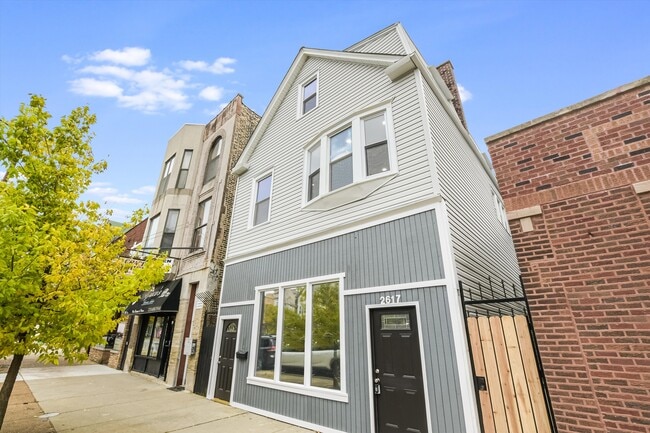
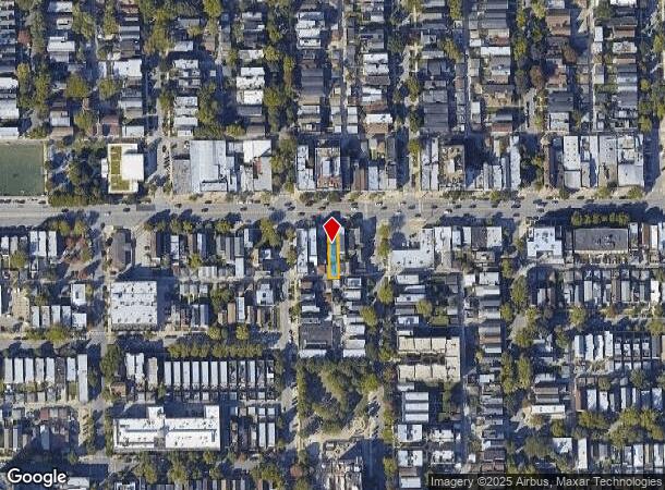
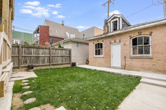
2617 W Fullerton Ave, Chicago, IL 60647
Current Lease Availabilities
NEARBY LISTINGS FOR SALE OR LEASE
Property Detail
2617 W Fullerton Ave
Chicago-Naperville-Elgin, IL-IN-WI
Allens Add
13-36-202-004-0000
JAMES H (ALLENS) ADD SUB OF LTS1&2 OF GRAYS SUB OF 8A CS E & ADJ W25ACS N OF MILWAUKEE AVE PLANK RD IN NE SEC 36-40-13
Miscresidentialimprovement
Cook
X
Illinois
17031C0415J
1,2
2023
0.07 AC
2024
Northwest City
221400
Chicago
3,931 SF
DEMOGRAPHICS near 2617 W Fullerton Ave
1 Mile
3 Mile
5 Mile
2024 Total Population
58,273
519,274
1,240,381
2029 Population
57,530
509,890
1,228,622
Pop Growth 2024-2029
(1.28%)
(1.81%)
(0.95%)
Average Age
35
36
38
2024 Total Households
26,850
233,722
567,463
HH Growth 2024-2029
(1.46%)
(1.70%)
(0.63%)
Median Household Inc
$113,557
$104,887
$94,476
Avg Household Size
2.10
2.10
2.10
2024 Avg HH Vehicles
1.00
1.00
1.00
Median Home Value
$618,588
$563,459
$437,159
Median Year Built
1947
1948
1954
Nearby Places
- Restaurants
- Banks
- Shops
- Fitness
- Groceries
PUBLIC TRANSPORTATION
TRANSIT/SUBWAY
California Station (Blue Line - O'Hare Branch) (Blue Line - Chicago Transit Authority "L" Trains (The "L"))
DRIVE
WALK
Distance
California Station (Blue Line - O'Hare Branch) (Blue Line - Chicago Transit Authority "L" Trains (The "L"))
1 min
9 min
0.4 mi
Western Station (Blue Line - O'Hare Branch) (Blue Line - Chicago Transit Authority "L" Trains (The "L"))
DRIVE
WALK
Distance
Western Station (Blue Line - O'Hare Branch) (Blue Line - Chicago Transit Authority "L" Trains (The "L"))
3 min
15 min
0.8 mi
Logan Square Station (Blue Line - Chicago Transit Authority "L" Trains (The "L"))
DRIVE
WALK
Distance
Logan Square Station (Blue Line - Chicago Transit Authority "L" Trains (The "L"))
3 min
17 min
0.9 mi
COMMUTER RAIL
Clybourn Station (Union Pacific North Line - Northeast Illinois Regional Commuter Railroad (Metra), Union Pacific Northwest Line - Northeast Illinois Regional Commuter Railroad (Metra))
DRIVE
WALK
Distance
Clybourn Station (Union Pacific North Line - Northeast Illinois Regional Commuter Railroad (Metra), Union Pacific Northwest Line - Northeast Illinois Regional Commuter Railroad (Metra))
4 min
1.6 mi
Healy Station (Milwaukee District North Line - Northeast Illinois Regional Commuter Railroad (Metra))
DRIVE
WALK
Distance
Healy Station (Milwaukee District North Line - Northeast Illinois Regional Commuter Railroad (Metra))
4 min
1.9 mi
AIRPORT
Chicago Midway International
DRIVE
WALK
Distance
Chicago Midway International
26 min
13.0 mi
Chicago O'Hare International
DRIVE
WALK
Distance
Chicago O'Hare International
45 min
16.2 mi
Nearby Properties
Address
Land Use
TOTAL SIZE
Lot Size
Zoning
Address
Land Use
TOTAL SIZE
Lot Size
Zoning
73,700 SF
0.48 AC
RM-6.5
Address
Land Use
TOTAL SIZE
Lot Size
Zoning
228,018 SF
8.72 AC
PD 958
Address
Land Use
TOTAL SIZE
Lot Size
Zoning
222,240 SF
2.45 AC
PD 1439
Address
Land Use
TOTAL SIZE
Lot Size
Zoning
266,248 SF
Address
Land Use
TOTAL SIZE
Lot Size
Zoning
0.96 AC
PD 958
Address
Land Use
TOTAL SIZE
Lot Size
Zoning
16.93 AC
POS-1,PD 1
Address
Land Use
TOTAL SIZE
Lot Size
Zoning
19,500 SF
12.06 AC
PD 367
Address
Land Use
TOTAL SIZE
Lot Size
Zoning
0.66 AC
RS-3
Address
Land Use
TOTAL SIZE
Lot Size
Zoning
376,302 SF
PD 1019
Address
Land Use
TOTAL SIZE
Lot Size
Zoning
434,320 SF
1.16 AC
C3-5
Address
Land Use
TOTAL SIZE
Lot Size
Zoning
268,778 SF
0.59 AC
RM-6.5
Address
Land Use
TOTAL SIZE
Lot Size
Zoning
0.64 AC
PD 158
Address
Land Use
TOTAL SIZE
Lot Size
Zoning
0.81 AC
PD 158
Address
Land Use
TOTAL SIZE
Lot Size
Zoning
1.32 AC
PD 1398
Address
Land Use
TOTAL SIZE
Lot Size
Zoning
237,832 SF
14.04 AC
PD 418
Address
Land Use
TOTAL SIZE
Lot Size
Zoning
82,000 SF
9.68 AC
PD 437
Address
Land Use
TOTAL SIZE
Lot Size
Zoning
277,195 SF
1.78 AC
PD 1094
Address
Land Use
TOTAL SIZE
Lot Size
Zoning
190,011 SF
5.90 AC
PD 353
Address
Land Use
TOTAL SIZE
Lot Size
Zoning
1,184,800 SF
3.74 AC
PMD 2,PD 1
Address
Land Use
TOTAL SIZE
Lot Size
Zoning
16,600 SF
3.67 AC
PMD 2,PD 1
Address
Land Use
TOTAL SIZE
Lot Size
Zoning
170,538 SF
0.76 AC
PD 112
Address
Land Use
TOTAL SIZE
Lot Size
Zoning
331,294 SF
13.03 AC
PD 439
Address
Land Use
TOTAL SIZE
Lot Size
Zoning
82,600 SF
3.55 AC
PD 1539
Address
Land Use
TOTAL SIZE
Lot Size
Zoning
311,556 SF
PD 1420
Address
Land Use
TOTAL SIZE
Lot Size
Zoning
2.25 AC
PD 612
Address
Land Use
TOTAL SIZE
Lot Size
Zoning
162,700 SF
0.64 AC
PD 50
Address
Land Use
TOTAL SIZE
Lot Size
Zoning
55,476 SF
6.16 AC
PD 619
Address
Land Use
TOTAL SIZE
Lot Size
Zoning
140,451 SF
9.48 AC
PD 213
Address
Land Use
TOTAL SIZE
Lot Size
Zoning
311,612 SF
2.40 AC
PD 1096
Address
Land Use
TOTAL SIZE
Lot Size
Zoning
7.07 AC
PD 1075
The World's #1 Commercial Real Estate Marketplace
Connect with us
© 2025 CoStar Group
The information above has been obtained from sources believed reliable. While we do not doubt its accuracy we have not verified it and make no guarantee, warranty or representation about it. It is your responsibility to independently confirm its accuracy and completeness. Any projections, opinions, assumptions, or estimates used are for example only and do not represent the current or future performance of the property. The value of this transaction to you depends on tax and other factors which should be evaluated by your tax, financial, and legal advisors. You and your advisors should conduct a careful, independent investigation of the property to determine to your satisfaction the suitability of the property for your needs.