Property Record
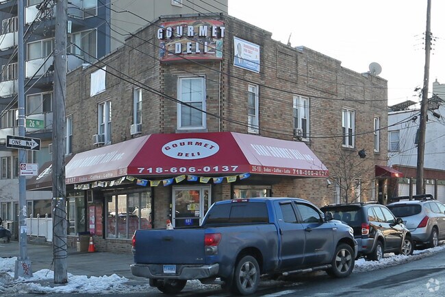
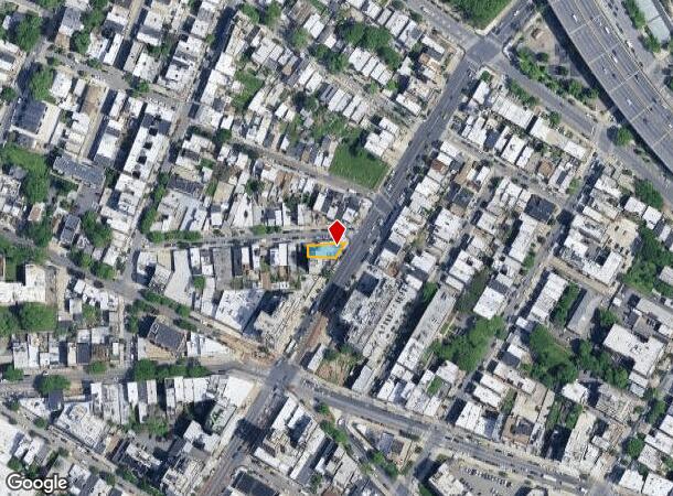
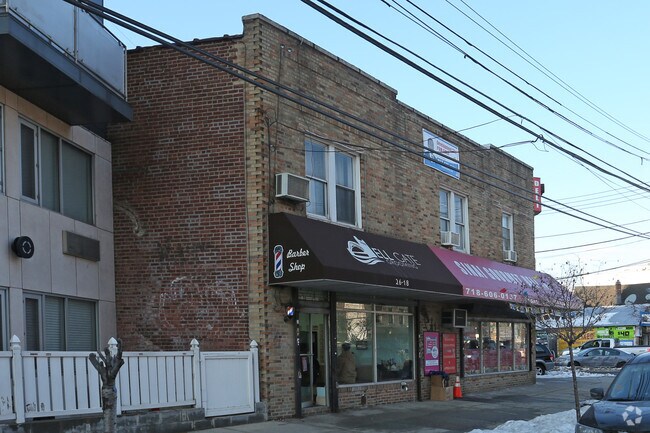
2618 21St St, Astoria, NY 11102
NEARBY LISTINGS FOR SALE OR LEASE
Property Detail
2618 21St St
00885-0038
Queens
Commercialofficeresidentialmixeduse
New York
X
38
3604970093F
0.07 AC
2024
Northwest Queens
2025
Long Island (New York)
008300
New York-Jersey City-White Plains, NY-NJ
5,492 SF
DEMOGRAPHICS near 2618 21St St
1 Mile
3 Mile
5 Mile
2024 Total Population
118,463
1,110,580
2,936,363
2029 Population
112,749
1,036,062
2,741,606
Pop Growth 2024-2029
(4.82%)
(6.71%)
(6.63%)
Average Age
40
41
40
2024 Total Households
52,573
499,128
1,245,759
HH Growth 2024-2029
(5.23%)
(6.94%)
(6.92%)
Median Household Inc
$84,253
$83,574
$73,725
Avg Household Size
2.20
2.10
2.20
2024 Avg HH Vehicles
.00
.00
.00
Median Home Value
$822,913
$891,347
$818,343
Median Year Built
1949
1954
1955
Nearby Places
- Restaurants
- Banks
- Shops
- Fitness
- Groceries
PUBLIC TRANSPORTATION
TRANSIT/SUBWAY
Astoria Blvd (Broadway Local - N - MTA New York City Transit, Broadway Local - W - MTA New York City Transit)
DRIVE
WALK
Distance
Astoria Blvd (Broadway Local - N - MTA New York City Transit, Broadway Local - W - MTA New York City Transit)
3 min
10 min
0.5 mi
30 Av (Broadway Local - N - MTA New York City Transit, Broadway Local - W - MTA New York City Transit)
DRIVE
WALK
Distance
30 Av (Broadway Local - N - MTA New York City Transit, Broadway Local - W - MTA New York City Transit)
3 min
11 min
0.6 mi
Broadway (Broadway Local - N - MTA New York City Transit, Broadway Local - W - MTA New York City Transit)
DRIVE
WALK
Distance
Broadway (Broadway Local - N - MTA New York City Transit, Broadway Local - W - MTA New York City Transit)
3 min
18 min
1.0 mi
Astoria-Ditmars Blvd (Broadway Local - N - MTA New York City Transit, Broadway Local - W - MTA New York City Transit)
DRIVE
WALK
Distance
Astoria-Ditmars Blvd (Broadway Local - N - MTA New York City Transit, Broadway Local - W - MTA New York City Transit)
4 min
18 min
1.0 mi
COMMUTER RAIL
Woodside Station (Babylon Branch - Long Island Rail Road, Far Rockaway Branch - Long Island Rail Road, Hempstead Branch - Long Island Rail Road, Long Beach Branch - Long Island Rail Road, Montauk Branch - Long Island Rail Road, Port Jefferson Branch - Long Island Rail Road, Port Washington Branch - Long Island Rail Road, Ronkonkoma Branch - Long Island Rail Road)
DRIVE
WALK
Distance
Woodside Station (Babylon Branch - Long Island Rail Road, Far Rockaway Branch - Long Island Rail Road, Hempstead Branch - Long Island Rail Road, Long Beach Branch - Long Island Rail Road, Montauk Branch - Long Island Rail Road, Port Jefferson Branch - Long Island Rail Road, Port Washington Branch - Long Island Rail Road, Ronkonkoma Branch - Long Island Rail Road)
7 min
3.4 mi
Harlem-125Th Street Station (Harlem Line - Metro-North Commuter Railroad Company (Metro-North), Hudson Line - Metro-North Commuter Railroad Company (Metro-North), New Haven Line - Metro-North Commuter Railroad Company (Metro-North))
DRIVE
WALK
Distance
Harlem-125Th Street Station (Harlem Line - Metro-North Commuter Railroad Company (Metro-North), Hudson Line - Metro-North Commuter Railroad Company (Metro-North), New Haven Line - Metro-North Commuter Railroad Company (Metro-North))
10 min
4.4 mi
AIRPORT
LaGuardia
DRIVE
WALK
Distance
LaGuardia
9 min
3.5 mi
John F Kennedy International
DRIVE
WALK
Distance
John F Kennedy International
22 min
14.7 mi
Newark Liberty International
DRIVE
WALK
Distance
Newark Liberty International
30 min
19.3 mi
Freight Ports
NY - Red Hook Container Terminal
DRIVE
WALK
Distance
NY - Red Hook Container Terminal
21 min
9.7 mi
SALE & LEASE HISTORY
LISTING DATE
SALE/LEASE

Jan 17, 2018
For Sale
Nearby Properties
Address
Land Use
TOTAL SIZE
Lot Size
Zoning
Address
Land Use
TOTAL SIZE
Lot Size
Zoning
1,783,434 SF
1.94 AC
C5-3
Address
Land Use
TOTAL SIZE
Lot Size
Zoning
5,519,372 SF
409.21 AC
C8-2
Address
Land Use
TOTAL SIZE
Lot Size
Zoning
2,734,038 SF
4.24 AC
C52.5
Address
Land Use
TOTAL SIZE
Lot Size
Zoning
1,897,491 SF
2.06 AC
C52.5
Address
Land Use
TOTAL SIZE
Lot Size
Zoning
1,233,684 SF
16.94 AC
PARK
Address
Land Use
TOTAL SIZE
Lot Size
Zoning
1,638,259 SF
1.43 AC
C52.5
Address
Land Use
TOTAL SIZE
Lot Size
Zoning
1,586,876 SF
1.87 AC
C5-3
Address
Land Use
TOTAL SIZE
Lot Size
Zoning
1,842,991 SF
2.08 AC
C66.5
Address
Land Use
TOTAL SIZE
Lot Size
Zoning
2,215,000 SF
6.43 AC
R9
Address
Land Use
TOTAL SIZE
Lot Size
Zoning
2,344,406 SF
1.84 AC
C5-3
Address
Land Use
TOTAL SIZE
Lot Size
Zoning
2,400,000 SF
15.14 AC
C5-2
Address
Land Use
TOTAL SIZE
Lot Size
Zoning
1,169,666 SF
1.42 AC
C52.5
Address
Land Use
TOTAL SIZE
Lot Size
Zoning
1,482,208 SF
1.71 AC
C5-3
Address
Land Use
TOTAL SIZE
Lot Size
Zoning
1,160,500 SF
1.62 AC
C6-6
Address
Land Use
TOTAL SIZE
Lot Size
Zoning
2,230,742 SF
6.33 AC
R9
Address
Land Use
TOTAL SIZE
Lot Size
Zoning
1,015,287 SF
1 AC
C5-3
Address
Land Use
TOTAL SIZE
Lot Size
Zoning
822,014 SF
1.38 AC
C52.5
Address
Land Use
TOTAL SIZE
Lot Size
Zoning
916,553 SF
1.39 AC
C5-3
Address
Land Use
TOTAL SIZE
Lot Size
Zoning
539,643 SF
C5-2
Address
Land Use
TOTAL SIZE
Lot Size
Zoning
1,033,031 SF
1.87 AC
C52.5
Address
Land Use
TOTAL SIZE
Lot Size
Zoning
685,125 SF
0.85 AC
C5-3
Address
Land Use
TOTAL SIZE
Lot Size
Zoning
1,064,223 SF
0.88 AC
C52.5
Address
Land Use
TOTAL SIZE
Lot Size
Zoning
1,242,587 SF
1.49 AC
C6-6
Address
Land Use
TOTAL SIZE
Lot Size
Zoning
1,174,988 SF
0.99 AC
C5-3
Address
Land Use
TOTAL SIZE
Lot Size
Zoning
986,246 SF
0.90 AC
C5-3
Address
Land Use
TOTAL SIZE
Lot Size
Zoning
782,503 SF
0.88 AC
C5-3
Address
Land Use
TOTAL SIZE
Lot Size
Zoning
984,485 SF
1.03 AC
C6-6
Address
Land Use
TOTAL SIZE
Lot Size
Zoning
624,883 SF
0.75 AC
C6-6
Address
Land Use
TOTAL SIZE
Lot Size
Zoning
810,426 SF
0.81 AC
C52.5
Address
Land Use
TOTAL SIZE
Lot Size
Zoning
2,278,432 SF
5.99 AC
R7-2
The World's #1 Commercial Real Estate Marketplace
Connect with us
© 2025 CoStar Group
The information above has been obtained from sources believed reliable. While we do not doubt its accuracy we have not verified it and make no guarantee, warranty or representation about it. It is your responsibility to independently confirm its accuracy and completeness. Any projections, opinions, assumptions, or estimates used are for example only and do not represent the current or future performance of the property. The value of this transaction to you depends on tax and other factors which should be evaluated by your tax, financial, and legal advisors. You and your advisors should conduct a careful, independent investigation of the property to determine to your satisfaction the suitability of the property for your needs.