Property Record
2618 State Route 43, Mogadore, OH 44260


NEARBY LISTINGS FOR SALE OR LEASE
-
-
View all Mogadore listings for sale on LoopNet.com
Property Detail
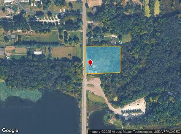
2618 State Route 43
36-025-00-00-022-000
LOT 25
Storebuilding
Portage
A
Ohio
39133C0250D
25
2024
2.19 AC
2024
Portage County
602101
Cleveland
3,740 SF
Akron, OH
DEMOGRAPHICS near 2618 State Route 43
1 Mile
3 Mile
5 Mile
2024 Total Population
495
11,078
48,243
2029 Population
498
11,115
48,099
Pop Growth 2024-2029
+ 0.61%
+ 0.33%
(0.30%)
Average Age
44
44
43
2024 Total Households
201
4,462
20,320
HH Growth 2024-2029
+ 0.50%
+ 0.20%
(0.38%)
Median Household Inc
$78,500
$70,421
$65,217
Avg Household Size
2.40
2.50
2.30
2024 Avg HH Vehicles
2.00
2.00
2.00
Median Home Value
$228,000
$186,983
$170,793
Median Year Built
1975
1969
1969
Nearby Places
Map Layers
Map Styles
 Street
 Aerial
- Restaurants
- Banks
- Shops
- Fitness
- Groceries
PUBLIC TRANSPORTATION
AIRPORT
Akron-Canton Regional
DRIVE
WALK
Distance
Akron-Canton Regional
28 min
15.8 mi
Freight Ports
Port of Toledo
DRIVE
WALK
Distance
Port of Toledo
173 min
141.5 mi
Nearby Properties
Address
Land Use
TOTAL SIZE
Lot Size
Zoning
Address
Land Use
TOTAL SIZE
Lot Size
Zoning
91,286 SF
27.27 AC
Address
Land Use
TOTAL SIZE
Lot Size
Zoning
115,586 SF
4.93 AC
Address
Land Use
TOTAL SIZE
Lot Size
Zoning
168,889 SF
30.80 AC
Address
Land Use
TOTAL SIZE
Lot Size
Zoning
250,693 SF
93.26 AC
Address
Land Use
TOTAL SIZE
Lot Size
Zoning
57,542 SF
9.44 AC
Address
Land Use
TOTAL SIZE
Lot Size
Zoning
53,454 SF
3.78 AC
Address
Land Use
TOTAL SIZE
Lot Size
Zoning
46,978 SF
7 AC
Address
Land Use
TOTAL SIZE
Lot Size
Zoning
328,600 SF
19.36 AC
Address
Land Use
TOTAL SIZE
Lot Size
Zoning
62,064 SF
10 AC
Address
Land Use
TOTAL SIZE
Lot Size
Zoning
Address
Land Use
TOTAL SIZE
Lot Size
Zoning
273,024 SF
14 AC
Address
Land Use
TOTAL SIZE
Lot Size
Zoning
120,480 SF
5.45 AC
Address
Land Use
TOTAL SIZE
Lot Size
Zoning
34,000 SF
196.68 AC
Address
Land Use
TOTAL SIZE
Lot Size
Zoning
144,900 SF
7.24 AC
Address
Land Use
TOTAL SIZE
Lot Size
Zoning
36,184 SF
5.03 AC
Address
Land Use
TOTAL SIZE
Lot Size
Zoning
88,400 SF
5.58 AC
Address
Land Use
TOTAL SIZE
Lot Size
Zoning
16,838 SF
0.75 AC
Address
Land Use
TOTAL SIZE
Lot Size
Zoning
13,904 SF
8.18 AC
Address
Land Use
TOTAL SIZE
Lot Size
Zoning
61,305 SF
24.71 AC
Address
Land Use
TOTAL SIZE
Lot Size
Zoning
25,609 SF
2.33 AC
Address
Land Use
TOTAL SIZE
Lot Size
Zoning
62,592 SF
6.39 AC
Address
Land Use
TOTAL SIZE
Lot Size
Zoning
Address
Land Use
TOTAL SIZE
Lot Size
Zoning
14,481 SF
1.49 AC
Address
Land Use
TOTAL SIZE
Lot Size
Zoning
61,860 SF
3.70 AC
Address
Land Use
TOTAL SIZE
Lot Size
Zoning
33,936 SF
4.43 AC
Address
Land Use
TOTAL SIZE
Lot Size
Zoning
19,080 SF
1.41 AC
Address
Land Use
TOTAL SIZE
Lot Size
Zoning
5,760 SF
119.50 AC
Address
Land Use
TOTAL SIZE
Lot Size
Zoning
6,448 SF
89.72 AC
Address
Land Use
TOTAL SIZE
Lot Size
Zoning
38,170 SF
3.98 AC
Address
Land Use
TOTAL SIZE
Lot Size
Zoning
16,674 SF
55.66 AC
The World's #1 Commercial Real Estate Marketplace
Connect with us
© 2025 CoStar Group
The information above has been obtained from sources believed reliable. While we do not doubt its accuracy we have not verified it and make no guarantee, warranty or representation about it. It is your responsibility to independently confirm its accuracy and completeness. Any projections, opinions, assumptions, or estimates used are for example only and do not represent the current or future performance of the property. The value of this transaction to you depends on tax and other factors which should be evaluated by your tax, financial, and legal advisors. You and your advisors should conduct a careful, independent investigation of the property to determine to your satisfaction the suitability of the property for your needs.