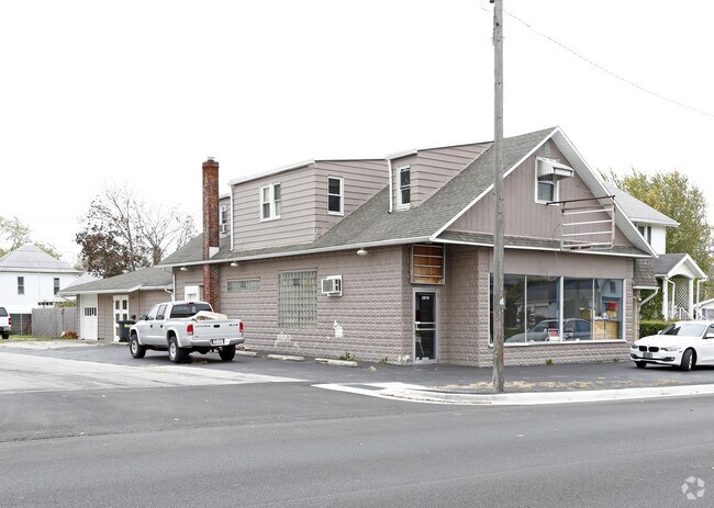
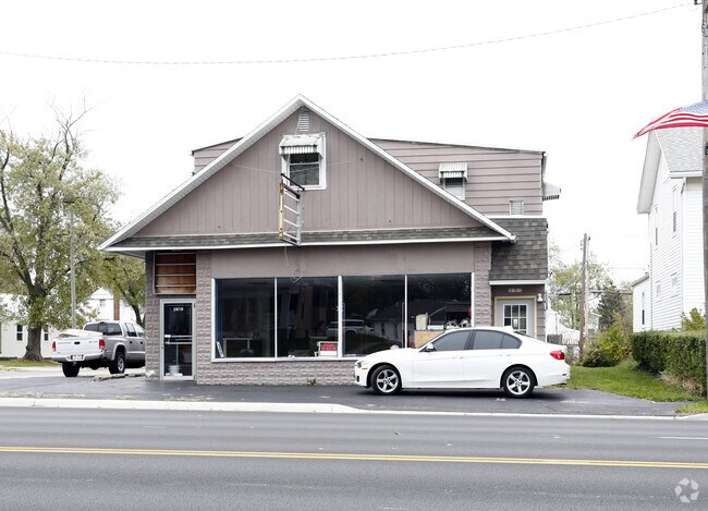
Property Record
2619 N Main St, Findlay, OH 45840
NEARBY LISTINGS FOR SALE OR LEASE
Property Detail
2619 N Main St
Findlay, OH
North View Sub
59-0000266510
NORTH VIEW SUB DIV BLK 19 LOT 1 EX E90FT
Storebuilding
Hancock
X
Ohio
39063C0209E
1
2024
0.11 AC
2024
Hancock County
000500
Toledo
1,596 SF
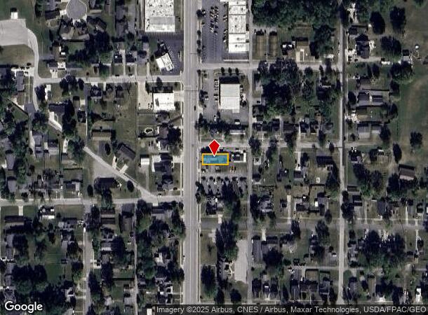
DEMOGRAPHICS near 2619 N Main St
1 Mile
3 Mile
5 Mile
2024 Total Population
9,517
38,990
55,342
2029 Population
9,584
39,360
55,734
Pop Growth 2024-2029
+ 0.70%
+ 0.95%
+ 0.71%
Average Age
40
40
41
2024 Total Households
4,111
16,891
23,456
HH Growth 2024-2029
+ 0.61%
+ 0.88%
+ 0.64%
Median Household Inc
$53,170
$56,756
$64,120
Avg Household Size
2.10
2.20
2.20
2024 Avg HH Vehicles
2.00
2.00
2.00
Median Home Value
$137,290
$157,066
$173,594
Median Year Built
1973
1974
1974
Nearby Places
Map Layers
Map Styles
 Street
 Aerial
- Restaurants
- Banks
- Shops
- Fitness
- Groceries
SALE & LEASE HISTORY
LISTING DATE
SALE/LEASE

Sep 28, 2016
For Lease
Sep 24, 2016
For Sale
Nov 22, 2017
For Sale
Feb 09, 2018
For Lease
Nearby Properties
Address
Land Use
TOTAL SIZE
Lot Size
Zoning
Address
Land Use
TOTAL SIZE
Lot Size
Zoning
1,192,452 SF
109.12 AC
Address
Land Use
TOTAL SIZE
Lot Size
Zoning
733,320 SF
99.55 AC
Address
Land Use
TOTAL SIZE
Lot Size
Zoning
741,600 SF
73.96 AC
Address
Land Use
TOTAL SIZE
Lot Size
Zoning
Address
Land Use
TOTAL SIZE
Lot Size
Zoning
21,080 SF
73.76 AC
Address
Land Use
TOTAL SIZE
Lot Size
Zoning
38,934 SF
63.14 AC
Address
Land Use
TOTAL SIZE
Lot Size
Zoning
125,040 SF
50.59 AC
Address
Land Use
TOTAL SIZE
Lot Size
Zoning
6,250 SF
50.52 AC
Address
Land Use
TOTAL SIZE
Lot Size
Zoning
527,242 SF
68.22 AC
Address
Land Use
TOTAL SIZE
Lot Size
Zoning
4,155 SF
8.40 AC
Address
Land Use
TOTAL SIZE
Lot Size
Zoning
1,344 SF
60 AC
Address
Land Use
TOTAL SIZE
Lot Size
Zoning
24,352 SF
3.59 AC
Address
Land Use
TOTAL SIZE
Lot Size
Zoning
100,000 SF
20.99 AC
Address
Land Use
TOTAL SIZE
Lot Size
Zoning
322,391 SF
40.25 AC
Address
Land Use
TOTAL SIZE
Lot Size
Zoning
3,009 SF
12.60 AC
Address
Land Use
TOTAL SIZE
Lot Size
Zoning
130,000 SF
7.10 AC
Address
Land Use
TOTAL SIZE
Lot Size
Zoning
16,521 SF
2.41 AC
Address
Land Use
TOTAL SIZE
Lot Size
Zoning
3,712 SF
22.05 AC
Address
Land Use
TOTAL SIZE
Lot Size
Zoning
100,000 SF
20.99 AC
Address
Land Use
TOTAL SIZE
Lot Size
Zoning
553,774 SF
24.56 AC
Address
Land Use
TOTAL SIZE
Lot Size
Zoning
402,604 SF
24.21 AC
Address
Land Use
TOTAL SIZE
Lot Size
Zoning
31,682 SF
17.80 AC
Address
Land Use
TOTAL SIZE
Lot Size
Zoning
196,982 SF
28.26 AC
Address
Land Use
TOTAL SIZE
Lot Size
Zoning
14,750 SF
3.59 AC
Address
Land Use
TOTAL SIZE
Lot Size
Zoning
Address
Land Use
TOTAL SIZE
Lot Size
Zoning
29,554 SF
7.80 AC
Address
Land Use
TOTAL SIZE
Lot Size
Zoning
465,444 SF
76 AC
Address
Land Use
TOTAL SIZE
Lot Size
Zoning
40,797 SF
1.12 AC
Address
Land Use
TOTAL SIZE
Lot Size
Zoning
115,336 SF
15.77 AC
Address
Land Use
TOTAL SIZE
Lot Size
Zoning
1,136 SF
115.72 AC
The World's #1 Commercial Real Estate Marketplace
Connect with us
© 2025 CoStar Group
The information above has been obtained from sources believed reliable. While we do not doubt its accuracy we have not verified it and make no guarantee, warranty or representation about it. It is your responsibility to independently confirm its accuracy and completeness. Any projections, opinions, assumptions, or estimates used are for example only and do not represent the current or future performance of the property. The value of this transaction to you depends on tax and other factors which should be evaluated by your tax, financial, and legal advisors. You and your advisors should conduct a careful, independent investigation of the property to determine to your satisfaction the suitability of the property for your needs.