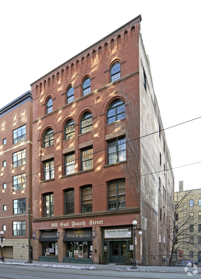
Property Record
262 4Th St E, Saint Paul, MN 55101
NEARBY LISTINGS FOR SALE OR LEASE
Property Detail
262 4Th St E
Minneapolis-St. Paul-Bloomington, MN-WI
Hopkins Addition
32-29-22-33-0049
HOPKINS ADDITION LOT 3 BLK 2
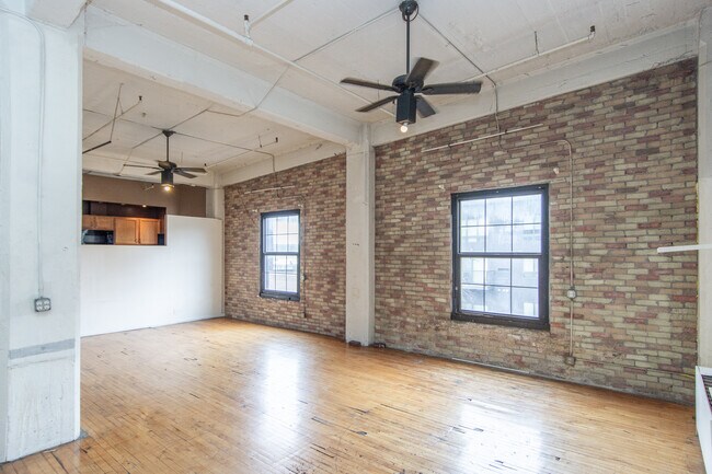
Apartment
Ramsey
X
Minnesota
27037C0050E
3
2024
0.15 AC
2025
Lowertown
034201
Minneapolis/St Paul
42,500 SF
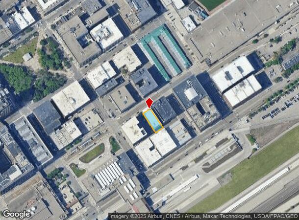
DEMOGRAPHICS near 262 4Th St E
1 Mile
3 Mile
5 Mile
2024 Total Population
17,289
163,606
350,885
2029 Population
17,182
159,579
343,285
Pop Growth 2024-2029
(0.62%)
(2.46%)
(2.17%)
Average Age
40
36
37
2024 Total Households
9,331
61,654
137,263
HH Growth 2024-2029
(0.26%)
(2.41%)
(2.14%)
Median Household Inc
$59,722
$59,552
$66,890
Avg Household Size
1.70
2.50
2.40
2024 Avg HH Vehicles
1.00
2.00
2.00
Median Home Value
$251,188
$238,080
$267,580
Median Year Built
1970
1952
1957
Nearby Places
Map Layers
Map Styles
 Street
 Aerial
- Restaurants
- Banks
- Shops
- Fitness
- Groceries
PUBLIC TRANSPORTATION
COMMUTER RAIL
DRIVE
WALK
Distance
1 min
2 min
0.1 mi
AIRPORT
Minneapolis-St Paul International/Wold-Chamberlain
DRIVE
WALK
Distance
Minneapolis-St Paul International/Wold-Chamberlain
16 min
9.5 mi
SALE & LEASE HISTORY
LISTING DATE
SALE/LEASE

Sep 28, 2016
For Sale
Sep 28, 2016
For Sale
May 09, 2018
For Sale
May 02, 2017
For Sale
Apr 02, 2024
For Sale
Nearby Properties
Address
Land Use
TOTAL SIZE
Lot Size
Zoning
Address
Land Use
TOTAL SIZE
Lot Size
Zoning
384,515 SF
18.04 AC
Address
Land Use
TOTAL SIZE
Lot Size
Zoning
384,515 SF
1.33 AC
Address
Land Use
TOTAL SIZE
Lot Size
Zoning
582,896 SF
14 AC
Address
Land Use
TOTAL SIZE
Lot Size
Zoning
825,463 SF
7.04 AC
Address
Land Use
TOTAL SIZE
Lot Size
Zoning
63.12 AC
Address
Land Use
TOTAL SIZE
Lot Size
Zoning
646,900 SF
7.66 AC
Address
Land Use
TOTAL SIZE
Lot Size
Zoning
32,854 SF
5.55 AC
Address
Land Use
TOTAL SIZE
Lot Size
Zoning
404,491 SF
27.01 AC
Address
Land Use
TOTAL SIZE
Lot Size
Zoning
408.23 AC
Address
Land Use
TOTAL SIZE
Lot Size
Zoning
420,177 SF
2.13 AC
Address
Land Use
TOTAL SIZE
Lot Size
Zoning
516,325 SF
16.81 AC
Address
Land Use
TOTAL SIZE
Lot Size
Zoning
759,622 SF
2.66 AC
Address
Land Use
TOTAL SIZE
Lot Size
Zoning
786,042 SF
2.10 AC
Address
Land Use
TOTAL SIZE
Lot Size
Zoning
643,305 SF
1.93 AC
Address
Land Use
TOTAL SIZE
Lot Size
Zoning
7.41 AC
Address
Land Use
TOTAL SIZE
Lot Size
Zoning
793,465 SF
1.93 AC
Address
Land Use
TOTAL SIZE
Lot Size
Zoning
3,050 SF
58.60 AC
Address
Land Use
TOTAL SIZE
Lot Size
Zoning
329,070 SF
5.75 AC
Address
Land Use
TOTAL SIZE
Lot Size
Zoning
160,800 SF
5.05 AC
Address
Land Use
TOTAL SIZE
Lot Size
Zoning
393,443 SF
3.75 AC
Address
Land Use
TOTAL SIZE
Lot Size
Zoning
260,739 SF
3.04 AC
Address
Land Use
TOTAL SIZE
Lot Size
Zoning
445,437 SF
7.80 AC
Address
Land Use
TOTAL SIZE
Lot Size
Zoning
265,736 SF
6.67 AC
Address
Land Use
TOTAL SIZE
Lot Size
Zoning
3.13 AC
Address
Land Use
TOTAL SIZE
Lot Size
Zoning
47,670 SF
179 AC
Address
Land Use
TOTAL SIZE
Lot Size
Zoning
207.61 AC
Address
Land Use
TOTAL SIZE
Lot Size
Zoning
364,480 SF
8.33 AC
Address
Land Use
TOTAL SIZE
Lot Size
Zoning
444,819 SF
0.86 AC
Address
Land Use
TOTAL SIZE
Lot Size
Zoning
290,482 SF
1.46 AC
Address
Land Use
TOTAL SIZE
Lot Size
Zoning
13.10 AC
The World's #1 Commercial Real Estate Marketplace
Connect with us
© 2025 CoStar Group
The information above has been obtained from sources believed reliable. While we do not doubt its accuracy we have not verified it and make no guarantee, warranty or representation about it. It is your responsibility to independently confirm its accuracy and completeness. Any projections, opinions, assumptions, or estimates used are for example only and do not represent the current or future performance of the property. The value of this transaction to you depends on tax and other factors which should be evaluated by your tax, financial, and legal advisors. You and your advisors should conduct a careful, independent investigation of the property to determine to your satisfaction the suitability of the property for your needs.