Property Record
262 County Farm Rd, Dover, NH 03820

NEARBY LISTINGS FOR SALE OR LEASE
-
-
View all Dover listings for sale on LoopNet.com
Property Detail
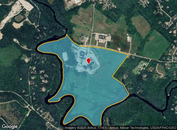
262 County Farm Rd
DOVR-000004-000000-C000000
Strafford
Governmentalpublicusegeneral
New Hampshire
A
26 AC
33017C0305E
Strafford County
2024
Boston
2024
Boston-Cambridge-Newton, MA-NH
081600
DEMOGRAPHICS near 262 County Farm Rd
1 Mile
3 Mile
5 Mile
2024 Total Population
1,265
12,431
56,778
2029 Population
1,311
12,958
59,564
Pop Growth 2024-2029
+ 3.64%
+ 4.24%
+ 4.91%
Average Age
43
41
40
2024 Total Households
312
4,662
24,070
HH Growth 2024-2029
+ 4.49%
+ 4.44%
+ 5.08%
Median Household Inc
$162,115
$117,225
$96,153
Avg Household Size
2.70
2.50
2.30
2024 Avg HH Vehicles
2.00
2.00
2.00
Median Home Value
$460,848
$365,924
$326,827
Median Year Built
1996
1981
1976
Nearby Places
Map Layers
Map Styles
 Street
 Aerial
- Restaurants
- Banks
- Shops
- Fitness
- Groceries
PUBLIC TRANSPORTATION
COMMUTER RAIL
Dover (Downeaster - Amtrak)
DRIVE
WALK
Distance
Dover (Downeaster - Amtrak)
10 min
4.1 mi
Durham (Downeaster - Amtrak)
DRIVE
WALK
Distance
Durham (Downeaster - Amtrak)
20 min
8.7 mi
AIRPORT
Portsmouth International at Pease
DRIVE
WALK
Distance
Portsmouth International at Pease
25 min
14.4 mi
Freight Ports
Portland, ME
DRIVE
WALK
Distance
Portland, ME
77 min
53.1 mi
Nearby Properties
Address
Land Use
TOTAL SIZE
Lot Size
Zoning
Address
Land Use
TOTAL SIZE
Lot Size
Zoning
220.20 AC
IT
Address
Land Use
TOTAL SIZE
Lot Size
Zoning
177,717 SF
116.87 AC
COMMER
Address
Land Use
TOTAL SIZE
Lot Size
Zoning
7.84 AC
C
Address
Land Use
TOTAL SIZE
Lot Size
Zoning
15.46 AC
C
Address
Land Use
TOTAL SIZE
Lot Size
Zoning
127 AC
RCY
Address
Land Use
TOTAL SIZE
Lot Size
Zoning
35 AC
R-40
Address
Land Use
TOTAL SIZE
Lot Size
Zoning
37,781 SF
65 AC
RCY
Address
Land Use
TOTAL SIZE
Lot Size
Zoning
11.08 AC
RM-U
Address
Land Use
TOTAL SIZE
Lot Size
Zoning
77,916 SF
6.58 AC
A
Address
Land Use
TOTAL SIZE
Lot Size
Zoning
4.15 AC
RM-U
Address
Land Use
TOTAL SIZE
Lot Size
Zoning
12.60 AC
IT
Address
Land Use
TOTAL SIZE
Lot Size
Zoning
5 AC
C
Address
Land Use
TOTAL SIZE
Lot Size
Zoning
38.27 AC
RM-U
Address
Land Use
TOTAL SIZE
Lot Size
Zoning
8.96 AC
IT
Address
Land Use
TOTAL SIZE
Lot Size
Zoning
6.81 AC
CM
Address
Land Use
TOTAL SIZE
Lot Size
Zoning
5.24 AC
C
Address
Land Use
TOTAL SIZE
Lot Size
Zoning
3 AC
IT
Address
Land Use
TOTAL SIZE
Lot Size
Zoning
12.74 AC
C
Address
Land Use
TOTAL SIZE
Lot Size
Zoning
8.65 AC
IT
Address
Land Use
TOTAL SIZE
Lot Size
Zoning
106,003 SF
27.94 AC
COMMER
Address
Land Use
TOTAL SIZE
Lot Size
Zoning
14.50 AC
CI
Address
Land Use
TOTAL SIZE
Lot Size
Zoning
26.27 AC
IT*
Address
Land Use
TOTAL SIZE
Lot Size
Zoning
46.98 AC
CI
Address
Land Use
TOTAL SIZE
Lot Size
Zoning
13.60 AC
R-12
Address
Land Use
TOTAL SIZE
Lot Size
Zoning
2.02 AC
C
Address
Land Use
TOTAL SIZE
Lot Size
Zoning
25.05 AC
CM
Address
Land Use
TOTAL SIZE
Lot Size
Zoning
7.66 AC
RM-U
Address
Land Use
TOTAL SIZE
Lot Size
Zoning
2.04 AC
C
Address
Land Use
TOTAL SIZE
Lot Size
Zoning
34,964 SF
1.47 AC
COM-B
The World's #1 Commercial Real Estate Marketplace
Connect with us
© 2026 CoStar Group
The information above has been obtained from sources believed reliable. While we do not doubt its accuracy we have not verified it and make no guarantee, warranty or representation about it. It is your responsibility to independently confirm its accuracy and completeness. Any projections, opinions, assumptions, or estimates used are for example only and do not represent the current or future performance of the property. The value of this transaction to you depends on tax and other factors which should be evaluated by your tax, financial, and legal advisors. You and your advisors should conduct a careful, independent investigation of the property to determine to your satisfaction the suitability of the property for your needs.