Property Record
2620 90Th St, Sturtevant, WI 53177


NEARBY LISTINGS FOR SALE OR LEASE
Property Detail
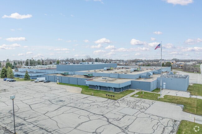
2620 90Th St
Racine, WI
Certified Survey Map No 2772
181-032221051020
PT SE1/4 CSM #2772 V8 P841 #2079033 LOT 1 FROM 181032221051000 IN 06 FOR 07 ROLL **TOTAL ACRES** 12.90
Manufacturinglight
Racine
X
Wisconsin
55101C0209D
1
2024
12.90 AC
2024
Racine East
001703
Milwaukee/Madison
159,700 SF
DEMOGRAPHICS near 2620 90Th St
1 Mile
3 Mile
5 Mile
2024 Total Population
4,723
23,301
81,324
2029 Population
4,656
23,192
80,673
Pop Growth 2024-2029
(1.42%)
(0.47%)
(0.80%)
Average Age
40
43
41
2024 Total Households
1,572
9,513
32,838
HH Growth 2024-2029
(1.08%)
(0.28%)
(0.83%)
Median Household Inc
$74,036
$68,534
$67,954
Avg Household Size
2.40
2.20
2.30
2024 Avg HH Vehicles
2.00
2.00
2.00
Median Home Value
$185,261
$221,201
$198,026
Median Year Built
1972
1980
1969
Nearby Places
Map Layers
Map Styles
 Street
 Aerial
- Restaurants
- Banks
- Shops
- Fitness
- Groceries
PUBLIC TRANSPORTATION
COMMUTER RAIL
Sturtevant Amtrak Station (Hiawatha Service - Amtrak)
DRIVE
WALK
Distance
Sturtevant Amtrak Station (Hiawatha Service - Amtrak)
6 min
2.6 mi
AIRPORT
General Mitchell International
DRIVE
WALK
Distance
General Mitchell International
30 min
21.5 mi
Freight Ports
Port Milwaukee
DRIVE
WALK
Distance
Port Milwaukee
35 min
25.4 mi
SALE & LEASE HISTORY
LISTING DATE
SALE/LEASE

Nov 11, 2016
For Lease
Mar 29, 2017
For Lease
Mar 29, 2017
For Sale
Jun 05, 2023
For Lease
Apr 22, 2020
For Lease
Nearby Properties
Address
Land Use
TOTAL SIZE
Lot Size
Zoning
Address
Land Use
TOTAL SIZE
Lot Size
Zoning
861.42 AC
Address
Land Use
TOTAL SIZE
Lot Size
Zoning
318.64 AC
Address
Land Use
TOTAL SIZE
Lot Size
Zoning
22.34 AC
Address
Land Use
TOTAL SIZE
Lot Size
Zoning
241.29 AC
Address
Land Use
TOTAL SIZE
Lot Size
Zoning
241.29 AC
Address
Land Use
TOTAL SIZE
Lot Size
Zoning
Address
Land Use
TOTAL SIZE
Lot Size
Zoning
9.40 AC
B-3
Address
Land Use
TOTAL SIZE
Lot Size
Zoning
23.10 AC
Address
Land Use
TOTAL SIZE
Lot Size
Zoning
37.55 AC
Address
Land Use
TOTAL SIZE
Lot Size
Zoning
47.01 AC
M-1
Address
Land Use
TOTAL SIZE
Lot Size
Zoning
32.55 AC
Address
Land Use
TOTAL SIZE
Lot Size
Zoning
57.80 AC
M1
Address
Land Use
TOTAL SIZE
Lot Size
Zoning
26.79 AC
Address
Land Use
TOTAL SIZE
Lot Size
Zoning
Address
Land Use
TOTAL SIZE
Lot Size
Zoning
Address
Land Use
TOTAL SIZE
Lot Size
Zoning
23.21 AC
Address
Land Use
TOTAL SIZE
Lot Size
Zoning
140.07 AC
Address
Land Use
TOTAL SIZE
Lot Size
Zoning
9.31 AC
Address
Land Use
TOTAL SIZE
Lot Size
Zoning
Address
Land Use
TOTAL SIZE
Lot Size
Zoning
30.45 AC
002
Address
Land Use
TOTAL SIZE
Lot Size
Zoning
18.33 AC
Address
Land Use
TOTAL SIZE
Lot Size
Zoning
10.72 AC
Address
Land Use
TOTAL SIZE
Lot Size
Zoning
20.61 AC
Address
Land Use
TOTAL SIZE
Lot Size
Zoning
19.29 AC
002
Address
Land Use
TOTAL SIZE
Lot Size
Zoning
5.74 AC
Address
Land Use
TOTAL SIZE
Lot Size
Zoning
Address
Land Use
TOTAL SIZE
Lot Size
Zoning
Address
Land Use
TOTAL SIZE
Lot Size
Zoning
22.98 AC
M-1
Address
Land Use
TOTAL SIZE
Lot Size
Zoning
32.99 AC
002
Address
Land Use
TOTAL SIZE
Lot Size
Zoning
The World's #1 Commercial Real Estate Marketplace
Connect with us
© 2025 CoStar Group
The information above has been obtained from sources believed reliable. While we do not doubt its accuracy we have not verified it and make no guarantee, warranty or representation about it. It is your responsibility to independently confirm its accuracy and completeness. Any projections, opinions, assumptions, or estimates used are for example only and do not represent the current or future performance of the property. The value of this transaction to you depends on tax and other factors which should be evaluated by your tax, financial, and legal advisors. You and your advisors should conduct a careful, independent investigation of the property to determine to your satisfaction the suitability of the property for your needs.