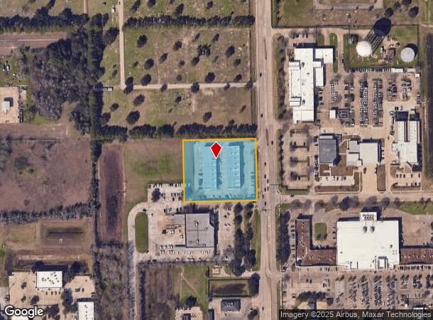
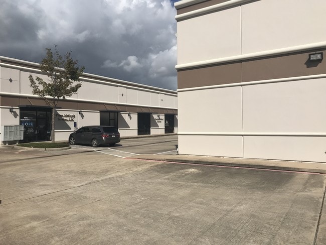
Property Record
2620 Cullen Pkwy, Pearland, TX 77581

NEARBY LISTINGS FOR SALE OR LEASE
Property Detail
2620 Cullen Pkwy
0506-0045-110
H T & B R R
Commercialnec
A0506 H T & B R R TRACT 59 ACRES 2.389
AE
Brazoria
48039C0040K
Texas
2024
2.39 AC
2025
Far South
660610
Houston
24,000 SF
Houston-The Woodlands-Sugar Land, TX
DEMOGRAPHICS near 2620 Cullen Pkwy
1 Mile
3 Mile
5 Mile
2024 Total Population
7,880
67,347
168,945
2029 Population
8,671
73,841
184,502
Pop Growth 2024-2029
+ 10.04%
+ 9.64%
+ 9.21%
Average Age
36
37
36
2024 Total Households
2,738
23,106
57,086
HH Growth 2024-2029
+ 10.37%
+ 9.75%
+ 9.30%
Median Household Inc
$93,958
$106,464
$92,982
Avg Household Size
2.80
2.90
2.90
2024 Avg HH Vehicles
2.00
2.00
2.00
Median Home Value
$326,401
$304,838
$287,197
Median Year Built
2001
2001
2004
Nearby Places
Map Layers
Map Styles
 Street
 Aerial
- Restaurants
- Banks
- Shops
- Fitness
- Groceries
PUBLIC TRANSPORTATION
AIRPORT
William P Hobby
DRIVE
WALK
Distance
William P Hobby
20 min
10.2 mi
George Bush Intcntl/Houston
DRIVE
WALK
Distance
George Bush Intcntl/Houston
47 min
35.4 mi
Freight Ports
Port of Houston
DRIVE
WALK
Distance
Port of Houston
29 min
17.4 mi
SALE & LEASE HISTORY
LISTING DATE
SALE/LEASE

Nov 16, 2016
For Lease
Nearby Properties
Address
Land Use
TOTAL SIZE
Lot Size
Zoning
Address
Land Use
TOTAL SIZE
Lot Size
Zoning
66.85 AC
0047
Address
Land Use
TOTAL SIZE
Lot Size
Zoning
367,766 SF
43.71 AC
Address
Land Use
TOTAL SIZE
Lot Size
Zoning
567,513 SF
5.82 AC
Address
Land Use
TOTAL SIZE
Lot Size
Zoning
150,275 SF
37.92 AC
Address
Land Use
TOTAL SIZE
Lot Size
Zoning
603,780 SF
36.94 AC
Address
Land Use
TOTAL SIZE
Lot Size
Zoning
42,360 SF
13.01 AC
Address
Land Use
TOTAL SIZE
Lot Size
Zoning
369,539 SF
30.71 AC
Address
Land Use
TOTAL SIZE
Lot Size
Zoning
421,680 SF
23.44 AC
Address
Land Use
TOTAL SIZE
Lot Size
Zoning
372,209 SF
17.91 AC
Address
Land Use
TOTAL SIZE
Lot Size
Zoning
428,639 SF
16.96 AC
Address
Land Use
TOTAL SIZE
Lot Size
Zoning
373,654 SF
16.35 AC
Address
Land Use
TOTAL SIZE
Lot Size
Zoning
372,280 SF
14.70 AC
0021
Address
Land Use
TOTAL SIZE
Lot Size
Zoning
379,071 SF
20.02 AC
Address
Land Use
TOTAL SIZE
Lot Size
Zoning
354,686 SF
15.85 AC
Address
Land Use
TOTAL SIZE
Lot Size
Zoning
321,409 SF
13.90 AC
Address
Land Use
TOTAL SIZE
Lot Size
Zoning
350,128 SF
16.98 AC
Address
Land Use
TOTAL SIZE
Lot Size
Zoning
334,628 SF
13.87 AC
Address
Land Use
TOTAL SIZE
Lot Size
Zoning
387,389 SF
21.40 AC
Address
Land Use
TOTAL SIZE
Lot Size
Zoning
124,254 SF
22.68 AC
0002
Address
Land Use
TOTAL SIZE
Lot Size
Zoning
323,168 SF
12.80 AC
Address
Land Use
TOTAL SIZE
Lot Size
Zoning
379,493 SF
14.27 AC
Address
Land Use
TOTAL SIZE
Lot Size
Zoning
225,854 SF
10.44 AC
Address
Land Use
TOTAL SIZE
Lot Size
Zoning
240,616 SF
10.01 AC
Address
Land Use
TOTAL SIZE
Lot Size
Zoning
252,472 SF
13.28 AC
Address
Land Use
TOTAL SIZE
Lot Size
Zoning
79.45 AC
1000
Address
Land Use
TOTAL SIZE
Lot Size
Zoning
16,677 SF
12.38 AC
Address
Land Use
TOTAL SIZE
Lot Size
Zoning
62,055 SF
5.46 AC
Address
Land Use
TOTAL SIZE
Lot Size
Zoning
241,488 SF
9.81 AC
Address
Land Use
TOTAL SIZE
Lot Size
Zoning
215,063 SF
19.13 AC
Address
Land Use
TOTAL SIZE
Lot Size
Zoning
228,276 SF
9.43 AC
0036
The World's #1 Commercial Real Estate Marketplace
Connect with us
© 2025 CoStar Group
The information above has been obtained from sources believed reliable. While we do not doubt its accuracy we have not verified it and make no guarantee, warranty or representation about it. It is your responsibility to independently confirm its accuracy and completeness. Any projections, opinions, assumptions, or estimates used are for example only and do not represent the current or future performance of the property. The value of this transaction to you depends on tax and other factors which should be evaluated by your tax, financial, and legal advisors. You and your advisors should conduct a careful, independent investigation of the property to determine to your satisfaction the suitability of the property for your needs.