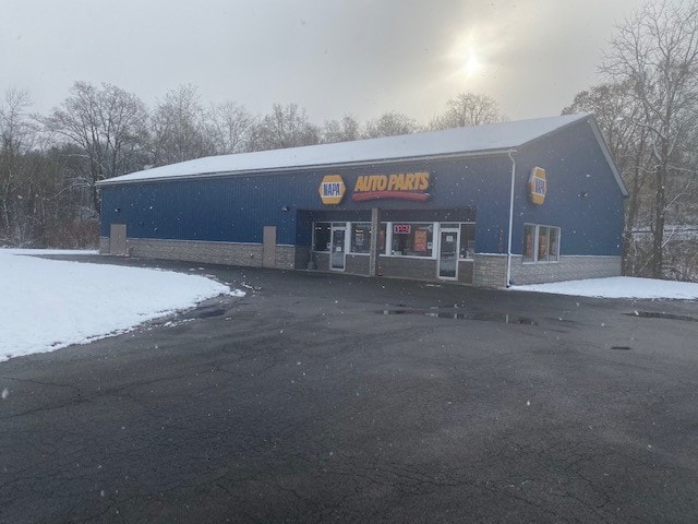
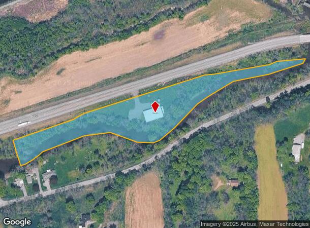
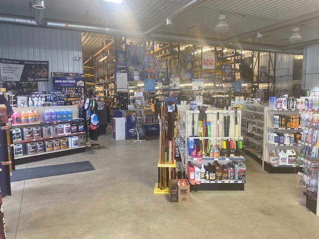
Property Record
2620 Route 31, Macedon, NY 14502
NEARBY LISTINGS FOR SALE OR LEASE
Property Detail
2620 Route 31
Rochester, NY
1303 32111-00-130654
543000-064-111-0000-105-652-0000
Wayne
Storesoffices
New York
0
105.652
2024
5.29 AC
020303
Wayne County
5,872 SF
Rochester
DEMOGRAPHICS near 2620 Route 31
1 Mile
3 Mile
5 Mile
2024 Total Population
1,939
8,800
15,382
2029 Population
1,957
8,781
15,296
Pop Growth 2024-2029
+ 0.93%
(0.22%)
(0.56%)
Average Age
42
43
43
2024 Total Households
806
3,790
6,476
HH Growth 2024-2029
+ 0.87%
(0.29%)
(0.60%)
Median Household Inc
$74,855
$72,473
$75,086
Avg Household Size
2.40
2.30
2.30
2024 Avg HH Vehicles
2.00
2.00
2.00
Median Home Value
$161,399
$156,458
$160,939
Median Year Built
1949
1962
1971
Nearby Places
- Restaurants
- Banks
- Shops
- Fitness
- Groceries
PUBLIC TRANSPORTATION
AIRPORT
Frederick Douglass/Greater Rochester International
DRIVE
WALK
Distance
Frederick Douglass/Greater Rochester International
37 min
23.7 mi
Freight Ports
Albany, NY Port
DRIVE
WALK
Distance
Albany, NY Port
246 min
208.1 mi
SALE & LEASE HISTORY
LISTING DATE
SALE/LEASE

Nov 08, 2019
For Sale
Nearby Properties
Address
Land Use
TOTAL SIZE
Lot Size
Zoning
Address
Land Use
TOTAL SIZE
Lot Size
Zoning
Address
Land Use
TOTAL SIZE
Lot Size
Zoning
13,806 SF
137.28 AC
LI
Address
Land Use
TOTAL SIZE
Lot Size
Zoning
11,144 SF
24.17 AC
05 - COMME
Address
Land Use
TOTAL SIZE
Lot Size
Zoning
126,403 SF
5.86 AC
R1
Address
Land Use
TOTAL SIZE
Lot Size
Zoning
110,254 SF
16.08 AC
R1
Address
Land Use
TOTAL SIZE
Lot Size
Zoning
4.60 AC
02 - SINGL
Address
Land Use
TOTAL SIZE
Lot Size
Zoning
25,541 SF
3.14 AC
05 - COMME
Address
Land Use
TOTAL SIZE
Lot Size
Zoning
77.84 AC
AR
Address
Land Use
TOTAL SIZE
Lot Size
Zoning
0.52 AC
Address
Land Use
TOTAL SIZE
Lot Size
Zoning
39.40 AC
Address
Land Use
TOTAL SIZE
Lot Size
Zoning
16,000 SF
6.29 AC
Address
Land Use
TOTAL SIZE
Lot Size
Zoning
55,180 SF
22.91 AC
05 - COMME
Address
Land Use
TOTAL SIZE
Lot Size
Zoning
24,484 SF
13.69 AC
R1
Address
Land Use
TOTAL SIZE
Lot Size
Zoning
61,044 SF
3.33 AC
R2
Address
Land Use
TOTAL SIZE
Lot Size
Zoning
10,904 SF
1 AC
C3
Address
Land Use
TOTAL SIZE
Lot Size
Zoning
910 SF
22 AC
RR
Address
Land Use
TOTAL SIZE
Lot Size
Zoning
44.80 AC
Address
Land Use
TOTAL SIZE
Lot Size
Zoning
1,208 SF
3.34 AC
R2-PD
Address
Land Use
TOTAL SIZE
Lot Size
Zoning
6,080 SF
16.15 AC
R1
Address
Land Use
TOTAL SIZE
Lot Size
Zoning
9,298 SF
14.80 AC
R2
Address
Land Use
TOTAL SIZE
Lot Size
Zoning
Address
Land Use
TOTAL SIZE
Lot Size
Zoning
18,938 SF
58.50 AC
ORM
Address
Land Use
TOTAL SIZE
Lot Size
Zoning
65,195 SF
1.27 AC
C1
Address
Land Use
TOTAL SIZE
Lot Size
Zoning
11,600 SF
39.67 AC
Address
Land Use
TOTAL SIZE
Lot Size
Zoning
4,232 SF
3.14 AC
C3
Address
Land Use
TOTAL SIZE
Lot Size
Zoning
16,628 SF
3.13 AC
05 - COMME
Address
Land Use
TOTAL SIZE
Lot Size
Zoning
0.01 AC
Address
Land Use
TOTAL SIZE
Lot Size
Zoning
Address
Land Use
TOTAL SIZE
Lot Size
Zoning
12,528 SF
1.75 AC
C1
Address
Land Use
TOTAL SIZE
Lot Size
Zoning
5,400 SF
155.32 AC
The World's #1 Commercial Real Estate Marketplace
Connect with us
© 2025 CoStar Group
The information above has been obtained from sources believed reliable. While we do not doubt its accuracy we have not verified it and make no guarantee, warranty or representation about it. It is your responsibility to independently confirm its accuracy and completeness. Any projections, opinions, assumptions, or estimates used are for example only and do not represent the current or future performance of the property. The value of this transaction to you depends on tax and other factors which should be evaluated by your tax, financial, and legal advisors. You and your advisors should conduct a careful, independent investigation of the property to determine to your satisfaction the suitability of the property for your needs.