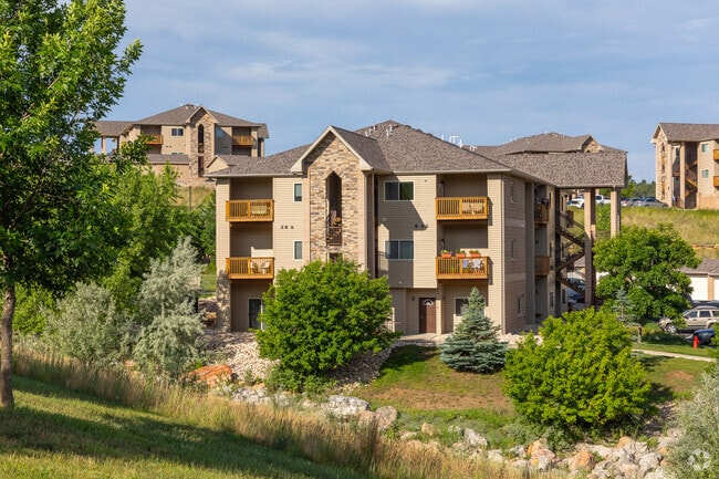
Property Record
2621 Belgarde Blvd, Rapid City, SD 57702


NEARBY LISTINGS FOR SALE OR LEASE
-
-
View all Rapid City listings for sale on LoopNet.com
Property Detail
2621 Belgarde Blvd
Rapid City, SD
Stoney Creek South #2 Subd
0060090
STONEY CREEK SOUTH #2 SUBD, LOT 1
Clubslodgesprofessionalassociations
Pennington
D
South Dakota
46103C0770H
1
0
27.57 AC
2025
Rapid City
011002
Other Market Areas
3,312 SF
DEMOGRAPHICS near 2621 Belgarde Blvd
1 Mile
3 Mile
5 Mile
2024 Total Population
3,494
26,408
60,796
2029 Population
3,863
29,437
67,632
Pop Growth 2024-2029
+ 10.56%
+ 11.47%
+ 11.24%
Average Age
42
44
42
2024 Total Households
1,624
11,076
25,669
HH Growth 2024-2029
+ 10.84%
+ 11.81%
+ 11.66%
Median Household Inc
$72,698
$79,635
$65,095
Avg Household Size
2.10
2.30
2.20
2024 Avg HH Vehicles
2.00
2.00
2.00
Median Home Value
$410,294
$367,672
$287,079
Median Year Built
2001
1988
1978
Nearby Places
Map Layers
Map Styles
 Street
 Aerial
- Restaurants
- Banks
- Shops
- Fitness
- Groceries
PUBLIC TRANSPORTATION
AIRPORT
Rapid City Regional
DRIVE
WALK
Distance
Rapid City Regional
22 min
14.0 mi
Freight Ports
Tulsa Port Of Catoosa
DRIVE
WALK
Distance
Tulsa Port Of Catoosa
975 min
894.7 mi
Nearby Properties
Address
Land Use
TOTAL SIZE
Lot Size
Zoning
Address
Land Use
TOTAL SIZE
Lot Size
Zoning
19,728 SF
7.67 AC
Address
Land Use
TOTAL SIZE
Lot Size
Zoning
23,278 SF
9.23 AC
Address
Land Use
TOTAL SIZE
Lot Size
Zoning
9,294 SF
8.82 AC
Address
Land Use
TOTAL SIZE
Lot Size
Zoning
56,132 SF
7.14 AC
Address
Land Use
TOTAL SIZE
Lot Size
Zoning
4,759 SF
7.78 AC
Address
Land Use
TOTAL SIZE
Lot Size
Zoning
3,703 SF
8.46 AC
Address
Land Use
TOTAL SIZE
Lot Size
Zoning
12,258 SF
7.62 AC
Address
Land Use
TOTAL SIZE
Lot Size
Zoning
50,794 SF
7.05 AC
Address
Land Use
TOTAL SIZE
Lot Size
Zoning
12,464 SF
4.94 AC
Address
Land Use
TOTAL SIZE
Lot Size
Zoning
8,764 SF
6 AC
Address
Land Use
TOTAL SIZE
Lot Size
Zoning
2,058 SF
6.70 AC
Address
Land Use
TOTAL SIZE
Lot Size
Zoning
48,108 SF
38.14 AC
Address
Land Use
TOTAL SIZE
Lot Size
Zoning
24,360 SF
4.24 AC
Address
Land Use
TOTAL SIZE
Lot Size
Zoning
48,263 SF
7.28 AC
Address
Land Use
TOTAL SIZE
Lot Size
Zoning
25,762 SF
5.74 AC
Address
Land Use
TOTAL SIZE
Lot Size
Zoning
48,084 SF
5.74 AC
Address
Land Use
TOTAL SIZE
Lot Size
Zoning
17,392 SF
7.85 AC
Address
Land Use
TOTAL SIZE
Lot Size
Zoning
10,128 SF
2 AC
Address
Land Use
TOTAL SIZE
Lot Size
Zoning
164,294 SF
19 AC
Address
Land Use
TOTAL SIZE
Lot Size
Zoning
35,999 SF
3.01 AC
Address
Land Use
TOTAL SIZE
Lot Size
Zoning
19,302 SF
4.74 AC
Address
Land Use
TOTAL SIZE
Lot Size
Zoning
21,722 SF
7.50 AC
Address
Land Use
TOTAL SIZE
Lot Size
Zoning
15,407 SF
4.83 AC
Address
Land Use
TOTAL SIZE
Lot Size
Zoning
38,026 SF
7.59 AC
Address
Land Use
TOTAL SIZE
Lot Size
Zoning
15,200 SF
2.37 AC
Address
Land Use
TOTAL SIZE
Lot Size
Zoning
8,901 SF
4.07 AC
Address
Land Use
TOTAL SIZE
Lot Size
Zoning
15,012 SF
3.55 AC
Address
Land Use
TOTAL SIZE
Lot Size
Zoning
13,152 SF
2.20 AC
Address
Land Use
TOTAL SIZE
Lot Size
Zoning
20,941 SF
10.83 AC
The World's #1 Commercial Real Estate Marketplace
Connect with us
© 2026 CoStar Group
The information above has been obtained from sources believed reliable. While we do not doubt its accuracy we have not verified it and make no guarantee, warranty or representation about it. It is your responsibility to independently confirm its accuracy and completeness. Any projections, opinions, assumptions, or estimates used are for example only and do not represent the current or future performance of the property. The value of this transaction to you depends on tax and other factors which should be evaluated by your tax, financial, and legal advisors. You and your advisors should conduct a careful, independent investigation of the property to determine to your satisfaction the suitability of the property for your needs.