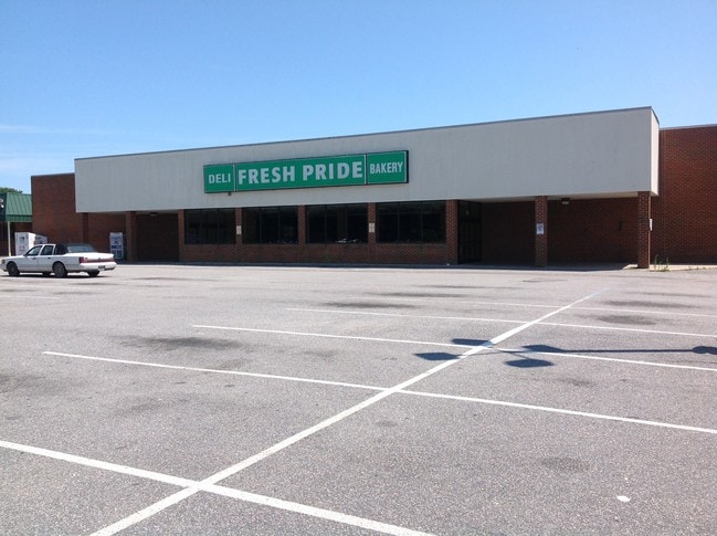
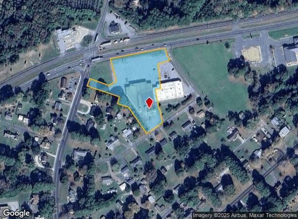
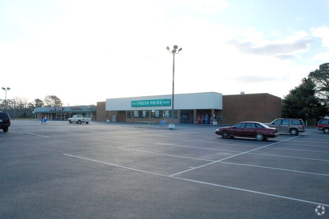
Property Record
2625 Lankford Hwy, Exmore, VA 23350
NEARBY LISTINGS FOR SALE OR LEASE
Property Detail
2625 Lankford Hwy
10A2-4-1
Exmore
Supermarket
PARCEL I
X
Northampton
51001C0790G
Virginia
2024
2.56 AC
2024
Virginia Regional
930100
Other Market Areas
27,050 SF
DEMOGRAPHICS near 2625 Lankford Hwy
1 Mile
3 Mile
5 Mile
2024 Total Population
918
3,134
4,941
2029 Population
831
2,868
4,550
Pop Growth 2024-2029
(9.48%)
(8.49%)
(7.91%)
Average Age
43
44
44
2024 Total Households
401
1,352
2,100
HH Growth 2024-2029
(9.98%)
(9.25%)
(8.67%)
Median Household Inc
$42,954
$45,777
$46,409
Avg Household Size
2.20
2.20
2.20
2024 Avg HH Vehicles
2.00
2.00
2.00
Median Home Value
$134,375
$139,642
$147,671
Median Year Built
1971
1977
1979
Nearby Places
Map Layers
Map Styles
 Street
 Aerial
- Restaurants
- Banks
- Shops
- Fitness
- Groceries
SALE & LEASE HISTORY
LISTING DATE
SALE/LEASE

Sep 25, 2016
For Lease
Sep 23, 2016
For Sale
Dec 20, 2017
For Lease
Nearby Properties
Address
Land Use
TOTAL SIZE
Lot Size
Zoning
Address
Land Use
TOTAL SIZE
Lot Size
Zoning
11.54 AC
Address
Land Use
TOTAL SIZE
Lot Size
Zoning
86.33 AC
Address
Land Use
TOTAL SIZE
Lot Size
Zoning
2.76 AC
Address
Land Use
TOTAL SIZE
Lot Size
Zoning
2.73 AC
Address
Land Use
TOTAL SIZE
Lot Size
Zoning
92,000 SF
7.50 AC
Address
Land Use
TOTAL SIZE
Lot Size
Zoning
5,000 SF
10.47 AC
Address
Land Use
TOTAL SIZE
Lot Size
Zoning
Address
Land Use
TOTAL SIZE
Lot Size
Zoning
0.50 AC
Address
Land Use
TOTAL SIZE
Lot Size
Zoning
13.64 AC
Address
Land Use
TOTAL SIZE
Lot Size
Zoning
10.60 AC
Address
Land Use
TOTAL SIZE
Lot Size
Zoning
53,920 SF
0.75 AC
Address
Land Use
TOTAL SIZE
Lot Size
Zoning
3.80 AC
Address
Land Use
TOTAL SIZE
Lot Size
Zoning
33,036 SF
11 AC
Address
Land Use
TOTAL SIZE
Lot Size
Zoning
7.50 AC
Address
Land Use
TOTAL SIZE
Lot Size
Zoning
Address
Land Use
TOTAL SIZE
Lot Size
Zoning
153.88 AC
Address
Land Use
TOTAL SIZE
Lot Size
Zoning
4.86 AC
Address
Land Use
TOTAL SIZE
Lot Size
Zoning
828 SF
67.30 AC
Address
Land Use
TOTAL SIZE
Lot Size
Zoning
17,984 SF
3.17 AC
Address
Land Use
TOTAL SIZE
Lot Size
Zoning
11,680 SF
5 AC
Address
Land Use
TOTAL SIZE
Lot Size
Zoning
2.56 AC
Address
Land Use
TOTAL SIZE
Lot Size
Zoning
225.90 AC
Address
Land Use
TOTAL SIZE
Lot Size
Zoning
2.25 AC
Address
Land Use
TOTAL SIZE
Lot Size
Zoning
1.90 AC
Address
Land Use
TOTAL SIZE
Lot Size
Zoning
5,952 SF
0.25 AC
Address
Land Use
TOTAL SIZE
Lot Size
Zoning
972 SF
86.76 AC
Address
Land Use
TOTAL SIZE
Lot Size
Zoning
1,134 SF
204.70 AC
Address
Land Use
TOTAL SIZE
Lot Size
Zoning
693 SF
8 AC
Address
Land Use
TOTAL SIZE
Lot Size
Zoning
1.43 AC
PE
Address
Land Use
TOTAL SIZE
Lot Size
Zoning
1.23 AC
The World's #1 Commercial Real Estate Marketplace
Connect with us
© 2025 CoStar Group
The information above has been obtained from sources believed reliable. While we do not doubt its accuracy we have not verified it and make no guarantee, warranty or representation about it. It is your responsibility to independently confirm its accuracy and completeness. Any projections, opinions, assumptions, or estimates used are for example only and do not represent the current or future performance of the property. The value of this transaction to you depends on tax and other factors which should be evaluated by your tax, financial, and legal advisors. You and your advisors should conduct a careful, independent investigation of the property to determine to your satisfaction the suitability of the property for your needs.