Property Record
2625 Old Denton Rd, Carrollton, TX 75007


NEARBY LISTINGS FOR SALE OR LEASE
Property Detail
2625 Old Denton Rd
Dallas-Fort Worth-Arlington, TX
Furneaux Creek Center Rep
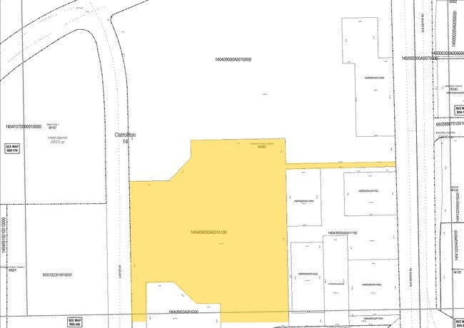
140409000A0010100
FURNEAUX CREEK CENTER REP BLK A LT 1.1 ACS 6.5322 INT201100219063 DD08182011 CO-DC 0409000A00101 1CC0409000A
Storemultistory
Dallas
X
Texas
48113C0160K
1
2024
6.53 AC
2025
North Carrollton
013719
Dallas/Ft Worth
78,952 SF
DEMOGRAPHICS near 2625 Old Denton Rd
1 Mile
3 Mile
5 Mile
2024 Total Population
8,993
100,476
315,136
2029 Population
9,900
112,387
350,331
Pop Growth 2024-2029
+ 10.09%
+ 11.85%
+ 11.17%
Average Age
43
39
38
2024 Total Households
3,357
36,959
128,414
HH Growth 2024-2029
+ 10.07%
+ 12.35%
+ 11.88%
Median Household Inc
$98,311
$86,647
$83,361
Avg Household Size
2.70
2.60
2.40
2024 Avg HH Vehicles
2.00
2.00
2.00
Median Home Value
$343,188
$307,750
$351,165
Median Year Built
1986
1986
1990
Nearby Places
Map Layers
Map Styles
 Street
 Aerial
- Restaurants
- Banks
- Shops
- Fitness
- Groceries
PUBLIC TRANSPORTATION
COMMUTER RAIL
Trinity Mills Station (Green Line - Dallas Area Rapid Transit (DART))
DRIVE
WALK
Distance
Trinity Mills Station (Green Line - Dallas Area Rapid Transit (DART))
4 min
1.6 mi
DRIVE
WALK
Distance
9 min
5.1 mi
AIRPORT
Dallas-Fort Worth International
DRIVE
WALK
Distance
Dallas-Fort Worth International
19 min
14.1 mi
Dallas Love Field
DRIVE
WALK
Distance
Dallas Love Field
26 min
15.4 mi
Nearby Properties
Address
Land Use
TOTAL SIZE
Lot Size
Zoning
Address
Land Use
TOTAL SIZE
Lot Size
Zoning
660,180 SF
29.95 AC
Address
Land Use
TOTAL SIZE
Lot Size
Zoning
462,692 SF
30.77 AC
2G
Address
Land Use
TOTAL SIZE
Lot Size
Zoning
513,871 SF
3.63 AC
Z235
Address
Land Use
TOTAL SIZE
Lot Size
Zoning
242,707 SF
27.63 AC
Z343
Address
Land Use
TOTAL SIZE
Lot Size
Zoning
321,732 SF
4.05 AC
Z235
Address
Land Use
TOTAL SIZE
Lot Size
Zoning
343,234 SF
32.41 AC
Address
Land Use
TOTAL SIZE
Lot Size
Zoning
266,871 SF
87 SF
Address
Land Use
TOTAL SIZE
Lot Size
Zoning
725,972 SF
4 AC
Address
Land Use
TOTAL SIZE
Lot Size
Zoning
189,500 SF
53.90 AC
Address
Land Use
TOTAL SIZE
Lot Size
Zoning
297,932 SF
14.05 AC
Address
Land Use
TOTAL SIZE
Lot Size
Zoning
397,889 SF
23.14 AC
2A
Address
Land Use
TOTAL SIZE
Lot Size
Zoning
270,915 SF
3.91 AC
Z84
Address
Land Use
TOTAL SIZE
Lot Size
Zoning
374,093 SF
21.54 AC
Z268
Address
Land Use
TOTAL SIZE
Lot Size
Zoning
711,360 SF
32.62 AC
Address
Land Use
TOTAL SIZE
Lot Size
Zoning
228,674 SF
11.81 AC
Z235
Address
Land Use
TOTAL SIZE
Lot Size
Zoning
294,764 SF
18 AC
Address
Land Use
TOTAL SIZE
Lot Size
Zoning
276,509 SF
16.67 AC
2G
Address
Land Use
TOTAL SIZE
Lot Size
Zoning
262,065 SF
7.77 AC
1A
Address
Land Use
TOTAL SIZE
Lot Size
Zoning
90,900 SF
10.21 AC
Address
Land Use
TOTAL SIZE
Lot Size
Zoning
268,158 SF
12.25 AC
1G
Address
Land Use
TOTAL SIZE
Lot Size
Zoning
288,278 SF
16.16 AC
2G
Address
Land Use
TOTAL SIZE
Lot Size
Zoning
219,057 SF
12.63 AC
2B
Address
Land Use
TOTAL SIZE
Lot Size
Zoning
232,109 SF
4.38 AC
Address
Land Use
TOTAL SIZE
Lot Size
Zoning
220,681 SF
13.97 AC
2B
Address
Land Use
TOTAL SIZE
Lot Size
Zoning
178,000 SF
21.05 AC
Address
Land Use
TOTAL SIZE
Lot Size
Zoning
171,826 SF
12.49 AC
Z235
Address
Land Use
TOTAL SIZE
Lot Size
Zoning
175,000 SF
20.50 AC
Address
Land Use
TOTAL SIZE
Lot Size
Zoning
222,975 SF
15.34 AC
2G
Address
Land Use
TOTAL SIZE
Lot Size
Zoning
197,024 SF
11.89 AC
Z235
Address
Land Use
TOTAL SIZE
Lot Size
Zoning
245,538 SF
14.24 AC
2G
The World's #1 Commercial Real Estate Marketplace
Connect with us
© 2025 CoStar Group
The information above has been obtained from sources believed reliable. While we do not doubt its accuracy we have not verified it and make no guarantee, warranty or representation about it. It is your responsibility to independently confirm its accuracy and completeness. Any projections, opinions, assumptions, or estimates used are for example only and do not represent the current or future performance of the property. The value of this transaction to you depends on tax and other factors which should be evaluated by your tax, financial, and legal advisors. You and your advisors should conduct a careful, independent investigation of the property to determine to your satisfaction the suitability of the property for your needs.