Property Record
2625 W Us Highway 50, Pueblo, CO 81008


NEARBY LISTINGS FOR SALE OR LEASE
Property Detail
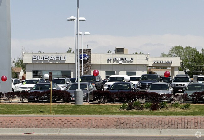
2625 W Us Highway 50
Pueblo, CO
Com-Hwy 50 Db
0-5-14-2-28-007
LOT 1 BLK 2 HEDLAND SUB + LOT 1 BLK 2 WESTROADS SUB 1ST,FILING LESS 409.00 SQ FT TO CDOT FORMERLY,#05-142-28-006
Commercialacreage
Pueblo
X
Colorado
08101C0492D
1
2024
2.99 AC
2024
Colorado East Area
002919
Other Market Areas
22,781 SF
DEMOGRAPHICS near 2625 W Us Highway 50
1 Mile
3 Mile
5 Mile
2024 Total Population
7,272
34,909
96,577
2029 Population
7,443
35,949
99,205
Pop Growth 2024-2029
+ 2.35%
+ 2.98%
+ 2.72%
Average Age
41
40
40
2024 Total Households
3,019
14,958
39,341
HH Growth 2024-2029
+ 2.48%
+ 3.14%
+ 2.85%
Median Household Inc
$66,303
$53,696
$51,008
Avg Household Size
2.40
2.20
2.30
2024 Avg HH Vehicles
2.00
2.00
2.00
Median Home Value
$253,825
$246,231
$232,067
Median Year Built
1994
1976
1969
Nearby Places
Map Layers
Map Styles
 Street
 Aerial
- Restaurants
- Banks
- Shops
- Fitness
- Groceries
PUBLIC TRANSPORTATION
AIRPORT
City of Colorado Springs Municipal
DRIVE
WALK
Distance
City of Colorado Springs Municipal
57 min
44.9 mi
Nearby Properties
Address
Land Use
TOTAL SIZE
Lot Size
Zoning
Address
Land Use
TOTAL SIZE
Lot Size
Zoning
486,484 SF
3.75 AC
R5:RES/MUL
Address
Land Use
TOTAL SIZE
Lot Size
Zoning
168,237 SF
3.69 AC
S-1
Address
Land Use
TOTAL SIZE
Lot Size
Zoning
80,928 SF
148.57 AC
Address
Land Use
TOTAL SIZE
Lot Size
Zoning
47,007 SF
8.79 AC
Address
Land Use
TOTAL SIZE
Lot Size
Zoning
61,095 SF
5.58 AC
B3:COMM/H&
Address
Land Use
TOTAL SIZE
Lot Size
Zoning
44,544 SF
4 AC
R5:RES/MUL
Address
Land Use
TOTAL SIZE
Lot Size
Zoning
200,121 SF
21.03 AC
B4:COMM/RE
Address
Land Use
TOTAL SIZE
Lot Size
Zoning
16,888 SF
5.31 AC
A-1
Address
Land Use
TOTAL SIZE
Lot Size
Zoning
25,172 SF
1.42 AC
R5:RES/MUL
Address
Land Use
TOTAL SIZE
Lot Size
Zoning
23,025 SF
1.21 AC
R5:RES/MUL
Address
Land Use
TOTAL SIZE
Lot Size
Zoning
13,178 SF
1.10 AC
R2:RES/1 F
Address
Land Use
TOTAL SIZE
Lot Size
Zoning
15,741 SF
24.16 AC
R5:RES/MUL
Address
Land Use
TOTAL SIZE
Lot Size
Zoning
22,611 SF
6.85 AC
S1:SPC/PUB
Address
Land Use
TOTAL SIZE
Lot Size
Zoning
91,409 SF
12.23 AC
B-3
Address
Land Use
TOTAL SIZE
Lot Size
Zoning
25,983 SF
0.97 AC
B4:COMM/RE
Address
Land Use
TOTAL SIZE
Lot Size
Zoning
113,152 SF
5.84 AC
R4:RES/MUL
Address
Land Use
TOTAL SIZE
Lot Size
Zoning
50,464 SF
9.34 AC
B4:COMM/RE
Address
Land Use
TOTAL SIZE
Lot Size
Zoning
17,956 SF
3.31 AC
R1:RES/1 F
Address
Land Use
TOTAL SIZE
Lot Size
Zoning
25,180 SF
1.83 AC
B4:COMM/RE
Address
Land Use
TOTAL SIZE
Lot Size
Zoning
20,507 SF
2.93 AC
B3:COMM/H&
Address
Land Use
TOTAL SIZE
Lot Size
Zoning
202,847 SF
22.04 AC
B4:COMM/RE
Address
Land Use
TOTAL SIZE
Lot Size
Zoning
88,208 SF
11.96 AC
B-3
Address
Land Use
TOTAL SIZE
Lot Size
Zoning
104,405 SF
8.17 AC
A2:AG/1&2
Address
Land Use
TOTAL SIZE
Lot Size
Zoning
181,050 SF
12.97 AC
B3:COMM/H&
Address
Land Use
TOTAL SIZE
Lot Size
Zoning
146,292 SF
17.81 AC
B3:COMM/H&
Address
Land Use
TOTAL SIZE
Lot Size
Zoning
53,088 SF
2.39 AC
Address
Land Use
TOTAL SIZE
Lot Size
Zoning
90,175 SF
7.86 AC
B3:COMM/H&
Address
Land Use
TOTAL SIZE
Lot Size
Zoning
26,467 SF
2.02 AC
B4:COMM/RE
Address
Land Use
TOTAL SIZE
Lot Size
Zoning
50,104 SF
6.56 AC
Address
Land Use
TOTAL SIZE
Lot Size
Zoning
22,531 SF
1.98 AC
R5:RES/MUL
The World's #1 Commercial Real Estate Marketplace
Connect with us
© 2026 CoStar Group
The information above has been obtained from sources believed reliable. While we do not doubt its accuracy we have not verified it and make no guarantee, warranty or representation about it. It is your responsibility to independently confirm its accuracy and completeness. Any projections, opinions, assumptions, or estimates used are for example only and do not represent the current or future performance of the property. The value of this transaction to you depends on tax and other factors which should be evaluated by your tax, financial, and legal advisors. You and your advisors should conduct a careful, independent investigation of the property to determine to your satisfaction the suitability of the property for your needs.