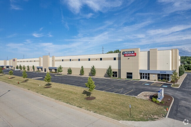
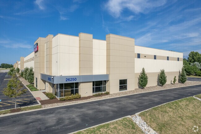
Property Record
26250 Bluestone Blvd, Euclid, OH 44132

Property Detail
26250 Bluestone Blvd
648-08-005
AFN 201710200530 PARCEL NO. 3 FF 628..63 5.7817 ACRES 20 OL 2018 SR
Publicstorage
Cuyahoga
B and X Area of moderate flood hazard, usually the area between the limits of the 100-year and 500-year floods.
Ohio
2025
5.78 AC
2025
Wickliffe/Willowick
152303
Cleveland
75,624 SF
Cleveland-Elyria, OH
NEARBY LISTINGS FOR SALE OR LEASE
DEMOGRAPHICS near 26250 Bluestone Blvd
1 mile
3 mile
5 mile
2025 Total Population
13,547
82,266
165,490
2030 Population
13,727
82,384
165,165
Pop Growth 2025-2030
+ 1.33%
+ 0.14%
(0.20%)
Average Age
39
42
43
2025 Total Households
6,439
37,662
76,271
HH Growth 2025-2030
+ 1.34%
+ 0.21%
(0.17%)
Median Household Inc
$38,040
$56,020
$55,769
Avg Household Size
2.10
2.10
2.10
2025 Avg HH Vehicles
1.00
1.00
1.00
Median Home Value
$119,988
$148,352
$161,445
Median Year Built
1962
1957
1958
Nearby Places
Map Layers
Map Styles
 Street
 Aerial
Layers
 Traffic
 Biking
Places
Listings with unknown addresses are not visible on the map
- Restaurants
- Banks
- Shops
- Fitness
- Groceries
PUBLIC TRANSPORTATION
AIRPORT
Cleveland-Hopkins International
Drive
Walk
Distance
Cleveland-Hopkins International
40 min
26.5 mi
Freight Ports
Port of Toledo
Drive
Walk
Distance
Port of Toledo
153 min
126.9 mi
SALE & LEASE HISTORY
LISTING DATE
SALE/LEASE

Dec 12, 2017
For Lease
Nearby Properties
Address
Land Use
TOTAL SIZE
Lot Size
Zoning
Address
Land Use
TOTAL SIZE
Lot Size
Zoning
71.14 AC
U4
Address
Land Use
TOTAL SIZE
Lot Size
Zoning
44,577 SF
39.90 AC
SI
Address
Land Use
TOTAL SIZE
Lot Size
Zoning
386,776 SF
14.70 AC
CI
Address
Land Use
TOTAL SIZE
Lot Size
Zoning
149,685 SF
27.66 AC
R-1
Address
Land Use
TOTAL SIZE
Lot Size
Zoning
19,776 SF
13.41 AC
CI
Address
Land Use
TOTAL SIZE
Lot Size
Zoning
166,392 SF
36.46 AC
RMF-2
Address
Land Use
TOTAL SIZE
Lot Size
Zoning
1,283,872 SF
11.33 AC
U3
Address
Land Use
TOTAL SIZE
Lot Size
Zoning
190,580 SF
7.90 AC
P.F.
Address
Land Use
TOTAL SIZE
Lot Size
Zoning
208,119 SF
72.98 AC
1-R
Address
Land Use
TOTAL SIZE
Lot Size
Zoning
2.53 AC
U6
Address
Land Use
TOTAL SIZE
Lot Size
Zoning
39.06 AC
U6
Address
Land Use
TOTAL SIZE
Lot Size
Zoning
300,691 SF
36.39 AC
1R
Address
Land Use
TOTAL SIZE
Lot Size
Zoning
10,200 SF
23.91 AC
Address
Land Use
TOTAL SIZE
Lot Size
Zoning
400,985 SF
34.80 AC
CI
Address
Land Use
TOTAL SIZE
Lot Size
Zoning
34.14 AC
U6
Address
Land Use
TOTAL SIZE
Lot Size
Zoning
392,586 SF
6.50 AC
M
Address
Land Use
TOTAL SIZE
Lot Size
Zoning
47,055 SF
154.97 AC
I-1
Address
Land Use
TOTAL SIZE
Lot Size
Zoning
27,466 SF
13.39 AC
U6
Address
Land Use
TOTAL SIZE
Lot Size
Zoning
92,659 SF
4.25 AC
M
Address
Land Use
TOTAL SIZE
Lot Size
Zoning
175,620 SF
8.65 AC
M
Address
Land Use
TOTAL SIZE
Lot Size
Zoning
208,610 SF
7.54 AC
M
Address
Land Use
TOTAL SIZE
Lot Size
Zoning
263,441 SF
17.18 AC
I
Address
Land Use
TOTAL SIZE
Lot Size
Zoning
827,164 SF
8 AC
U3
Address
Land Use
TOTAL SIZE
Lot Size
Zoning
70,574 SF
6.35 AC
CI
Address
Land Use
TOTAL SIZE
Lot Size
Zoning
417,806 SF
28.90 AC
Address
Land Use
TOTAL SIZE
Lot Size
Zoning
71,569 SF
5.74 AC
M
Address
Land Use
TOTAL SIZE
Lot Size
Zoning
70,643 SF
8.26 AC
CI
Address
Land Use
TOTAL SIZE
Lot Size
Zoning
358,547 SF
8.22 AC
U3EL
Address
Land Use
TOTAL SIZE
Lot Size
Zoning
65,558 SF
8.80 AC
M
Address
Land Use
TOTAL SIZE
Lot Size
Zoning
127,630 SF
3.19 AC
MF-1
The World's #1 Commercial Real Estate Marketplace
Connect with us
© 2026 CoStar Group
The information above has been obtained from sources believed reliable. While we do not doubt its accuracy we have not verified it and make no guarantee, warranty or representation about it. It is your responsibility to independently confirm its accuracy and completeness. Any projections, opinions, assumptions, or estimates used are for example only and do not represent the current or future performance of the property. The value of this transaction to you depends on tax and other factors which should be evaluated by your tax, financial, and legal advisors. You and your advisors should conduct a careful, independent investigation of the property to determine to your satisfaction the suitability of the property for your needs.