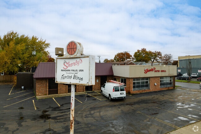
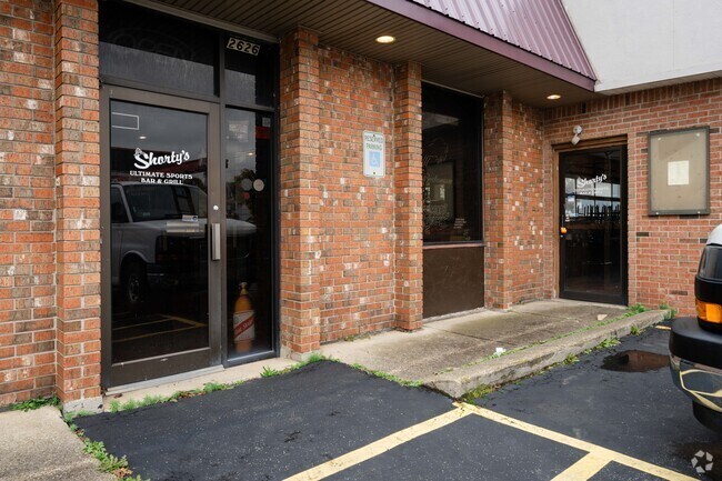
Property Record
2626 Pine Ave, Niagara Falls, NY 14301
NEARBY LISTINGS FOR SALE OR LEASE
Property Detail
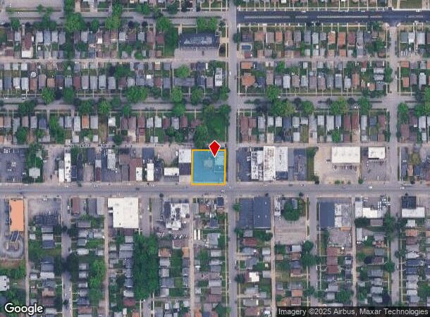
2626 Pine Ave
Buffalo-Cheektowaga-Niagara Falls, NY
Holland Land Companys Survey
291100-144-082-0002-031-000
TM 187 BL N LT 440 442 444
Restaurantbuilding
Niagara
X
New York
36029C0010J
31.000
2025
0.43 AC
2024
Niagara Falls
021000
Buffalo/Niagara Falls
6,062 SF
DEMOGRAPHICS near 2626 Pine Ave
1 Mile
3 Mile
5 Mile
2024 Total Population
18,768
44,246
67,997
2029 Population
18,399
43,895
67,463
Pop Growth 2024-2029
(1.97%)
(0.79%)
(0.79%)
Average Age
39
40
41
2024 Total Households
8,177
19,471
29,867
HH Growth 2024-2029
(2.09%)
(0.83%)
(0.81%)
Median Household Inc
$38,196
$41,015
$47,714
Avg Household Size
2.20
2.10
2.20
2024 Avg HH Vehicles
1.00
1.00
1.00
Median Home Value
$61,315
$83,094
$120,310
Median Year Built
1947
1948
1952
Nearby Places
- Restaurants
- Banks
- Shops
- Fitness
- Groceries
PUBLIC TRANSPORTATION
COMMUTER RAIL
DRIVE
WALK
Distance
6 min
2.2 mi
DRIVE
WALK
Distance
6 min
2.6 mi
AIRPORT
Niagara Falls International
DRIVE
WALK
Distance
Niagara Falls International
11 min
5.1 mi
Buffalo Niagara International
DRIVE
WALK
Distance
Buffalo Niagara International
36 min
23.4 mi
SALE & LEASE HISTORY
LISTING DATE
SALE/LEASE

Apr 03, 2018
For Sale
Nearby Properties
Address
Land Use
TOTAL SIZE
Lot Size
Zoning
Address
Land Use
TOTAL SIZE
Lot Size
Zoning
305,119 SF
11.80 AC
D1-D
Address
Land Use
TOTAL SIZE
Lot Size
Zoning
34.59 AC
I2
Address
Land Use
TOTAL SIZE
Lot Size
Zoning
23,280 SF
163.20 AC
Address
Land Use
TOTAL SIZE
Lot Size
Zoning
22.40 AC
INS
Address
Land Use
TOTAL SIZE
Lot Size
Zoning
170.93 AC
OS
Address
Land Use
TOTAL SIZE
Lot Size
Zoning
14.70 AC
I2
Address
Land Use
TOTAL SIZE
Lot Size
Zoning
95,628 SF
5.10 AC
C2-A
Address
Land Use
TOTAL SIZE
Lot Size
Zoning
86,660 SF
11.60 AC
I2
Address
Land Use
TOTAL SIZE
Lot Size
Zoning
441,749 SF
20.54 AC
I2
Address
Land Use
TOTAL SIZE
Lot Size
Zoning
375,735 SF
6.90 AC
OS
Address
Land Use
TOTAL SIZE
Lot Size
Zoning
0.89 AC
I2
Address
Land Use
TOTAL SIZE
Lot Size
Zoning
61.20 AC
02 - SINGL
Address
Land Use
TOTAL SIZE
Lot Size
Zoning
6,496 SF
9.50 AC
INS
Address
Land Use
TOTAL SIZE
Lot Size
Zoning
7.50 AC
05 - COMME
Address
Land Use
TOTAL SIZE
Lot Size
Zoning
410,860 SF
35.20 AC
05 - COMME
Address
Land Use
TOTAL SIZE
Lot Size
Zoning
18,829 SF
2.76 AC
OS
Address
Land Use
TOTAL SIZE
Lot Size
Zoning
64,006 SF
447.28 AC
OS
Address
Land Use
TOTAL SIZE
Lot Size
Zoning
0.30 AC
R1-C
Address
Land Use
TOTAL SIZE
Lot Size
Zoning
270,580 SF
2.10 AC
D1-A
Address
Land Use
TOTAL SIZE
Lot Size
Zoning
250,062 SF
2.60 AC
INS
Address
Land Use
TOTAL SIZE
Lot Size
Zoning
240,000 SF
35.50 AC
05 - COMME
Address
Land Use
TOTAL SIZE
Lot Size
Zoning
74,558 SF
1.90 AC
INS
Address
Land Use
TOTAL SIZE
Lot Size
Zoning
247.60 AC
Address
Land Use
TOTAL SIZE
Lot Size
Zoning
59,474 SF
10.14 AC
06 - INDUS
Address
Land Use
TOTAL SIZE
Lot Size
Zoning
3.30 AC
D1-D
Address
Land Use
TOTAL SIZE
Lot Size
Zoning
628,572 SF
4.22 AC
D1-B
Address
Land Use
TOTAL SIZE
Lot Size
Zoning
2,000 SF
4.90 AC
D2
Address
Land Use
TOTAL SIZE
Lot Size
Zoning
Address
Land Use
TOTAL SIZE
Lot Size
Zoning
211,484 SF
18.30 AC
C3
Address
Land Use
TOTAL SIZE
Lot Size
Zoning
106,800 SF
3.15 AC
D1-A
The World's #1 Commercial Real Estate Marketplace
Connect with us
© 2025 CoStar Group
The information above has been obtained from sources believed reliable. While we do not doubt its accuracy we have not verified it and make no guarantee, warranty or representation about it. It is your responsibility to independently confirm its accuracy and completeness. Any projections, opinions, assumptions, or estimates used are for example only and do not represent the current or future performance of the property. The value of this transaction to you depends on tax and other factors which should be evaluated by your tax, financial, and legal advisors. You and your advisors should conduct a careful, independent investigation of the property to determine to your satisfaction the suitability of the property for your needs.