Property Record
2628 Long Prairie Rd, Flower Mound, TX 75022
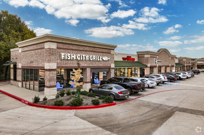

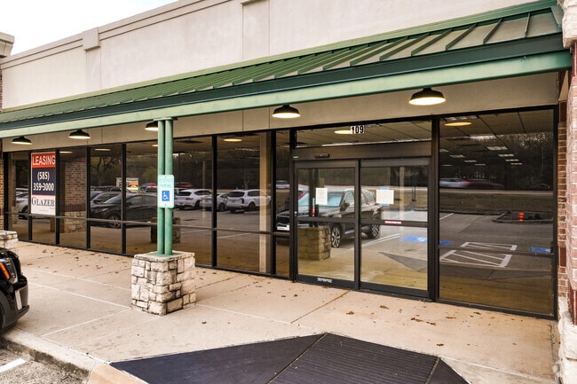
Property Detail
2628 Long Prairie Rd
Dallas-Fort Worth-Arlington, TX
CHAPARRAL COVE LOT 1-R
R232194
Denton
Commercialnec
Texas
AE The base floodplain where base flood elevations are provided. AE Zones are now used on new format FIRMs instead of A1-A30 Zones.
1-r
2024
2.64 AC
2025
Lewisville
021725
Dallas/Ft Worth
13,858 SF
NEARBY LISTINGS FOR SALE OR LEASE
DEMOGRAPHICS near 2628 Long Prairie Rd
1 mile
3 mile
5 mile
2024 Total Population
13,133
89,158
215,536
2029 Population
14,439
98,996
238,598
Pop Growth 2024-2029
+ 9.94%
+ 11.03%
+ 10.70%
Average Age
41
40
39
2024 Total Households
4,389
30,983
78,600
HH Growth 2024-2029
+ 10.18%
+ 11.26%
+ 10.85%
Median Household Inc
$160,786
$140,859
$114,433
Avg Household Size
3.00
2.80
2.70
2024 Avg HH Vehicles
2.00
2.00
2.00
Median Home Value
$519,527
$533,551
$481,093
Median Year Built
1994
1995
1994
Nearby Places
Map Layers
Map Styles
 Street
 Aerial
Transit
 Traffic
 Biking
Places
Listings with unknown addresses are not visible on the map
- Restaurants
- Banks
- Shops
- Fitness
- Groceries
PUBLIC TRANSPORTATION
COMMUTER RAIL
Old Town Station (A-train - Denton County Transportation Authority)
Drive
Walk
Distance
Old Town Station (A-train - Denton County Transportation Authority)
13 min
6.5 mi
Highland Village/Lewisville Lake Station (A-train - Denton County Transportation Authority)
Drive
Walk
Distance
Highland Village/Lewisville Lake Station (A-train - Denton County Transportation Authority)
13 min
7.6 mi
AIRPORT
Dallas-Fort Worth International
Drive
Walk
Distance
Dallas-Fort Worth International
16 min
10.3 mi
Dallas Love Field
Drive
Walk
Distance
Dallas Love Field
35 min
23.8 mi
Freight Ports
Port of Shreveport
Drive
Walk
Distance
Port of Shreveport
241 min
222.0 mi
SALE & LEASE HISTORY
LISTING DATE
SALE/LEASE

Sep 25, 2016
For Lease
Nearby Properties
Address
Land Use
TOTAL SIZE
Lot Size
Zoning
Address
Land Use
TOTAL SIZE
Lot Size
Zoning
563,145 SF
Address
Land Use
TOTAL SIZE
Lot Size
Zoning
478,148 SF
57.44 AC
Address
Land Use
TOTAL SIZE
Lot Size
Zoning
428,117 SF
67.02 AC
Address
Land Use
TOTAL SIZE
Lot Size
Zoning
531,979 SF
4.54 AC
Address
Land Use
TOTAL SIZE
Lot Size
Zoning
309,498 SF
9.57 AC
Address
Land Use
TOTAL SIZE
Lot Size
Zoning
282,766 SF
9 AC
Address
Land Use
TOTAL SIZE
Lot Size
Zoning
231,043 SF
11.89 AC
Address
Land Use
TOTAL SIZE
Lot Size
Zoning
269,300 SF
60.39 AC
Address
Land Use
TOTAL SIZE
Lot Size
Zoning
748,710 SF
37.91 AC
Address
Land Use
TOTAL SIZE
Lot Size
Zoning
371,268 SF
7.45 AC
Address
Land Use
TOTAL SIZE
Lot Size
Zoning
226,888 SF
5.62 AC
Address
Land Use
TOTAL SIZE
Lot Size
Zoning
302,183 SF
15.50 AC
7G
Address
Land Use
TOTAL SIZE
Lot Size
Zoning
650,000 SF
32.01 AC
Address
Land Use
TOTAL SIZE
Lot Size
Zoning
634,805 SF
31.17 AC
Address
Land Use
TOTAL SIZE
Lot Size
Zoning
285,996 SF
13.88 AC
7G
Address
Land Use
TOTAL SIZE
Lot Size
Zoning
226,871 SF
6.22 AC
Address
Land Use
TOTAL SIZE
Lot Size
Zoning
262,035 SF
10.88 AC
Address
Land Use
TOTAL SIZE
Lot Size
Zoning
199,049 SF
28.96 AC
Address
Land Use
TOTAL SIZE
Lot Size
Zoning
241,095 SF
13.02 AC
Address
Land Use
TOTAL SIZE
Lot Size
Zoning
480,400 SF
26.61 AC
Address
Land Use
TOTAL SIZE
Lot Size
Zoning
465,860 SF
26.80 AC
Address
Land Use
TOTAL SIZE
Lot Size
Zoning
401,600 SF
23.07 AC
Address
Land Use
TOTAL SIZE
Lot Size
Zoning
221,320 SF
12.79 AC
6B
Address
Land Use
TOTAL SIZE
Lot Size
Zoning
240,886 SF
6.65 AC
Address
Land Use
TOTAL SIZE
Lot Size
Zoning
91.17 AC
Address
Land Use
TOTAL SIZE
Lot Size
Zoning
327,800 SF
23.74 AC
Address
Land Use
TOTAL SIZE
Lot Size
Zoning
214,415 SF
1.16 AC
Address
Land Use
TOTAL SIZE
Lot Size
Zoning
156,748 SF
4.26 AC
Address
Land Use
TOTAL SIZE
Lot Size
Zoning
347,680 SF
30.36 AC
Address
Land Use
TOTAL SIZE
Lot Size
Zoning
351,792 SF
18.40 AC
The World's #1 Commercial Real Estate Marketplace
Connect with us
© 2026 CoStar Group
The information above has been obtained from sources believed reliable. While we do not doubt its accuracy we have not verified it and make no guarantee, warranty or representation about it. It is your responsibility to independently confirm its accuracy and completeness. Any projections, opinions, assumptions, or estimates used are for example only and do not represent the current or future performance of the property. The value of this transaction to you depends on tax and other factors which should be evaluated by your tax, financial, and legal advisors. You and your advisors should conduct a careful, independent investigation of the property to determine to your satisfaction the suitability of the property for your needs.