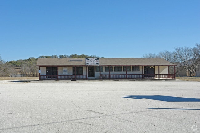
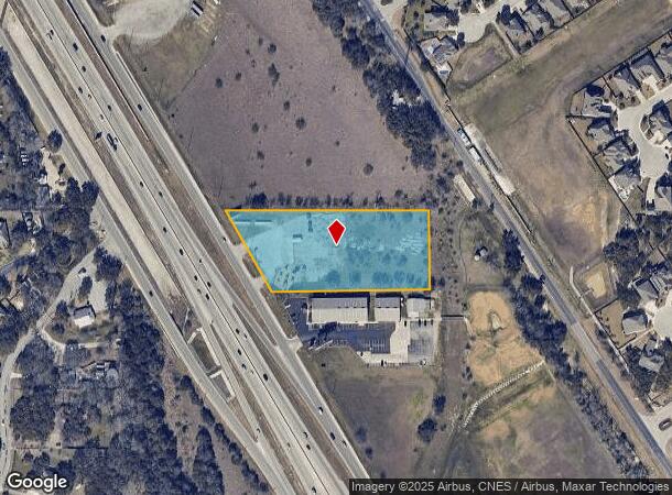
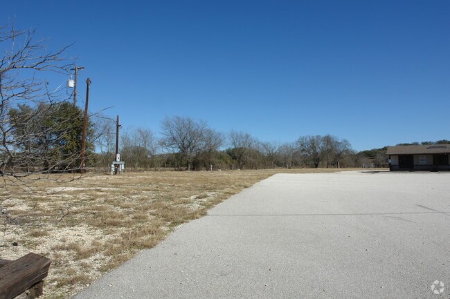
Property Record
26290 Interstate 10 W, Boerne, TX 78006
NEARBY LISTINGS FOR SALE OR LEASE
Property Detail
26290 Interstate 10 W
San Antonio-New Braunfels, TX
Conv A/S Code
04711-000-0020
CB 4711 P-2 ABS 528 2008-ADJUSTED PARCEL LINE PER ADJACENT TRANSACTION ON PID 254654. OMMITED P-101 FROM LEGAL DESCRIPTION.
Commercialnec
Bexar
A
Texas
48259C0525F
2
2024
3.16 AC
2025
Far Northwest
182101
San Antonio
3,860 SF
DEMOGRAPHICS near 26290 Interstate 10 W
1 Mile
3 Mile
5 Mile
2024 Total Population
7,497
33,356
54,551
2029 Population
8,117
35,886
59,652
Pop Growth 2024-2029
+ 8.27%
+ 7.58%
+ 9.35%
Average Age
36
38
39
2024 Total Households
2,498
11,396
19,428
HH Growth 2024-2029
+ 8.41%
+ 7.75%
+ 9.59%
Median Household Inc
$136,744
$130,263
$124,978
Avg Household Size
3.00
2.90
2.80
2024 Avg HH Vehicles
2.00
2.00
2.00
Median Home Value
$401,290
$416,305
$440,689
Median Year Built
2010
2010
2010
Nearby Places
Map Layers
Map Styles
 Street
 Aerial
- Restaurants
- Banks
- Shops
- Fitness
- Groceries
PUBLIC TRANSPORTATION
AIRPORT
San Antonio International
DRIVE
WALK
Distance
San Antonio International
26 min
20.6 mi
Freight Ports
Calhoun Port
DRIVE
WALK
Distance
Calhoun Port
205 min
172.2 mi
Nearby Properties
Address
Land Use
TOTAL SIZE
Lot Size
Zoning
Address
Land Use
TOTAL SIZE
Lot Size
Zoning
Address
Land Use
TOTAL SIZE
Lot Size
Zoning
361,559 SF
20 AC
Address
Land Use
TOTAL SIZE
Lot Size
Zoning
329,035 SF
21.28 AC
Address
Land Use
TOTAL SIZE
Lot Size
Zoning
260,536 SF
10.71 AC
Address
Land Use
TOTAL SIZE
Lot Size
Zoning
243,485 SF
9.34 AC
Address
Land Use
TOTAL SIZE
Lot Size
Zoning
282,991 SF
26.41 AC
Address
Land Use
TOTAL SIZE
Lot Size
Zoning
265,093 SF
12.55 AC
Address
Land Use
TOTAL SIZE
Lot Size
Zoning
215,736 SF
10.06 AC
Address
Land Use
TOTAL SIZE
Lot Size
Zoning
49,164 SF
11.98 AC
Address
Land Use
TOTAL SIZE
Lot Size
Zoning
46,562 SF
3.02 AC
Address
Land Use
TOTAL SIZE
Lot Size
Zoning
68,180 SF
10.22 AC
Address
Land Use
TOTAL SIZE
Lot Size
Zoning
91,013 SF
6.45 AC
Address
Land Use
TOTAL SIZE
Lot Size
Zoning
141,203 SF
12.49 AC
Address
Land Use
TOTAL SIZE
Lot Size
Zoning
147,976 SF
16.48 AC
Address
Land Use
TOTAL SIZE
Lot Size
Zoning
43,422 SF
6.38 AC
Address
Land Use
TOTAL SIZE
Lot Size
Zoning
71,658 SF
16.58 AC
Address
Land Use
TOTAL SIZE
Lot Size
Zoning
45,441 SF
3.84 AC
Address
Land Use
TOTAL SIZE
Lot Size
Zoning
142,425 SF
3.08 AC
Address
Land Use
TOTAL SIZE
Lot Size
Zoning
39,291 SF
4 AC
Address
Land Use
TOTAL SIZE
Lot Size
Zoning
129,911 SF
12.25 AC
Address
Land Use
TOTAL SIZE
Lot Size
Zoning
28,398 SF
5.04 AC
Address
Land Use
TOTAL SIZE
Lot Size
Zoning
29,227 SF
3.45 AC
Address
Land Use
TOTAL SIZE
Lot Size
Zoning
21,612 SF
2.98 AC
Address
Land Use
TOTAL SIZE
Lot Size
Zoning
14,644 SF
65.85 AC
Address
Land Use
TOTAL SIZE
Lot Size
Zoning
75,560 SF
3 AC
Address
Land Use
TOTAL SIZE
Lot Size
Zoning
103,963 SF
1.98 AC
Address
Land Use
TOTAL SIZE
Lot Size
Zoning
18,715 SF
2.32 AC
Address
Land Use
TOTAL SIZE
Lot Size
Zoning
11,429 SF
144 AC
Address
Land Use
TOTAL SIZE
Lot Size
Zoning
42,442 SF
119.10 AC
Address
Land Use
TOTAL SIZE
Lot Size
Zoning
24,336 SF
1.95 AC
The World's #1 Commercial Real Estate Marketplace
Connect with us
© 2026 CoStar Group
The information above has been obtained from sources believed reliable. While we do not doubt its accuracy we have not verified it and make no guarantee, warranty or representation about it. It is your responsibility to independently confirm its accuracy and completeness. Any projections, opinions, assumptions, or estimates used are for example only and do not represent the current or future performance of the property. The value of this transaction to you depends on tax and other factors which should be evaluated by your tax, financial, and legal advisors. You and your advisors should conduct a careful, independent investigation of the property to determine to your satisfaction the suitability of the property for your needs.