Property Record
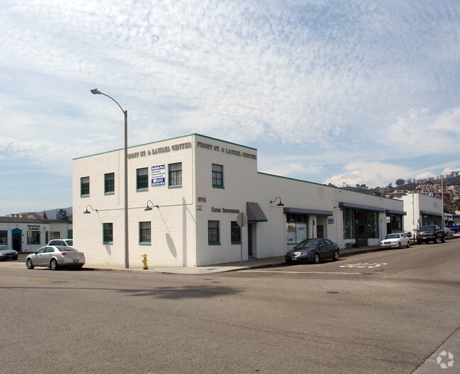
275 S Laurel St, Ventura, CA 93001


NEARBY LISTINGS FOR SALE OR LEASE
Property Detail
275 S Laurel St
073-0-144-110
San Buenaventura
Storesoffices
BLK 18 LOT 4
X
Ventura
06111C0743F
California
2024
0.81 AC
2025
Ventura
002400
Los Angeles
17,203 SF
Oxnard-Thousand Oaks-Ventura, CA
DEMOGRAPHICS near 275 S Laurel St
1 Mile
3 Mile
5 Mile
2024 Total Population
11,330
45,335
77,344
2029 Population
11,323
45,242
77,167
Pop Growth 2024-2029
(0.06%)
(0.21%)
(0.23%)
Average Age
43
42
42
2024 Total Households
5,228
18,194
30,461
HH Growth 2024-2029
+ 0.06%
(0.15%)
(0.21%)
Median Household Inc
$72,621
$81,886
$83,548
Avg Household Size
2.00
2.40
2.40
2024 Avg HH Vehicles
2.00
2.00
2.00
Median Home Value
$875,863
$772,815
$726,674
Median Year Built
1960
1962
1969
Nearby Places
Map Layers
Map Styles
 Street
 Aerial
- Restaurants
- Banks
- Shops
- Fitness
- Groceries
PUBLIC TRANSPORTATION
COMMUTER RAIL
DRIVE
WALK
Distance
5 min
18 min
0.9 mi
DRIVE
WALK
Distance
10 min
6.3 mi
AIRPORT
Santa Barbara Municipal
DRIVE
WALK
Distance
Santa Barbara Municipal
47 min
37.8 mi
Freight Ports
The Port of Hueneme
DRIVE
WALK
Distance
The Port of Hueneme
22 min
12.5 mi
SALE & LEASE HISTORY
LISTING DATE
SALE/LEASE

Sep 25, 2016
For Lease
Oct 02, 2020
For Lease
Jun 21, 2019
For Lease
Jan 18, 2017
For Lease
Feb 02, 2022
For Lease
Nearby Properties
Address
Land Use
TOTAL SIZE
Lot Size
Zoning
Address
Land Use
TOTAL SIZE
Lot Size
Zoning
1.99 AC
Address
Land Use
TOTAL SIZE
Lot Size
Zoning
4.19 AC
H
Address
Land Use
TOTAL SIZE
Lot Size
Zoning
Address
Land Use
TOTAL SIZE
Lot Size
Zoning
49,296 SF
11.08 AC
Address
Land Use
TOTAL SIZE
Lot Size
Zoning
7,280 SF
5.38 AC
C-T-O
Address
Land Use
TOTAL SIZE
Lot Size
Zoning
6.81 AC
C-T-O
Address
Land Use
TOTAL SIZE
Lot Size
Zoning
2.89 AC
C-T-O
Address
Land Use
TOTAL SIZE
Lot Size
Zoning
13,530 SF
10.85 AC
Address
Land Use
TOTAL SIZE
Lot Size
Zoning
25,401 SF
2.74 AC
C1AD
Address
Land Use
TOTAL SIZE
Lot Size
Zoning
639.79 AC
Address
Land Use
TOTAL SIZE
Lot Size
Zoning
107,360 SF
5.96 AC
RPD15
Address
Land Use
TOTAL SIZE
Lot Size
Zoning
7,993 SF
3.71 AC
C-T-O
Address
Land Use
TOTAL SIZE
Lot Size
Zoning
7,233 SF
7.39 AC
C1
Address
Land Use
TOTAL SIZE
Lot Size
Zoning
Address
Land Use
TOTAL SIZE
Lot Size
Zoning
13,996 SF
1.09 AC
Address
Land Use
TOTAL SIZE
Lot Size
Zoning
62,306 SF
1.33 AC
Address
Land Use
TOTAL SIZE
Lot Size
Zoning
11,444 SF
6.57 AC
Address
Land Use
TOTAL SIZE
Lot Size
Zoning
42,655 SF
0.94 AC
Address
Land Use
TOTAL SIZE
Lot Size
Zoning
732 SF
0.51 AC
DR
Address
Land Use
TOTAL SIZE
Lot Size
Zoning
0.84 AC
Address
Land Use
TOTAL SIZE
Lot Size
Zoning
56,561 SF
14.56 AC
MPD
Address
Land Use
TOTAL SIZE
Lot Size
Zoning
57,554 SF
0.58 AC
Address
Land Use
TOTAL SIZE
Lot Size
Zoning
0.82 AC
POD
Address
Land Use
TOTAL SIZE
Lot Size
Zoning
Address
Land Use
TOTAL SIZE
Lot Size
Zoning
24,904 SF
1.13 AC
R3-2
Address
Land Use
TOTAL SIZE
Lot Size
Zoning
295.55 AC
AEC-A
Address
Land Use
TOTAL SIZE
Lot Size
Zoning
62,354 SF
5.34 AC
Address
Land Use
TOTAL SIZE
Lot Size
Zoning
43,498 SF
1.67 AC
R33
Address
Land Use
TOTAL SIZE
Lot Size
Zoning
19,709 SF
0.14 AC
DC
The World's #1 Commercial Real Estate Marketplace
Connect with us
© 2025 CoStar Group
The information above has been obtained from sources believed reliable. While we do not doubt its accuracy we have not verified it and make no guarantee, warranty or representation about it. It is your responsibility to independently confirm its accuracy and completeness. Any projections, opinions, assumptions, or estimates used are for example only and do not represent the current or future performance of the property. The value of this transaction to you depends on tax and other factors which should be evaluated by your tax, financial, and legal advisors. You and your advisors should conduct a careful, independent investigation of the property to determine to your satisfaction the suitability of the property for your needs.