Property Record
263 Decatur St Se, Atlanta, GA 30312


NEARBY LISTINGS FOR SALE OR LEASE
Property Detail
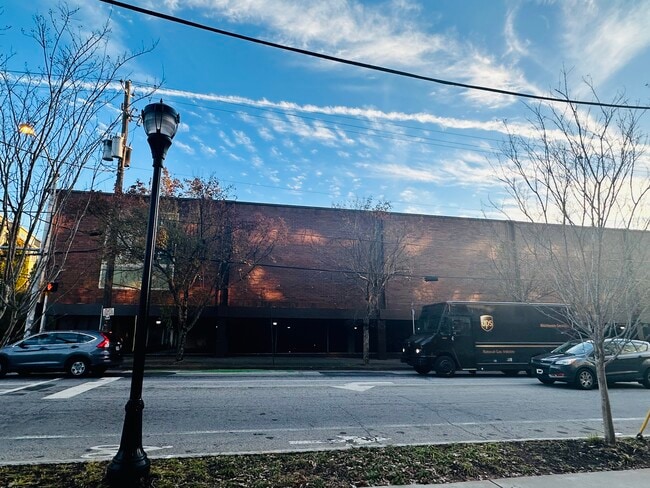
263 Decatur St Se
Atlanta-Sandy Springs-Roswell, GA
Former Southern Gf Bldg
14-0052-LL-001-7
KA FORMER SOUTHERN GF BLDG CONTACT PERSON - DICK LARSON
Scientificpharmaceuticalmedicalresearchfacility
Fulton
X
Georgia
13121C0357F
52
2024
4.23 AC
2025
Central Atlanta
011901
Atlanta
197,500 SF
DEMOGRAPHICS near 263 Decatur St Se
1 Mile
3 Mile
5 Mile
2024 Total Population
25,181
201,560
381,161
2029 Population
26,237
209,379
394,097
Pop Growth 2024-2029
+ 4.19%
+ 3.88%
+ 3.39%
Average Age
34
35
36
2024 Total Households
11,262
95,022
173,458
HH Growth 2024-2029
+ 5.13%
+ 4.22%
+ 3.64%
Median Household Inc
$59,392
$79,557
$76,989
Avg Household Size
1.70
1.80
2.00
2024 Avg HH Vehicles
1.00
1.00
1.00
Median Home Value
$456,493
$443,553
$434,035
Median Year Built
1998
1996
1987
Nearby Places
Map Layers
Map Styles
 Street
 Aerial
- Restaurants
- Banks
- Shops
- Fitness
- Groceries
PUBLIC TRANSPORTATION
TRANSIT/SUBWAY
King Memorial (Blue Line - Metropolitan Atlanta Rapid Transit Authority (MARTA), Green Line - Metropolitan Atlanta Rapid Transit Authority (MARTA))
DRIVE
WALK
Distance
King Memorial (Blue Line - Metropolitan Atlanta Rapid Transit Authority (MARTA), Green Line - Metropolitan Atlanta Rapid Transit Authority (MARTA))
1 min
7 min
0.4 mi
Georgia State (Blue Line - Metropolitan Atlanta Rapid Transit Authority (MARTA), Green Line - Metropolitan Atlanta Rapid Transit Authority (MARTA))
DRIVE
WALK
Distance
Georgia State (Blue Line - Metropolitan Atlanta Rapid Transit Authority (MARTA), Green Line - Metropolitan Atlanta Rapid Transit Authority (MARTA))
1 min
6 min
0.4 mi
Five Points (Blue Line - Metropolitan Atlanta Rapid Transit Authority (MARTA), Gold Line - Metropolitan Atlanta Rapid Transit Authority (MARTA), Green Line - Metropolitan Atlanta Rapid Transit Authority (MARTA), Red Line - Metropolitan Atlanta Rapid Transit Authority (MARTA))
DRIVE
WALK
Distance
Five Points (Blue Line - Metropolitan Atlanta Rapid Transit Authority (MARTA), Gold Line - Metropolitan Atlanta Rapid Transit Authority (MARTA), Green Line - Metropolitan Atlanta Rapid Transit Authority (MARTA), Red Line - Metropolitan Atlanta Rapid Transit Authority (MARTA))
3 min
13 min
0.7 mi
Peachtree Center (Gold Line - Metropolitan Atlanta Rapid Transit Authority (MARTA), Red Line - Metropolitan Atlanta Rapid Transit Authority (MARTA))
DRIVE
WALK
Distance
Peachtree Center (Gold Line - Metropolitan Atlanta Rapid Transit Authority (MARTA), Red Line - Metropolitan Atlanta Rapid Transit Authority (MARTA))
4 min
17 min
0.9 mi
AIRPORT
Hartsfield - Jackson Atlanta International
DRIVE
WALK
Distance
Hartsfield - Jackson Atlanta International
14 min
10.1 mi
Freight Ports
Georgia Ports - Savannah
DRIVE
WALK
Distance
Georgia Ports - Savannah
1 min
218.5 mi
SALE & LEASE HISTORY
LISTING DATE
SALE/LEASE

Sep 25, 2016
For Lease
Nov 28, 2022
For Lease
Mar 21, 2024
For Lease
Feb 24, 2017
For Lease
Apr 04, 2023
For Lease
Nearby Properties
Address
Land Use
TOTAL SIZE
Lot Size
Zoning
Address
Land Use
TOTAL SIZE
Lot Size
Zoning
19.94 AC
SPI1
Address
Land Use
TOTAL SIZE
Lot Size
Zoning
1,585,451 SF
1.97 AC
SPI2
Address
Land Use
TOTAL SIZE
Lot Size
Zoning
2,283,599 SF
12.93 AC
I1
Address
Land Use
TOTAL SIZE
Lot Size
Zoning
9.80 AC
C5
Address
Land Use
TOTAL SIZE
Lot Size
Zoning
179.40 AC
R4
Address
Land Use
TOTAL SIZE
Lot Size
Zoning
3.16 AC
SPI1
Address
Land Use
TOTAL SIZE
Lot Size
Zoning
9 AC
C5
Address
Land Use
TOTAL SIZE
Lot Size
Zoning
10.27 AC
C5
Address
Land Use
TOTAL SIZE
Lot Size
Zoning
1,039,831 SF
0.31 AC
C4
Address
Land Use
TOTAL SIZE
Lot Size
Zoning
1,227,912 SF
2.15 AC
SPI4
Address
Land Use
TOTAL SIZE
Lot Size
Zoning
1,736,017 SF
3.63 AC
SPI2
Address
Land Use
TOTAL SIZE
Lot Size
Zoning
1,300,309 SF
4.81 AC
SPI1
Address
Land Use
TOTAL SIZE
Lot Size
Zoning
1,434,872 SF
1.89 AC
SPI1
Address
Land Use
TOTAL SIZE
Lot Size
Zoning
61.57 AC
C5
Address
Land Use
TOTAL SIZE
Lot Size
Zoning
1,116,157 SF
1.48 AC
SPI3
Address
Land Use
TOTAL SIZE
Lot Size
Zoning
1,467,469 SF
0.07 AC
C4
Address
Land Use
TOTAL SIZE
Lot Size
Zoning
10,954,869 SF
28.88 AC
C3
Address
Land Use
TOTAL SIZE
Lot Size
Zoning
1.55 AC
SPI1
Address
Land Use
TOTAL SIZE
Lot Size
Zoning
1,646,011 SF
3.74 AC
SPI4
Address
Land Use
TOTAL SIZE
Lot Size
Zoning
7 AC
C3
Address
Land Use
TOTAL SIZE
Lot Size
Zoning
342,275 SF
0.70 AC
SPI3
Address
Land Use
TOTAL SIZE
Lot Size
Zoning
903,732 SF
0.34 AC
SPI1
Address
Land Use
TOTAL SIZE
Lot Size
Zoning
467,847 SF
1.62 AC
I2
Address
Land Use
TOTAL SIZE
Lot Size
Zoning
1,314,183 SF
2.61 AC
SPI1
Address
Land Use
TOTAL SIZE
Lot Size
Zoning
2,577,342 SF
2.04 AC
SPI1
Address
Land Use
TOTAL SIZE
Lot Size
Zoning
1,356,182 SF
2.52 AC
SPI4
Address
Land Use
TOTAL SIZE
Lot Size
Zoning
1,121,700 SF
2.21 AC
I2
Address
Land Use
TOTAL SIZE
Lot Size
Zoning
13,340,229 SF
3.68 AC
SPI1
Address
Land Use
TOTAL SIZE
Lot Size
Zoning
415,551 SF
1.13 AC
C4
Address
Land Use
TOTAL SIZE
Lot Size
Zoning
883,867 SF
2.71 AC
C1
The World's #1 Commercial Real Estate Marketplace
Connect with us
© 2026 CoStar Group
The information above has been obtained from sources believed reliable. While we do not doubt its accuracy we have not verified it and make no guarantee, warranty or representation about it. It is your responsibility to independently confirm its accuracy and completeness. Any projections, opinions, assumptions, or estimates used are for example only and do not represent the current or future performance of the property. The value of this transaction to you depends on tax and other factors which should be evaluated by your tax, financial, and legal advisors. You and your advisors should conduct a careful, independent investigation of the property to determine to your satisfaction the suitability of the property for your needs.