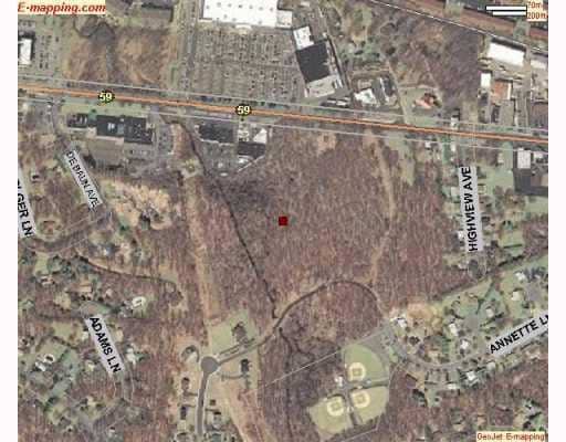
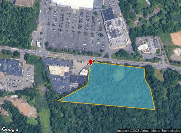
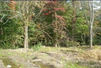
Property Record
263 Rt 59, Suffern, NY 10901

NEARBY LISTINGS FOR SALE OR LEASE
Property Detail
263 Rt 59
392621-055-012-0001-049-001-0000
Rockland
Commercialacreage
New York
A
49.1
34003C0076H
6.43 AC
2023
Ramapo
2024
Northern New Jersey
011603
New York-Jersey City-White Plains, NY-NJ
DEMOGRAPHICS near 263 Rt 59
1 Mile
3 Mile
5 Mile
2024 Total Population
8,043
104,626
211,460
2029 Population
8,078
104,094
210,803
Pop Growth 2024-2029
+ 0.44%
(0.51%)
(0.31%)
Average Age
39
33
35
2024 Total Households
2,452
29,071
60,648
HH Growth 2024-2029
+ 0.45%
(0.43%)
(0.24%)
Median Household Inc
$95,601
$85,164
$95,950
Avg Household Size
3.00
3.40
3.30
2024 Avg HH Vehicles
2.00
2.00
2.00
Median Home Value
$730,687
$626,557
$618,728
Median Year Built
1983
1975
1975
Nearby Places
- Restaurants
- Banks
- Shops
- Fitness
- Groceries
PUBLIC TRANSPORTATION
COMMUTER RAIL
Suffern (Bergen County/Port Jervis Line - NJ Transit Commuter Rail (NJ Transit), Main/Port Jervis Line - NJ Transit Commuter Rail (NJ Transit))
DRIVE
WALK
Distance
Suffern (Bergen County/Port Jervis Line - NJ Transit Commuter Rail (NJ Transit), Main/Port Jervis Line - NJ Transit Commuter Rail (NJ Transit))
5 min
2.7 mi
Mahwah (Bergen County/Port Jervis Line - NJ Transit Commuter Rail (NJ Transit), Main/Port Jervis Line - NJ Transit Commuter Rail (NJ Transit))
DRIVE
WALK
Distance
Mahwah (Bergen County/Port Jervis Line - NJ Transit Commuter Rail (NJ Transit), Main/Port Jervis Line - NJ Transit Commuter Rail (NJ Transit))
7 min
3.9 mi
AIRPORT
Westchester County
DRIVE
WALK
Distance
Westchester County
40 min
28.0 mi
LaGuardia
DRIVE
WALK
Distance
LaGuardia
53 min
36.7 mi
New York Stewart International
DRIVE
WALK
Distance
New York Stewart International
50 min
38.0 mi
Freight Ports
Port Newark Container Terminal
DRIVE
WALK
Distance
Port Newark Container Terminal
52 min
39.0 mi
Nearby Properties
Address
Land Use
TOTAL SIZE
Lot Size
Zoning
Address
Land Use
TOTAL SIZE
Lot Size
Zoning
1,056 SF
99.35 AC
OP200
Address
Land Use
TOTAL SIZE
Lot Size
Zoning
23.32 AC
Address
Land Use
TOTAL SIZE
Lot Size
Zoning
10.38 AC
Address
Land Use
TOTAL SIZE
Lot Size
Zoning
17.90 AC
IP
Address
Land Use
TOTAL SIZE
Lot Size
Zoning
170,941 SF
10.04 AC
IP
Address
Land Use
TOTAL SIZE
Lot Size
Zoning
14.09 AC
B200
Address
Land Use
TOTAL SIZE
Lot Size
Zoning
106,836 SF
8.85 AC
LO
Address
Land Use
TOTAL SIZE
Lot Size
Zoning
Address
Land Use
TOTAL SIZE
Lot Size
Zoning
68.78 AC
OP20
Address
Land Use
TOTAL SIZE
Lot Size
Zoning
609,540 SF
174.09 AC
R-50
Address
Land Use
TOTAL SIZE
Lot Size
Zoning
19.60 AC
OP200
Address
Land Use
TOTAL SIZE
Lot Size
Zoning
539,911 SF
38.80 AC
05
Address
Land Use
TOTAL SIZE
Lot Size
Zoning
33.50 AC
GI80
Address
Land Use
TOTAL SIZE
Lot Size
Zoning
68,905 SF
7.28 AC
LO
Address
Land Use
TOTAL SIZE
Lot Size
Zoning
219,765 SF
29.88 AC
07
Address
Land Use
TOTAL SIZE
Lot Size
Zoning
60,222 SF
17.39 AC
LO
Address
Land Use
TOTAL SIZE
Lot Size
Zoning
5.30 AC
GA200
Address
Land Use
TOTAL SIZE
Lot Size
Zoning
0.44 AC
OP20
Address
Land Use
TOTAL SIZE
Lot Size
Zoning
43,828 SF
3 AC
LO
Address
Land Use
TOTAL SIZE
Lot Size
Zoning
7.26 AC
GA200
Address
Land Use
TOTAL SIZE
Lot Size
Zoning
5.31 AC
GA200
Address
Land Use
TOTAL SIZE
Lot Size
Zoning
3.65 AC
Address
Land Use
TOTAL SIZE
Lot Size
Zoning
12.06 AC
GI80
Address
Land Use
TOTAL SIZE
Lot Size
Zoning
2.43 AC
B40
Address
Land Use
TOTAL SIZE
Lot Size
Zoning
12.53 AC
IP120
Address
Land Use
TOTAL SIZE
Lot Size
Zoning
4.71 AC
GA200
Address
Land Use
TOTAL SIZE
Lot Size
Zoning
2.43 AC
B3
Address
Land Use
TOTAL SIZE
Lot Size
Zoning
7.81 AC
Address
Land Use
TOTAL SIZE
Lot Size
Zoning
8.02 AC
Address
Land Use
TOTAL SIZE
Lot Size
Zoning
8.14 AC
IP120
The World's #1 Commercial Real Estate Marketplace
Connect with us
© 2025 CoStar Group
The information above has been obtained from sources believed reliable. While we do not doubt its accuracy we have not verified it and make no guarantee, warranty or representation about it. It is your responsibility to independently confirm its accuracy and completeness. Any projections, opinions, assumptions, or estimates used are for example only and do not represent the current or future performance of the property. The value of this transaction to you depends on tax and other factors which should be evaluated by your tax, financial, and legal advisors. You and your advisors should conduct a careful, independent investigation of the property to determine to your satisfaction the suitability of the property for your needs.