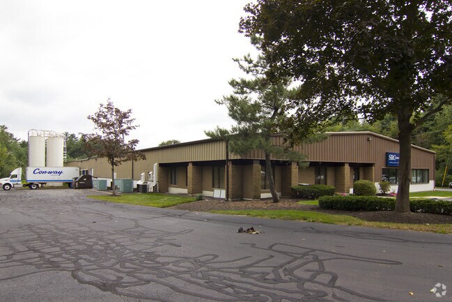
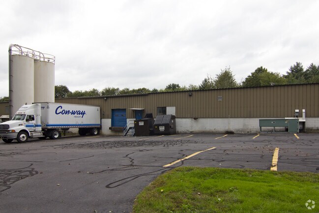
Property Record
263 Winter St, Hanover, MA 02339

Property Detail
263 Winter St
HANO-000068-000000-000052
Plymouth
Industrialgeneral
Massachusetts
I
52
A Areas with a 1% annual chance of flooding and a 26% chance of flooding over the life of a 30-year mortgage.
9.90 AC
2023
Route 3 South
2025
Boston
503102
Boston-Cambridge-Newton, MA-NH
37,542 SF
NEARBY LISTINGS FOR SALE OR LEASE
DEMOGRAPHICS near 263 Winter St
1 mile
3 mile
5 mile
2025 Total Population
2,597
31,470
86,518
2030 Population
2,614
31,833
87,429
Pop Growth 2025-2030
+ 0.65%
+ 1.15%
+ 1.05%
Average Age
41
42
42
2025 Total Households
847
11,170
31,806
HH Growth 2025-2030
+ 0.47%
+ 1.07%
+ 0.95%
Median Household Inc
$175,310
$133,564
$125,484
Avg Household Size
3.10
2.80
2.70
2025 Avg HH Vehicles
3.00
2.00
2.00
Median Home Value
$718,750
$659,998
$616,986
Median Year Built
1969
1970
1967
Nearby Places
Map Layers
Map Styles
 Street
 Aerial
Layers
 Traffic
 Biking
Places
Listings with unknown addresses are not visible on the map
- Restaurants
- Banks
- Shops
- Fitness
- Groceries
PUBLIC TRANSPORTATION
COMMUTER RAIL
Whitman (Kingston/Plymouth Line - Massachusetts Bay Transportation Authority Commuter Rail (Purple Line))
Drive
Walk
Distance
Whitman (Kingston/Plymouth Line - Massachusetts Bay Transportation Authority Commuter Rail (Purple Line))
10 min
4.7 mi
Hanson (Kingston/Plymouth Line - Massachusetts Bay Transportation Authority Commuter Rail (Purple Line))
Drive
Walk
Distance
Hanson (Kingston/Plymouth Line - Massachusetts Bay Transportation Authority Commuter Rail (Purple Line))
12 min
5.1 mi
AIRPORT
General Edward Lawrence Logan International
Drive
Walk
Distance
General Edward Lawrence Logan International
46 min
26.8 mi
Nearby Properties
Address
Land Use
TOTAL SIZE
Lot Size
Zoning
Address
Land Use
TOTAL SIZE
Lot Size
Zoning
69.93 AC
100
Address
Land Use
TOTAL SIZE
Lot Size
Zoning
23.41 AC
R
Address
Land Use
TOTAL SIZE
Lot Size
Zoning
78.50 AC
R
Address
Land Use
TOTAL SIZE
Lot Size
Zoning
99,138 SF
83.32 AC
100
Address
Land Use
TOTAL SIZE
Lot Size
Zoning
16.12 AC
RESIDE
Address
Land Use
TOTAL SIZE
Lot Size
Zoning
91,586 SF
13.70 AC
R
Address
Land Use
TOTAL SIZE
Lot Size
Zoning
121,800 SF
0.97 AC
C
Address
Land Use
TOTAL SIZE
Lot Size
Zoning
13.10 AC
Address
Land Use
TOTAL SIZE
Lot Size
Zoning
12.04 AC
C
Address
Land Use
TOTAL SIZE
Lot Size
Zoning
25,262 SF
244 AC
Address
Land Use
TOTAL SIZE
Lot Size
Zoning
9.30 AC
BUSINE
Address
Land Use
TOTAL SIZE
Lot Size
Zoning
24.07 AC
BD
Address
Land Use
TOTAL SIZE
Lot Size
Zoning
3.88 AC
BD
Address
Land Use
TOTAL SIZE
Lot Size
Zoning
64,168 SF
10 AC
100
Address
Land Use
TOTAL SIZE
Lot Size
Zoning
60,274 SF
15.10 AC
B
Address
Land Use
TOTAL SIZE
Lot Size
Zoning
127,644 SF
15.76 AC
Address
Land Use
TOTAL SIZE
Lot Size
Zoning
184,542 SF
13.58 AC
I
Address
Land Use
TOTAL SIZE
Lot Size
Zoning
16.12 AC
100
Address
Land Use
TOTAL SIZE
Lot Size
Zoning
2.25 AC
Address
Land Use
TOTAL SIZE
Lot Size
Zoning
40,466 SF
19 AC
RESIDE
Address
Land Use
TOTAL SIZE
Lot Size
Zoning
92,516 SF
12.68 AC
GR
Address
Land Use
TOTAL SIZE
Lot Size
Zoning
756 SF
11.11 AC
Address
Land Use
TOTAL SIZE
Lot Size
Zoning
31,600 SF
6.25 AC
C
Address
Land Use
TOTAL SIZE
Lot Size
Zoning
23.60 AC
I
Address
Land Use
TOTAL SIZE
Lot Size
Zoning
46,305 SF
6.33 AC
C
Address
Land Use
TOTAL SIZE
Lot Size
Zoning
85,465 SF
13.63 AC
INDUST
Address
Land Use
TOTAL SIZE
Lot Size
Zoning
38,351 SF
5.80 AC
RESIDE
Address
Land Use
TOTAL SIZE
Lot Size
Zoning
36,129 SF
36.70 AC
Address
Land Use
TOTAL SIZE
Lot Size
Zoning
13.51 AC
R
The World's #1 Commercial Real Estate Marketplace
Connect with us
© 2026 CoStar Group
The information above has been obtained from sources believed reliable. While we do not doubt its accuracy we have not verified it and make no guarantee, warranty or representation about it. It is your responsibility to independently confirm its accuracy and completeness. Any projections, opinions, assumptions, or estimates used are for example only and do not represent the current or future performance of the property. The value of this transaction to you depends on tax and other factors which should be evaluated by your tax, financial, and legal advisors. You and your advisors should conduct a careful, independent investigation of the property to determine to your satisfaction the suitability of the property for your needs.