Property Record
2630 Latrobe Ave, Fayetteville, NC 28304


NEARBY LISTINGS FOR SALE OR LEASE
Property Detail
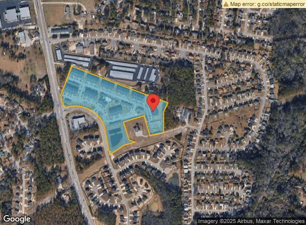
2630 Latrobe Ave
Fayetteville, NC
Grove At Park Place
0405-59-6243
BINGHAM PLACE LLC RECOMB LO:PT 1 SE:01 PL:0128-0152
Apartment
Cumberland
X
North Carolina
3720040500J
1
2025
15.66 AC
2025
Cliffdale
003203
Fayetteville
2,370 SF
DEMOGRAPHICS near 2630 Latrobe Ave
1 Mile
3 Mile
5 Mile
2024 Total Population
8,499
63,556
148,333
2029 Population
8,392
63,300
147,914
Pop Growth 2024-2029
(1.26%)
(0.40%)
(0.28%)
Average Age
36
36
36
2024 Total Households
3,509
24,832
59,102
HH Growth 2024-2029
(1.23%)
(0.39%)
(0.30%)
Median Household Inc
$54,520
$54,222
$56,032
Avg Household Size
2.40
2.50
2.50
2024 Avg HH Vehicles
2.00
2.00
2.00
Median Home Value
$140,136
$151,553
$160,647
Median Year Built
1987
1984
1987
Nearby Places
Map Layers
Map Styles
 Street
 Aerial
- Restaurants
- Banks
- Shops
- Fitness
- Groceries
PUBLIC TRANSPORTATION
COMMUTER RAIL
Fayetteville Amtrak Station (Palmetto - Amtrak, Silver Meteor - Amtrak)
DRIVE
WALK
Distance
Fayetteville Amtrak Station (Palmetto - Amtrak, Silver Meteor - Amtrak)
14 min
9.0 mi
AIRPORT
Fayetteville Regional/Grannis Field
DRIVE
WALK
Distance
Fayetteville Regional/Grannis Field
13 min
8.9 mi
Freight Ports
Port of Wilmington
DRIVE
WALK
Distance
Port of Wilmington
130 min
93.5 mi
Nearby Properties
Address
Land Use
TOTAL SIZE
Lot Size
Zoning
Address
Land Use
TOTAL SIZE
Lot Size
Zoning
182,282 SF
38.72 AC
OI
Address
Land Use
TOTAL SIZE
Lot Size
Zoning
161,719 SF
107.14 AC
RR
Address
Land Use
TOTAL SIZE
Lot Size
Zoning
2,064 SF
26.91 AC
R6CZ
Address
Land Use
TOTAL SIZE
Lot Size
Zoning
5,136 SF
19.84 AC
SF6
Address
Land Use
TOTAL SIZE
Lot Size
Zoning
2,114 SF
20.70 AC
MR5
Address
Land Use
TOTAL SIZE
Lot Size
Zoning
26,717 SF
89.19 AC
SF10
Address
Land Use
TOTAL SIZE
Lot Size
Zoning
66,637 SF
25.83 AC
RR
Address
Land Use
TOTAL SIZE
Lot Size
Zoning
26,016 SF
30.11 AC
SF10
Address
Land Use
TOTAL SIZE
Lot Size
Zoning
1,289 SF
37.83 AC
MR5
Address
Land Use
TOTAL SIZE
Lot Size
Zoning
3,840 SF
17.54 AC
SF10-SGLFA
Address
Land Use
TOTAL SIZE
Lot Size
Zoning
120,262 SF
12.45 AC
CP
Address
Land Use
TOTAL SIZE
Lot Size
Zoning
182,425 SF
23.13 AC
CP
Address
Land Use
TOTAL SIZE
Lot Size
Zoning
4,549 SF
29.20 AC
MR5
Address
Land Use
TOTAL SIZE
Lot Size
Zoning
121,079 SF
15.39 AC
CP
Address
Land Use
TOTAL SIZE
Lot Size
Zoning
7,418 SF
10 AC
OIP
Address
Land Use
TOTAL SIZE
Lot Size
Zoning
54,706 SF
27.30 AC
R10
Address
Land Use
TOTAL SIZE
Lot Size
Zoning
53,457 SF
10.07 AC
MXD
Address
Land Use
TOTAL SIZE
Lot Size
Zoning
2,126 SF
6.67 AC
MXDCU
Address
Land Use
TOTAL SIZE
Lot Size
Zoning
12,550 SF
6.87 AC
RR
Address
Land Use
TOTAL SIZE
Lot Size
Zoning
103,930 SF
9.12 AC
CC
Address
Land Use
TOTAL SIZE
Lot Size
Zoning
64,736 SF
4.96 AC
CC
Address
Land Use
TOTAL SIZE
Lot Size
Zoning
2,540 SF
4.05 AC
MR5
Address
Land Use
TOTAL SIZE
Lot Size
Zoning
37,334 SF
39.35 AC
CC
Address
Land Use
TOTAL SIZE
Lot Size
Zoning
2,056 SF
5.99 AC
MR5
Address
Land Use
TOTAL SIZE
Lot Size
Zoning
7,704 SF
19.98 AC
MR5
Address
Land Use
TOTAL SIZE
Lot Size
Zoning
26,366 SF
1.35 AC
MXD
Address
Land Use
TOTAL SIZE
Lot Size
Zoning
49,894 SF
7.13 AC
CC
Address
Land Use
TOTAL SIZE
Lot Size
Zoning
49,691 SF
7.09 AC
LC
Address
Land Use
TOTAL SIZE
Lot Size
Zoning
1,881 SF
15.18 AC
SF10
The World's #1 Commercial Real Estate Marketplace
Connect with us
© 2026 CoStar Group
The information above has been obtained from sources believed reliable. While we do not doubt its accuracy we have not verified it and make no guarantee, warranty or representation about it. It is your responsibility to independently confirm its accuracy and completeness. Any projections, opinions, assumptions, or estimates used are for example only and do not represent the current or future performance of the property. The value of this transaction to you depends on tax and other factors which should be evaluated by your tax, financial, and legal advisors. You and your advisors should conduct a careful, independent investigation of the property to determine to your satisfaction the suitability of the property for your needs.